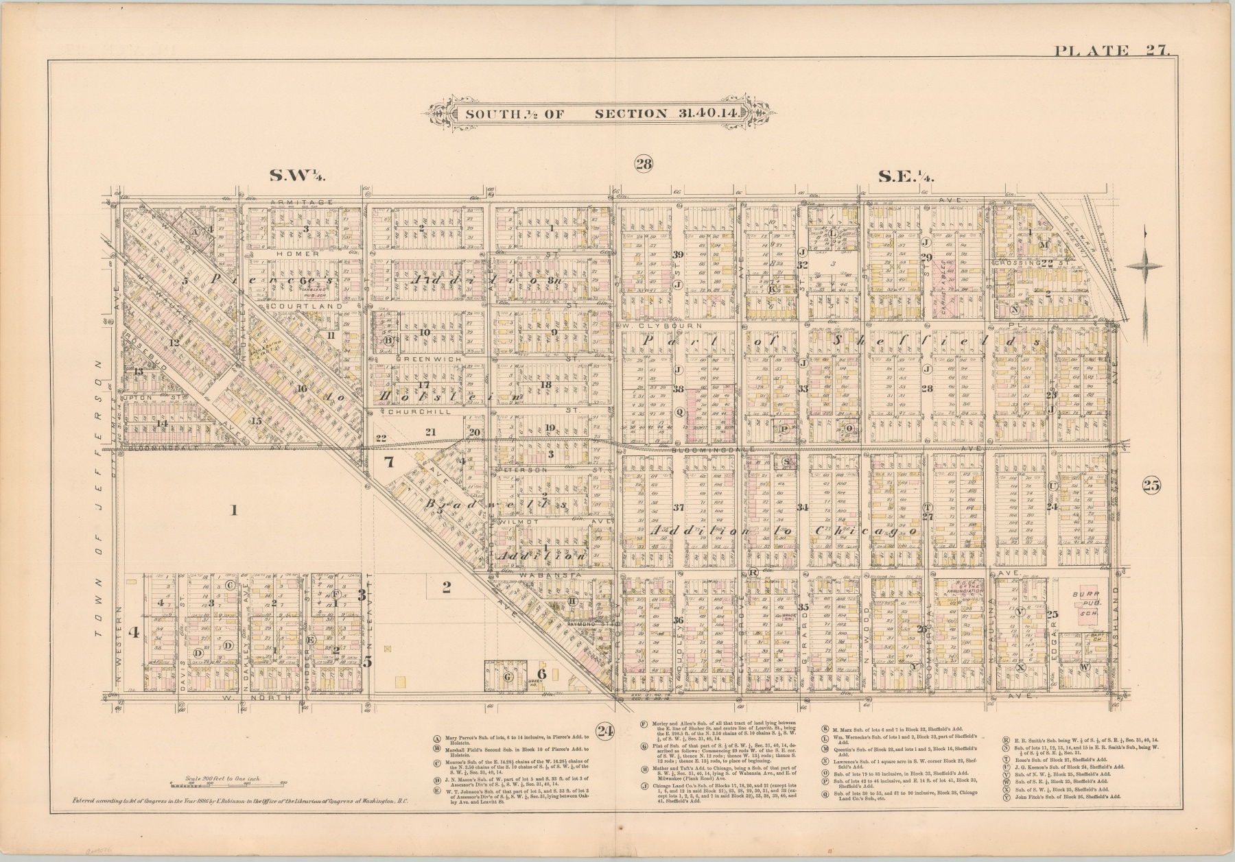
South 1/2 of Section 3.1.40.14 [Chicago]
$300.00
The heart of Wicker Park, almost 150 years ago.
1 in stock
Description
This fabulously detailed map of several city blocks in Chicago’s Wicker Park/Bucktown neighborhood was published in response to the devastating fire that rampaged through the city between October 8-10, 1871. Elisha Robinson, its creator, was one of the numerous publishers who issued atlases specifically for the fire insurance industry.
In order to properly assess risk, insurers needed information on building size, construction material, and the availability of water. Surveys were painstakingly performed, usually on foot, and the results are among the most complete snapshots of the city’s physical makeup in the late 19th and early 20th centuries.
The map, in theory, outlines every single building that existed at the time of publication. Color was applied by stencil and shows the construction material of each structure; pink is brick, yellow is wood, brown is stone, and blue is iron. Crosses on a building footprint indicate its use as a stable, and thus likely to hold combustible materials. Water lines, street elevation (which affects the flow), fire hydrants, and cisterns are also all noted.
The image is bounded by Western, Armitage, Ashland, and North Avenues. Only a small portion of the streets are paved, concentrated in the southeast and indicated by a faint orange tint. The neighborhood was largely ethnic and working class at the time of publication, with several commercial corridors and access to at least one horse-drawn street railway. Two public schools, several churches, a sash & blind factory, and large stable company are also shown. Still, large tracts of empty land remain adjacent to Milwaukee Avenue, and the area is considerably less dense than what can be seen today.
The map was issued as plate 27 in Volume IV of Robinson’s Fire Insurance Atlas of the City of Chicago. Published in Chicago by Elisha Robinson in 1886.
Map Details
Publication Date: 1886
Author: Elisha Robinson
Sheet Width (in): 32.75
Sheet Height (in): 22.6
Condition: A-
Condition Description: The outer edges are lightly toned and have a few small tears. Light spotting also confined to the margins and near the '24' in the lower key. Creased along vertical centerfold, but very good overall.
$300.00
1 in stock

