
Societe de Colonisation du Lac Temiskaming
$150.00
Late 19th-century efforts to settle Quebec’s far northern frontier.
1 in stock


Description
This fascinating French-language promotional booklet was published in Ottawa in 1885 by Canada’s Ministry of Agriculture to encourage immigration, industrial investment, and agricultural enterprise in Quebec’s Lake Témiscamingue region along the upper Ottawa River. Both the Canadian government and the Catholic Church were keenly invested in promoting settlement in this remote region—seeking to expand French-Canadian culture, boost the local economy, and spur the construction of vital transportation infrastructure.
The slim volume makes extensive reference to episcopal patronage and Church support (the Société de Colonisation operated under Catholic auspices), while offering practical details on climate, soil quality, geology, and local natural resources.
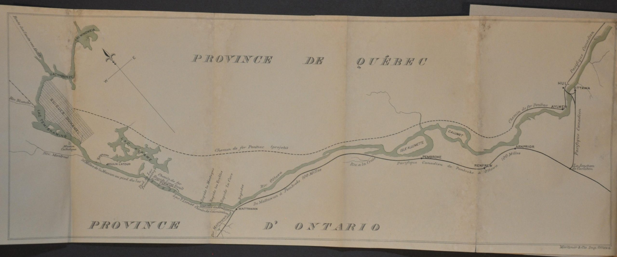
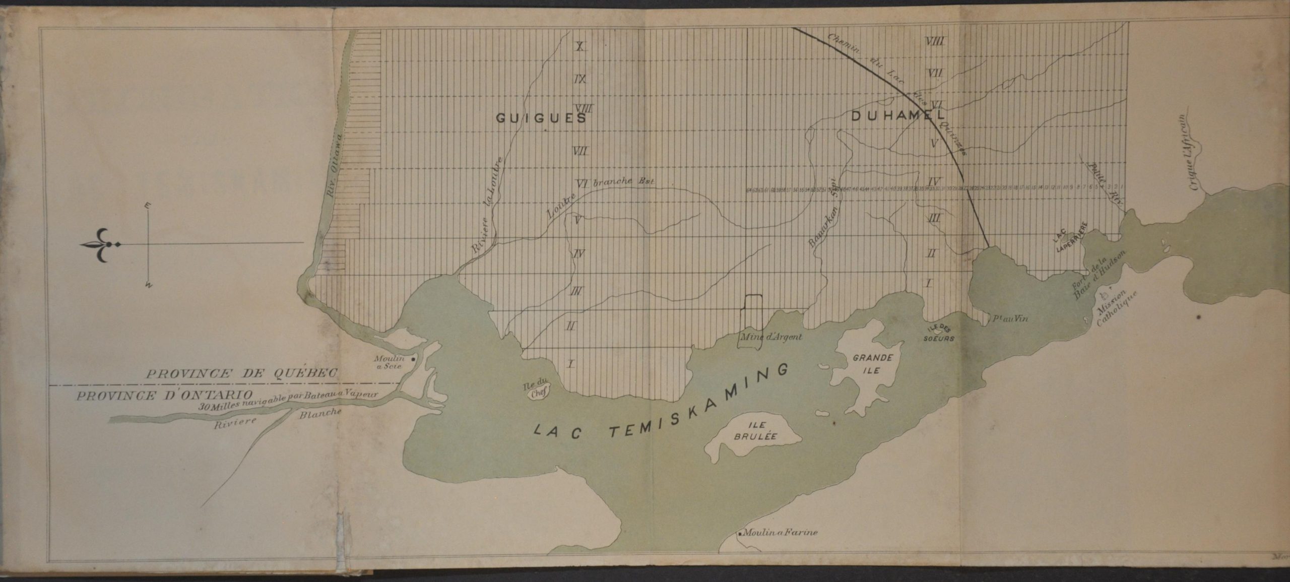
Two folding maps are included. The first depicts the route of the proposed Pontiac Railroad, intended to connect the newly surveyed townships of Guigues and Duhamel to the Ottawa River at Aylmer. The second, at a larger scale, details the area surrounding Lake Témiscamingue along the border with Ontario, highlighting early road networks, timber limits, and planned settlement tracts.
Map Details
Publication Date: 1885
Author: Canadian Ministry of Agriculture
Sheet Width (in): 5.25
Sheet Height (in): 7.5
Condition: B
Condition Description: 32 pp. + 2 fold outs, each about 20" x 7.5". A somewhat musty old pamphlet, expertly rebound in new paper wraps with original cover applied to the front. The contents, printed on thin paper, are moderately soiled and wormed along the fore-edge. The maps are creased, toned, and show some ink transference, but in good shape. Between fair and good condition overall.
$150.00
1 in stock