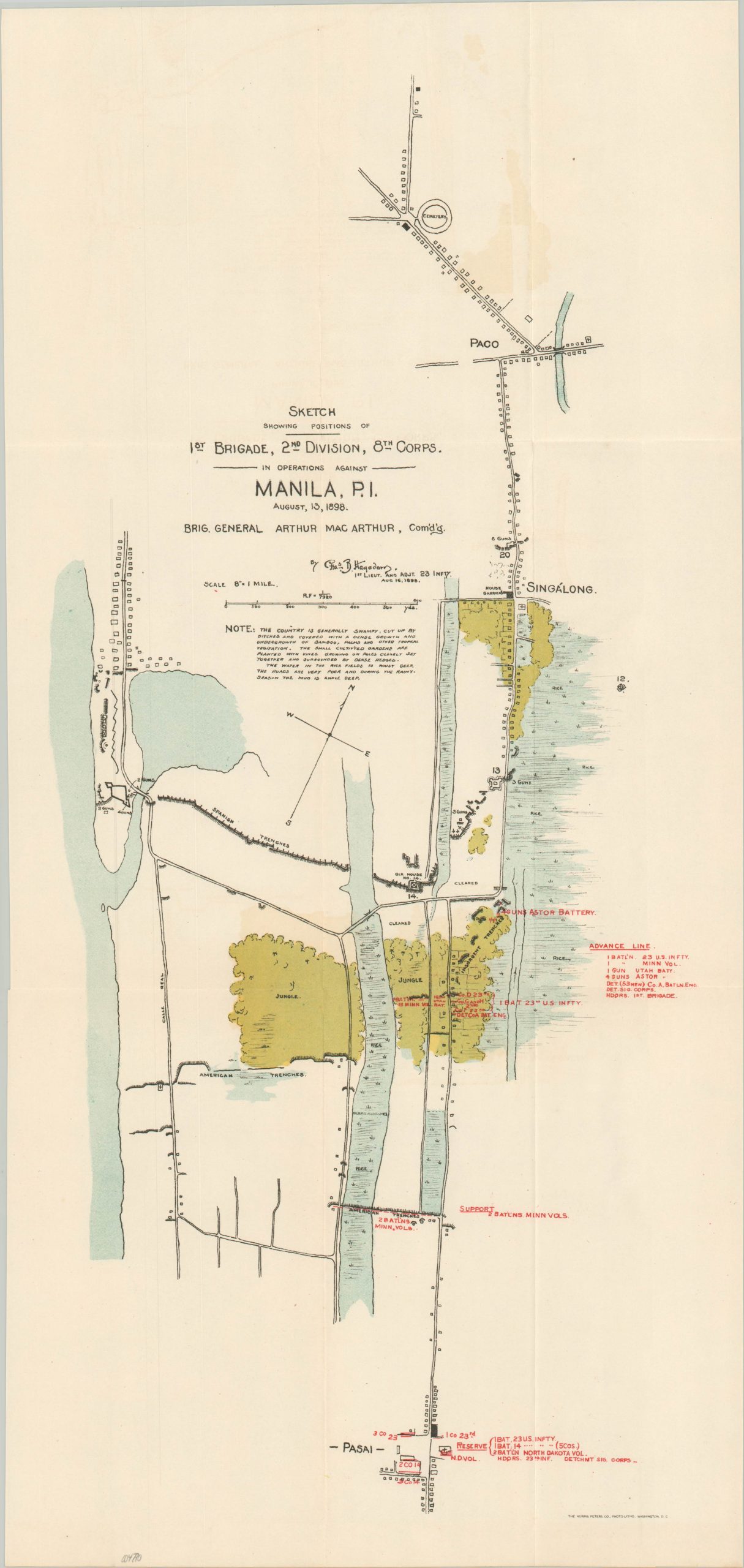
Sketch Showing Positions of 1st Brigade, 2nd Division, 8 Corps in Operations against Manila, P.I.
Near-contemporary plan of the ‘Mock’ Battle of Manila (1898).
Out of stock
Description
This detailed map shows the disposition of American troops south of the Philippine capital of Manila on the last day of the Spanish-American War. Swamps, jungles, Spanish defenses, and other obstacles are noted throughout. Red overprinting identifies the precise location of U.S. units under the command of Brigadier General Arthur MacArthur, father of Douglas MacArthur and the first Governor-General of American-occupied Philippines (1900).
Accompanying text gives some indication as to the misery experienced by the infantry during the campaign. “The roads are very poor and during the rainy season the mud is ankle deep.”
The map was drafted by 1st. Lieutenant of the 23rd Infantry Charles Baldwin Hagadorn. Lithographed by the Norris Peters Company in Washington D.C. and published as part of a government report in 1900.
Source: Yale University;
Map Details
Publication Date: 1900
Author: Charles Baldwin Hagadorn
Sheet Width (in): 10.5
Sheet Height (in): 22.25
Condition: A
Condition Description: Creasing along originally issued fold lines and light toning around the outer edges of the sheet. Near fine condition.
Out of stock