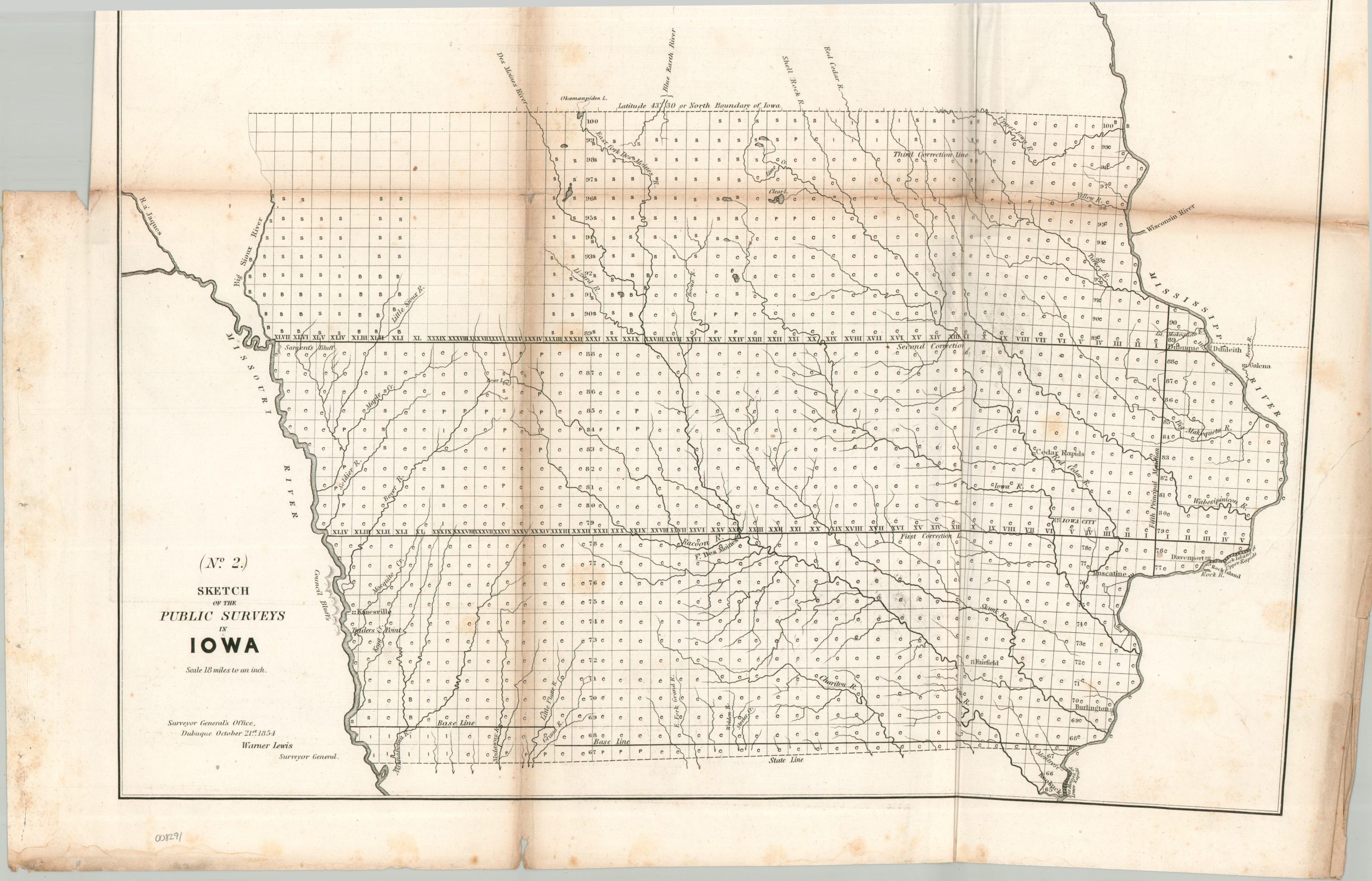
Sketch of the Public Surveys in Iowa
$100.00
Mapping the mapping of Iowa in the mid-19th century.
1 in stock
Description
This detailed mid-19th century map documents the progress of federal land surveying across the state of Iowa. Sectioned townships are filled with small symbols and letters reflecting their survey status, ranging from blank (not started) to C (platted and copied, with field notes recorded and transcribed). Survey lines, geographic features (mostly rivers) and a handful of scattered settlements are labeled throughout the image. Of particular note are Fort Des Moines, the important landmark of Council Bluffs (with the nearby outpost of Kanesville and Trader’s Point), and rapids along the Mississippi River (geographic barriers to a lucrative trade).
The image was approved by Surveyor General of Iowa Warner Lewis. Published in Washington in 1854 to accompany a Congressional Report by the General Land Office.
Map Details
Publication Date: 1854
Author: Warner Lewis
Sheet Width (in): 22.25
Sheet Height (in): 19.00
Condition: B
Condition Description: Lithographed map on a sheet of toned and brittle paper, heavily creased and discoloration along original folds. A 4" irregular closed tear, lower right, has been repaired on the verso and some light damp staining in the lower margin. Between fair and good overall.
$100.00
1 in stock