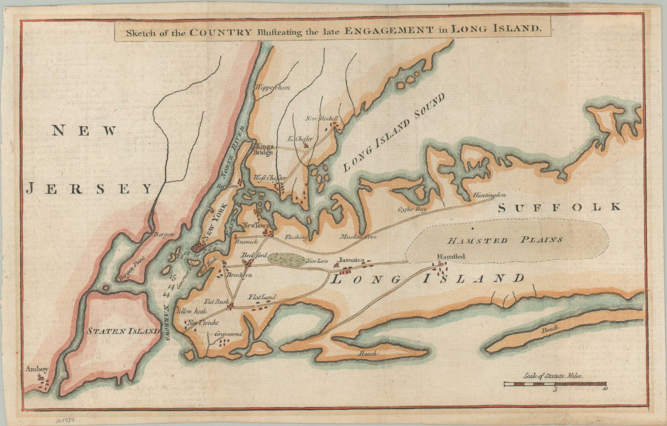
Sketch of the Country Illustrating the late engagement in Long Island
$450.00
Revolutionary War-era map illustrating the results of the Battle of Brooklyn.
1 in stock
Description
This relatively simple plan of New York City, eastern Long Island, and parts of New Jersey was originally published in London as part of an October 1776 edition of Gentleman’s Magazine. Just a few weeks earlier, George Washington’s Continental Army suffered a defeat at the Battle of Brooklyn (also known as the Battle of Long Island), forcing his troops to retreat and ultimately granting the British control of New York.
The image notes the major settlements, geographic features, and primary transportation routes across the theater of conflict. An eager British audience could track the movements of Howe and his 30,000+ troops as they crossed from Staten Island to Long Island, crushed Washington’s army near Brooklyn, and followed its retreat to Manhattan.
Map Details
Publication Date: 1776
Author: Gentleman's Magazine
Sheet Width (in): 13
Sheet Height (in): 8.25
Condition: A-
Condition Description: Moderate matte burn visible along the outer edges of the sheet, confined to the margins. Soft creasing and light wear along originally issued fold lines. A few tiny scattered spots within the image, which features attractive modern hand color. Very good overall. Blank on verso.
$450.00
1 in stock