Sketch of Chicago Harbor Illinois June 30th 1878
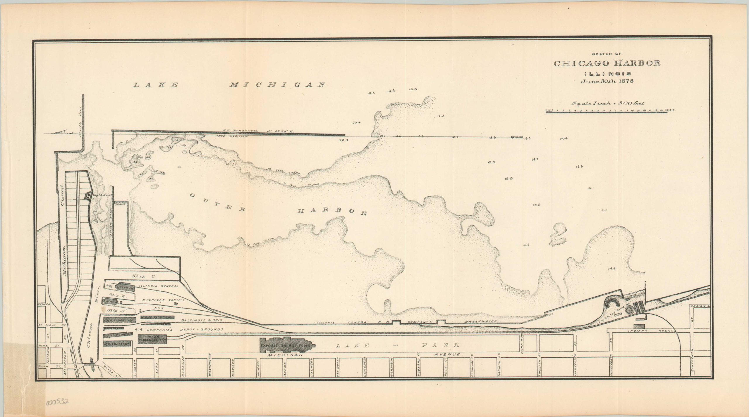
Federal survey of the Chicago Harbor a few years after the Great Fire.
Out of stock
Description
In pre-fire views of Chicago, the Illinois Central tracks are running along a trestle in Lake Michigan, with a quiet lagoon separating them from the beach. However, the conflagration that consumed much of the city in 1871 created vast amounts of debris, much of which was shoved into the lake creating the area labeled as Lake Park.
The Exposition Building is a structure created in 1873 and would eventually be replaced by the Art Institute Building for the Columbian Exposition in 1893. Elevators and depots can be seen along the shores of the Chicago River, the site of most commercial exchange in the city. Also present on the river is an early swing bridge. The lighthouse sits adjacent to the life saving station, and the Michigan Canal reflects an attempt in 1871 to enlarge and deepen the river in order to reverse its flow (this would later be achieved with the Sanitary and Ship Canal).
A map of the harbor today would exhibit further changes, as the majority of Grant Park and Museum Campus are still in Lake Michigan on this image.
Map Details
Publication Date: 1878
Author: Government Publishing Office
Sheet Width (in): 16.2
Sheet Height (in): 8.9
Condition: B+
Condition Description: Some discoloration along fold lines and a tear in the lower left hand corner with discoloration from a previous repair.
Out of stock