Sketch Map Showing Major Consolidations of Oroville Gold Dredging District
$135.00
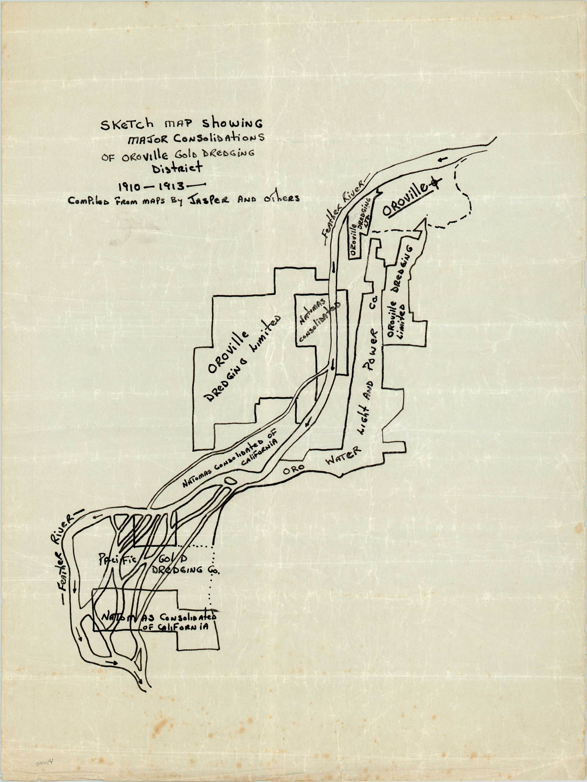
Manuscript map of mining operations in Northern California, near Oroville.
Description
The Oroville gold district was originally settled in 1849 on the banks of the Feather River as it enters the Sacramento Valley. It was intended as a trading post for miners entering the Sierra Nevada via the river, as it did not initially appear to contain much ore that was readily accessible with contemporary technology. However, bucket line dredging was introduced at the beginning of the 20th century, and by 1908 there were 35 dredges being operated by 12 different companies.
Productivity dropped after the end of WWI, and this map shows some of the claim consolidation that took place during that period between companies like Oroville Dredging Limited, Pacific Gold Dredging, and Oro Light and Power Company. Hand written in black ink on wax paper, the image shows the town in the upper right and the various claims along the course of the river as it flows south.
Map Details
Publication Date: c. 1916
Author: Unknown
Sheet Width (in): 18
Sheet Height (in): 23.25
Condition: B+
Condition Description: The map is in very good condition, with creases from folds and minor foxing.
$135.00