
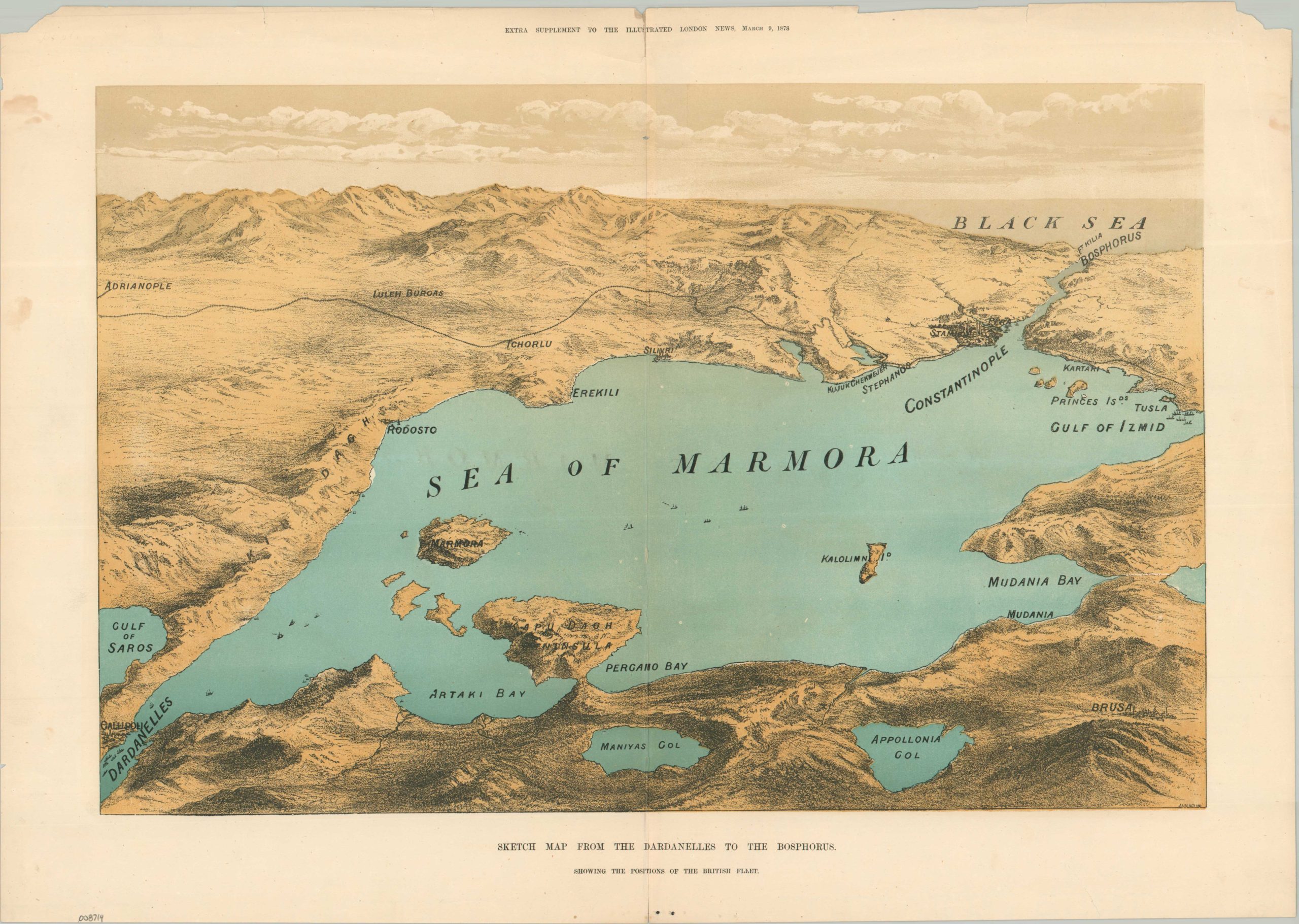
Sketch Map from the Dardanelles to the Bosphorus Showing the Positions of the British Fleet
Gunboat diplomacy during the Russo-Turkish War.
Out of stock
Description
This dramatic aerial view attempts to capture the geopolitical stakes of the ongoing Russo-Turkish War. Unexpected Russian successes against the Ottoman Empire led to the complete encirclement of Constantinople (troops were stationed at Stephanos and Pera), but Western powers feared that total victory would upset the balance of power in Europe. A reluctant peace was brokered under the watchful eye of the British fleet, stationed in the Gulf of Izmid and in the Dardanelles.
The bird’s-eye view was engraved by talented British landscape artist Richard Principal Leitch and published as an Extra Supplement to the Illustrated London News issue of March 9, 1878.
Map Details
Publication Date: 1878
Author: Illustrated London News
Sheet Width (in): 22.10
Sheet Height (in): 15.60
Condition: B
Condition Description: Color printed supplement with moderate marginal wear, including chipped upper corners, repaired tears, and soiling on the left side. Creased along vertical centerfold and some minor offsetting within the image (from the bold labels). About good condition overall.
Out of stock