SIZE!
$295.00
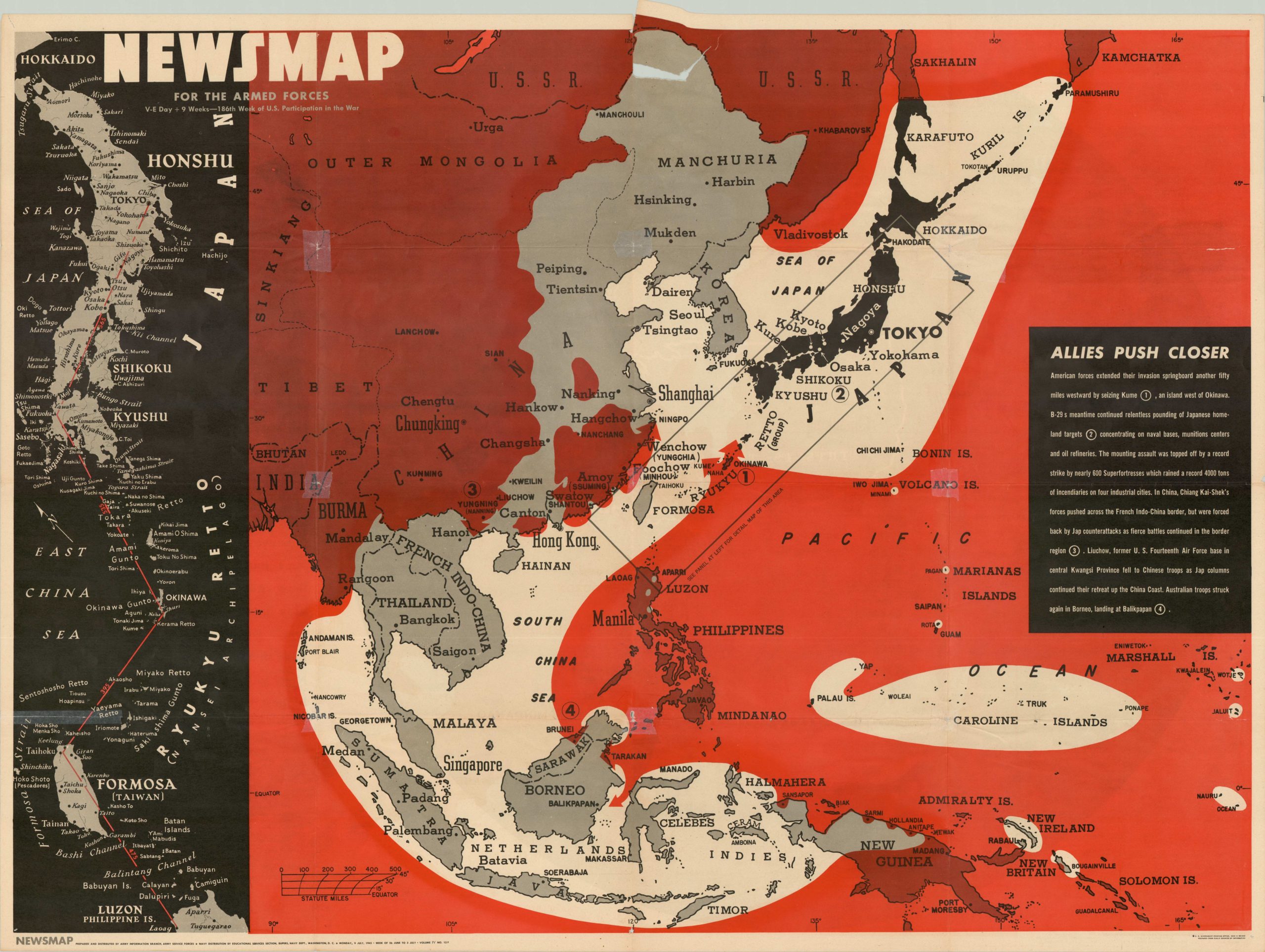
A dramatic map showing the relative expanse of the Pacific Ocean.

Description
Once the United States claimed victory in Europe, the American public was restless to finish the job in the Pacific. This map was issued as part of the NEWSMAP series of publications in July of 1945, less than a month before the first atomic bomb would detonate over Hiroshima.
The image foregoes geographic accuracy and extensive detail to make a statement about the vast immensity of the Pacific theater. The outline of the United States is shown boldly in white; comfortably surrounded by water on all sides. This impactful image carries with it the implication of logistical difficulties, long supply lines, and stretched communication while accompanying text elaborates on these issues and more.
The verso of the sheet shows a more detailed map of the Pacific Theater and how the Allied push is closing the noose on the Japanese Empire.
Map Details
Publication Date: 1945
Author: Army Information Branch, Army Service Forces
Sheet Width (in): 47.00
Sheet Height (in): 34.90
Condition: B
Condition Description: The sheet is in good condition, but there are several holes at fold intersections and elsewhere in the sheet. The most significant damage has been repaired by archival tape, but there is still some minor image loss as a result.
$295.00