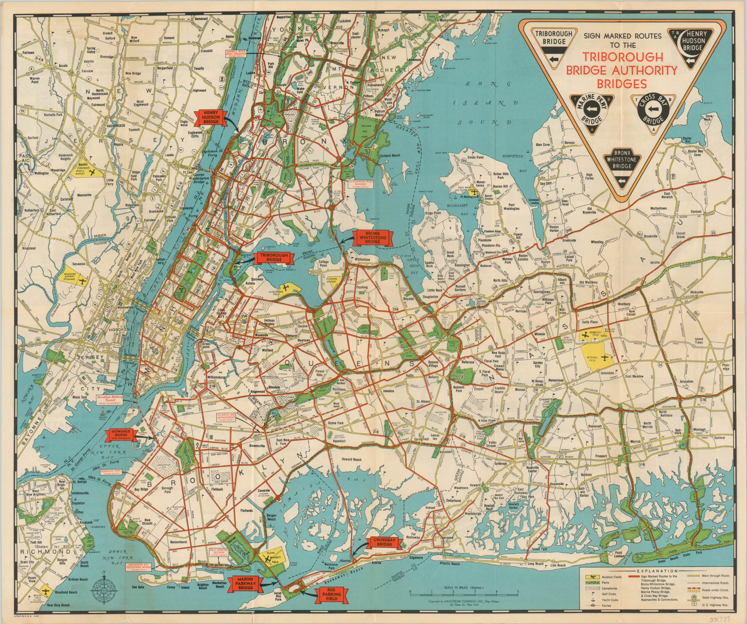
Sign Marked Routes to the Triborough Bridge Authority Bridges
$50.00
Unique transportation map of the Greater New York City area.
1 in stock
Description
Most maps of New York City focus on it’s world class amenities, robust subway system, or iconic landmarks, but this example highlights the various bridges under the jurisdiction of the Triborough Bridge Authority.
Established in 1929 to facilitate the construction of the Triborough Bridge, the TBA foundered in its initial years due to the Great Depression and political infighting. But the success of the Bronx-Whitestone Bridge, built in time for the 1939 World’s Fair in Queens, brought new life to the organization. In early 1940, the TBA merged with the New York City Parkway Authority, expanding its dominion to the seven bridges outlined on this map, published by Hagstrom the same year.
Each is labeled individually, with marked routes to each bridge noted in bright red. Aviation fields, parks, cemeteries, golf courses, and yacht clubs are also noted within the key. The verso features photographs of each bridge and a list of the toll rates for each vehicle class, including ambulances!
Map Details
Publication Date: 1940
Author: Hagstrom
Sheet Width (in): 20.30
Sheet Height (in): 16.90
Condition: A-
Condition Description: Minor soiling on the verso which does not affect the image and faint creasing along fold lines. Outer edges are slightly toned and worn, but overall in very good or better condition.
$50.00
1 in stock