Siege of Sebastopol
$75.00
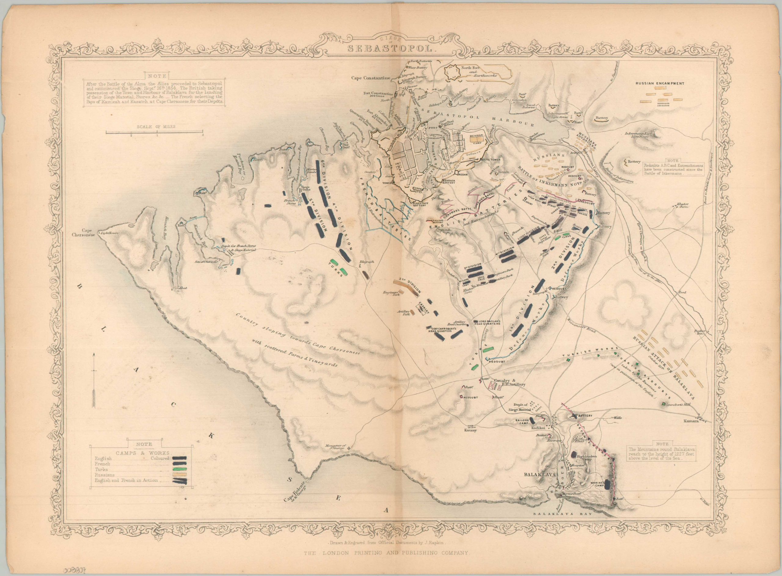
Contemporary mapping of the long and bloody Siege of Sevastopol.
1 in stock
Description
This fascinating 1855 map gives a front-row seat to the Siege of Sebastopol, the biggest and bloodiest campaign of the Crimean War. Drawn by John Rapkin and published by the London Printing and Publishing Company, it shows the massive network of trenches, forts, and camps set up by the British, French, and Ottoman armies as they tried to capture Russia’s main naval base on the Black Sea. The image uses fine, hand-drawn lines called hachures to show the rugged hills and deep ravines that made fighting here a nightmare. By looking closely at the landscape, you can spot the exact locations of the allied troop dispositions, showing where different regiments pitched their tents and dug in to squeeze the Russian defenses from the south.
What makes this specific edition so interesting is that it was updated right after the brutal Battle of Inkerman in early November 1854. The mapmaker went back to the steel printing plate to add the fresh lines of entrenchments dug immediately after that heavy engagement, giving British families back home a nearly real-time look at how the battlefield was evolving. While it looks as though the encirclement was nearly complete and Russian surrender was imminent, the grueling siege would last until October 1855. To balance out the grim reality of the war, the map is surrounded by a beautiful, decorative border- a trademark feature of Rapkin/Tallis maps.
Map Details
Publication Date: c. 1855
Author: John Tallis
Sheet Width (in): 14.6
Sheet Height (in): 10.9
Condition: B+
Condition Description: Steel engraved sheet with original hand color. Moderate toning along the vertical centerfold and in the margins. Good condition overall.
$75.00
1 in stock