Siberia and Chinese Tartary
$50.00
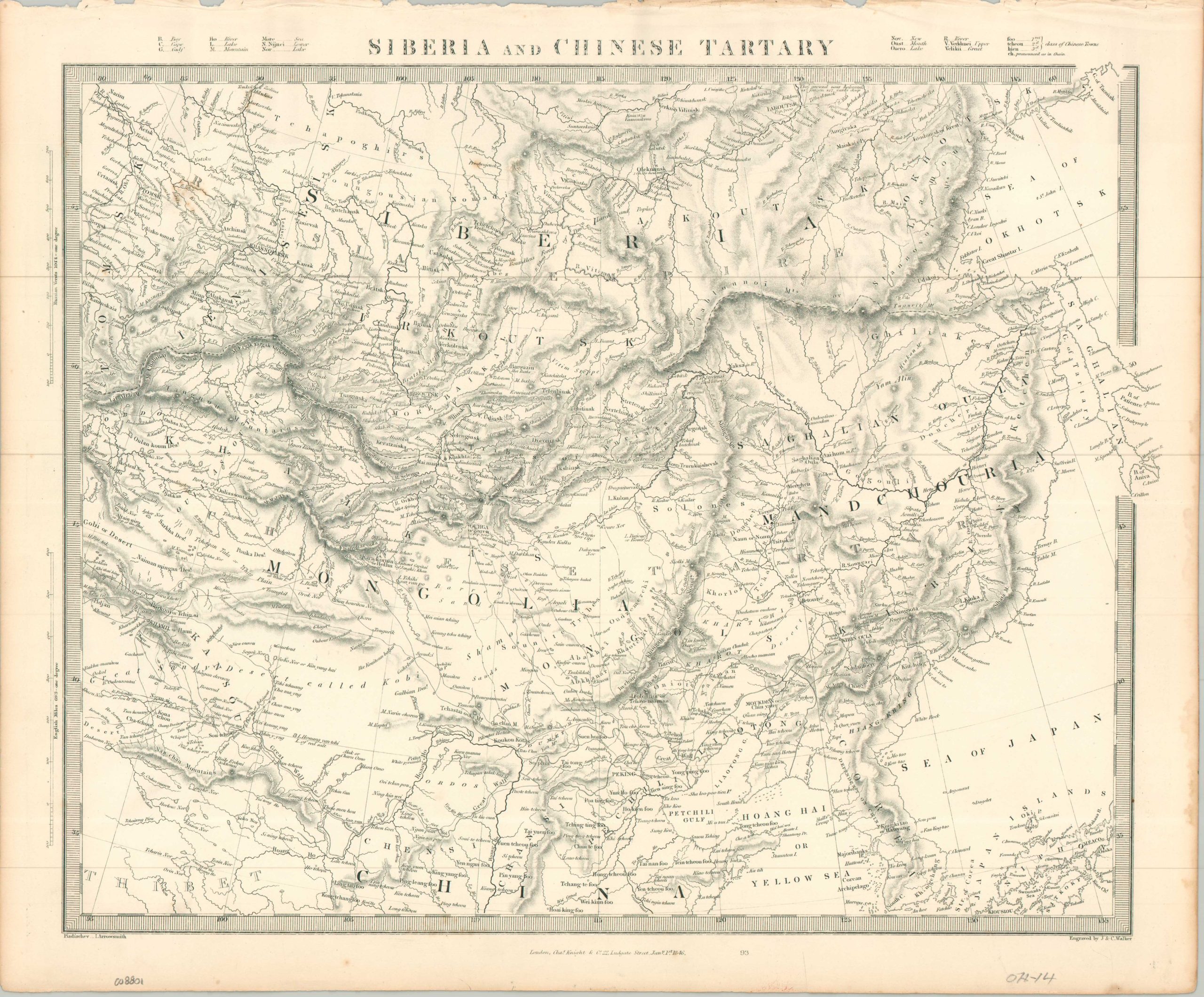
A detailed look at the border between Russia and China in the mid-19th century.
1 in stock
Description
This finely detailed steel-engraved map, titled Siberia and Chinese Tartary, was published in 1846 by the Society for the Diffusion of Useful Knowledge (SDUK). Demonstrating the Society’s commitment to making accurate geography accessible to the public, the map captures the vast, rugged expanses of Northern Asia with remarkable clarity. Using sources from cartographers Piadischev and John Arrowsmith, it employs precise hachuring to render the mountain and expansive river systems of the region, highlighting the formidable Altai and Himalayan ranges, while the Gobi Desert and the historic Willow Palisade are clearly delineated. A glossary of geographic terms at the top of the page is helpful for identifying the meaning behind the numerous toponyms.
Founded in 1827 by Lord Russel and Henry Brougham, the Society for the Diffusion of Useful Knowledge (S.D.U.K.) was formed to help the working man educate himself. With the concept that ‘Knowledge is Power’ behind it, the organization issued scientific works, an encyclopedia, an atlas, and other educational materials in relatively inexpensive formats. For instance, the atlas was originally published in parts – approximately two maps each month – with prices around a shilling for black-and-white copies. S.D.U.K. maps were neatly engraved on steel and often updated with the latest available geographic information, allowing the working class to stay up to date on international affairs. As such, they also provide some of the most detailed snapshots from areas across the globe during the mid-19th century. Though the maps are sometimes found undated, identifying the publisher helps to narrow the timeframe of publication. Charles Knight began issuing S.D.U.K. maps in 1844 and continued to do so until the organization’s closure in 1846. At that point, he purchased the steel plates and continued to publish them independently until 1852.
Map Details
Publication Date: 1846
Author: Society for the Diffusion of Useful Knowledge
Sheet Width (in): 17.00
Sheet Height (in): 14.10
Condition: B+
Condition Description: Ragged upper edge, where previously bound, and faint toning/staining visible in the margins. Good to very good condition overall.
$50.00
1 in stock