Sherlock Holmes Map
The world of Sherlock Holmes, beyond 221B Baker Street!
Out of stock
Description
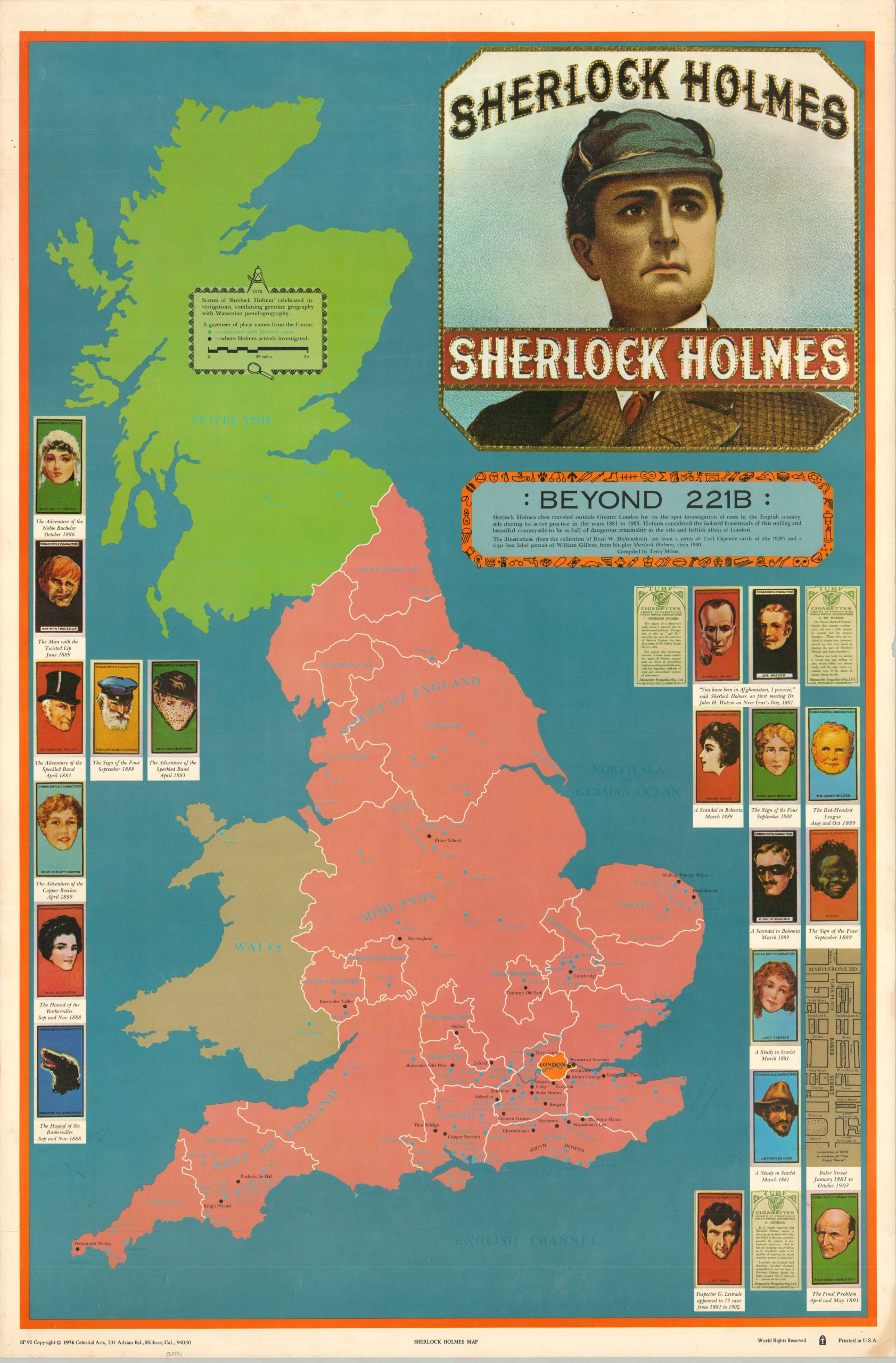
“Sherlock Holmes often traveled outside Greater London for on the spot investigation of cases in the English countryside during his active practice in the years 1881 to 1905. Holmes considered the isolated homesteads of this smiling and beautiful countryside to be as full of dangerous criminality as the vile and hellish alleys of London.” – Text, upper right.
This interesting map of the island of Britain pinpoints, with great care, the precise locations where investigations took place by the famed literary detective, Mr. Sherlock Holmes. Over fifty different place names across Scotland, England, and Wales are colored in blue (associated with a case) or black (the site of an active inquiry). The illustrations on the left and right originated with a series of 1920s Turf Cigarette cards, while a small inset in the lower right shows Baker Street during Holmes’ occupancy.
The map was compiled by Terry Milne by ‘combining genuine geography with Watsonian pseudogeography.’ Published in Millbrae, California by Celestial Arts in 1976. Likely issued in conjunction with the film, Sherlock Holmes in New York, released that same year.
Map Details
Publication Date: 1976
Author: Terry Milne
Sheet Width (in): 23
Sheet Height (in): 35
Condition: A-
Condition Description: Lightly wrinkled from where previously rolled and a few spots of spotting and edge wear visible in the margins. Very good condition overall.
Out of stock