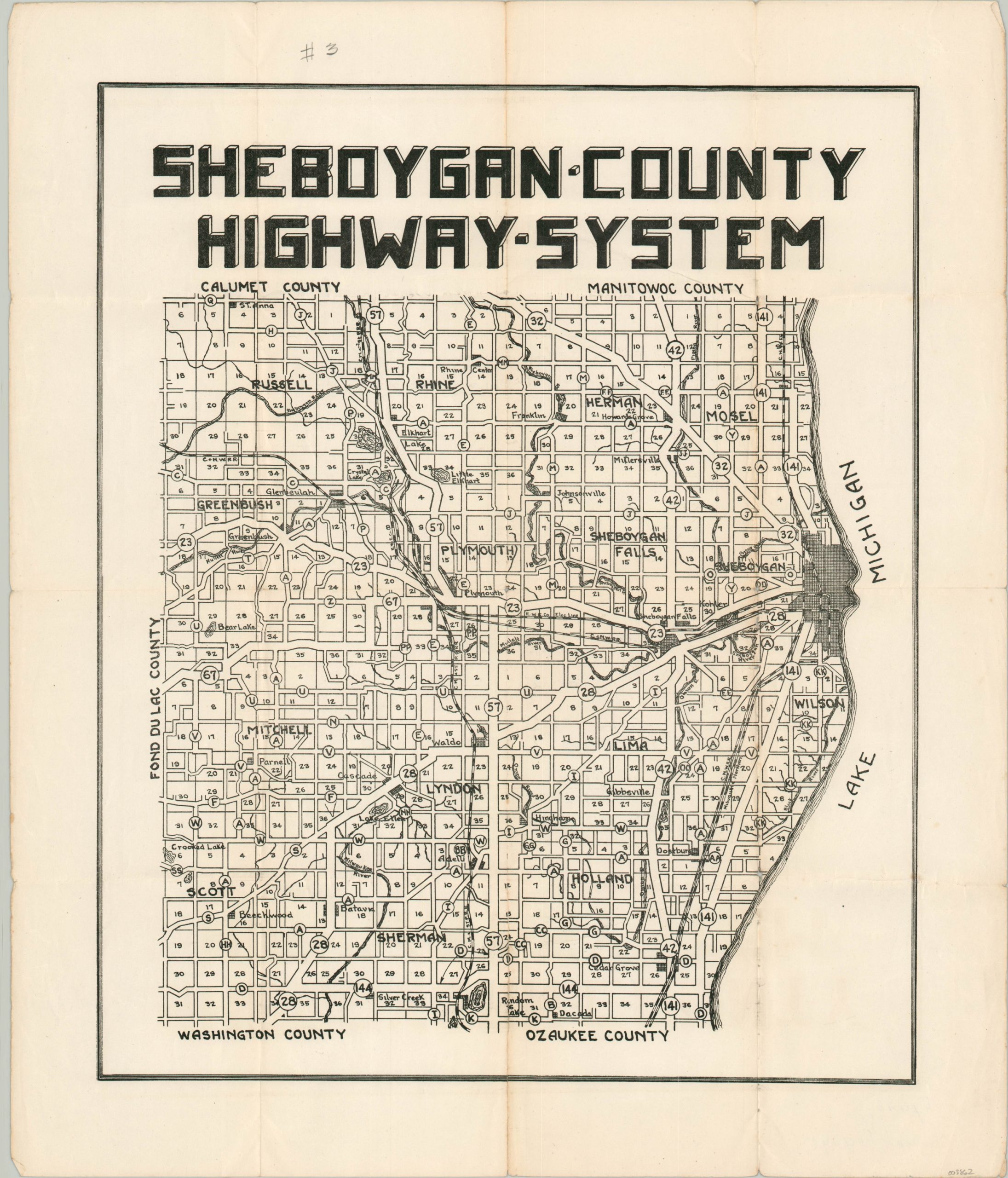
Sheboygan County Highway System
$75.00
The first numbered highway system in the United States.
1 in stock
Description
This detailed road map of Sheboygan County, Wisconsin shows an early overview of the state’s numbered highway system – the first to be established in the United States (1917). The image was issued about a decade after the initial legislation passed and shows the various routes in operation across the county, identified using a combination of numbers and letters.
Sheboygan can be seen situated on the shores of Lake Michigan on the right side, while other smaller settlements are also labeled throughout the image. Created anonymously and likely published by the state’s Highway Commission in the mid-1920s.
Map Details
Publication Date: c. 1925
Author: Anonymous
Sheet Width (in): 16.75
Sheet Height (in): 19.75
Condition: B+
Condition Description: Moderate wear along former fold lines, including minor discoloration, small holes at fold intersections, small edge tears, and about 6" of separation that has been repaired on the verso with archival tape.
$75.00
1 in stock