Seven Years’ Residence in the Great Deserts of North America
A pair of travel volumes published by a French minister to Texas.
Out of stock


Description
Though the title of these volumes implies that all seven years were spent residing in “The Great Deserts of North America,” author Emmanuel Domenech actually spent less than four years cumulatively traveling and operating as a Catholic minister in Texas. He arrived in the U.S. prior to completing his seminary studies in 1846, spent two years in St. Louis finishing his courses, and returned to France by 1852.
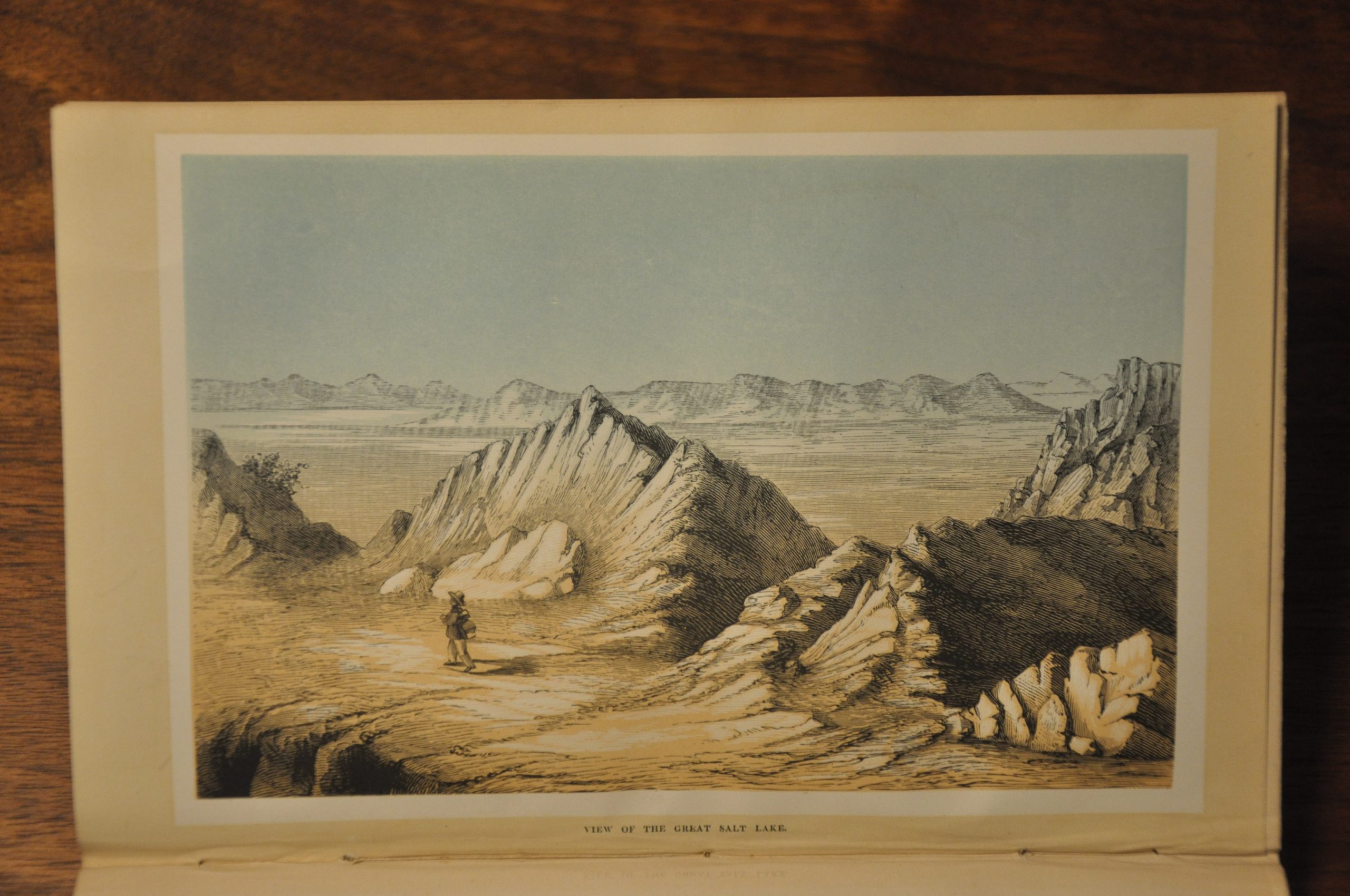
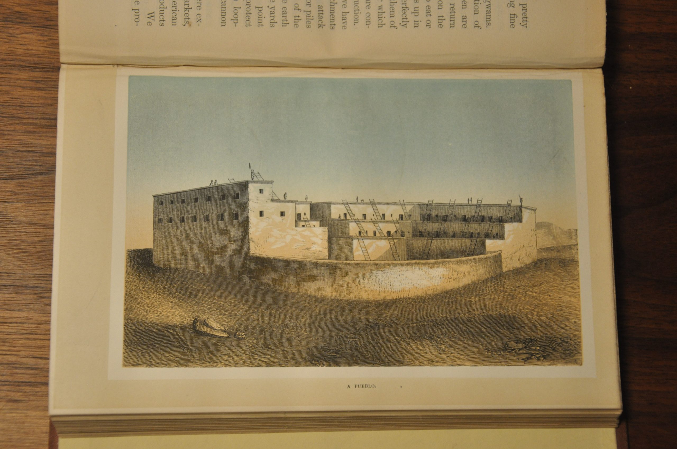
His efforts to mislead are not unsurprising, as later observers have noted that his plates are lifted directly from Caitlin and U.S. Government Reports. Nonetheless, the volumes are a fascinating chronicle of Native Americans and life in the Southwest prior to the outbreak of the Civil War, and includes numerous plates of tools, costumes, architecture, and landscape scenes.
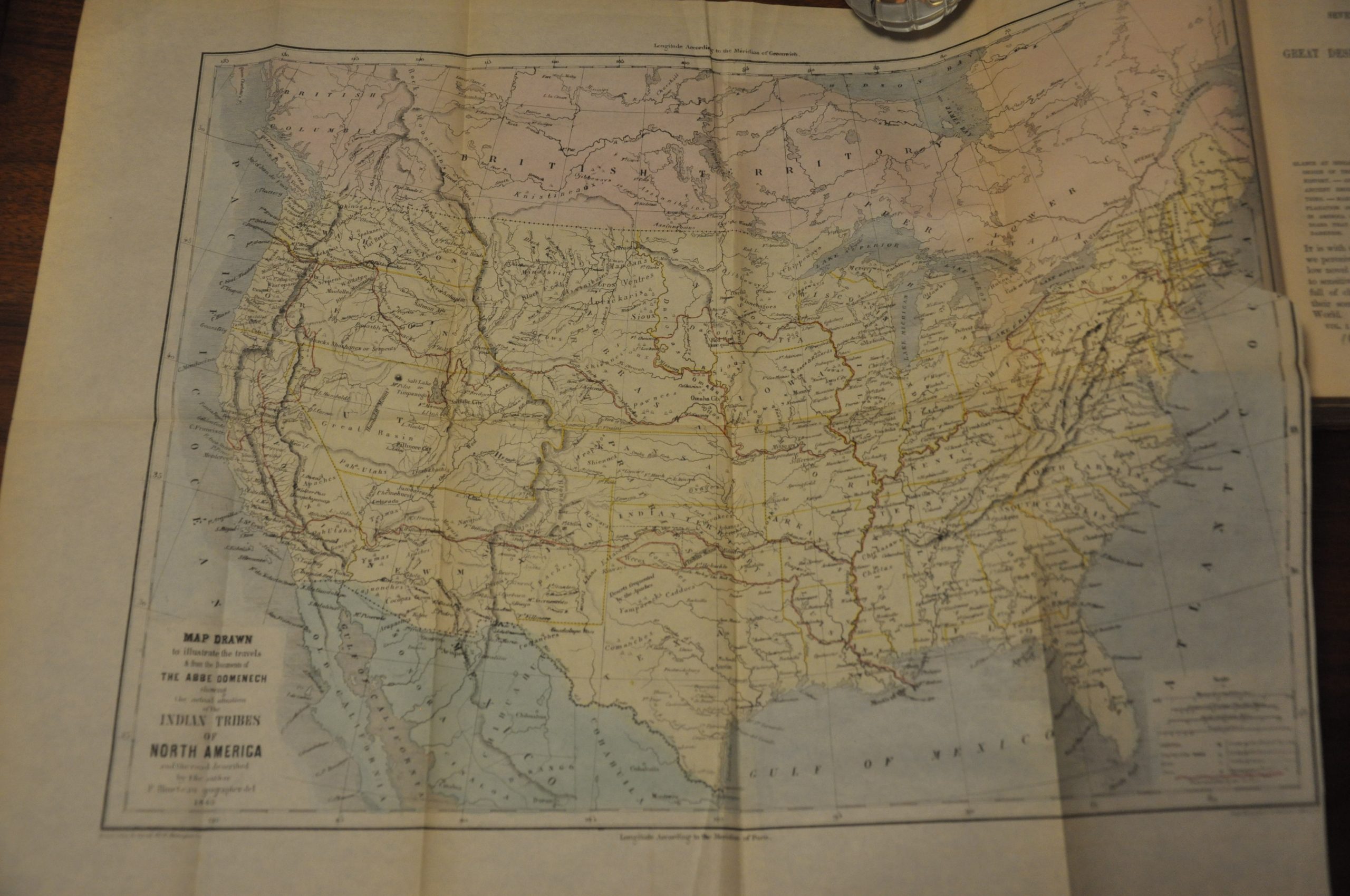
Also of note is the large fold out, “Map Drawn to Illustrate the Travels & From the Documents of the Abbe Domenech Showing the Actual Situation of the Indian Tribes of North America.” This hand colored map of the United States shows fascinating contemporary antebellum details; enlarged western territories, forts, and major geographic features are labeled and there is an obvious heavy emphasis on the locations of American Indian tribes.
Several exploration routes are shown, including those of Fremont, Marcy, and Kearney, while the circuitous path outlined within the book is highlighted in red. (Note: Domenech didn’t actually travel the route, only a fraction of it, and used careful language to present “the road described by the author”).
References: Wagner-Camp 356:1, Wheat Trans Mississippi 1008. Graaff 1121.
Map Details
Publication Date: 1860
Author: Emmanuel Domenech
Sheet Width (in): See Description
Sheet Height (in): See Description
Condition: B+
Condition Description: Two volumes, 445 & 465 pp, measuring 6" x 8.9". Bound in original reddish cloth with embossed boards and gilt spine. Some wear to the extremities and joints. Vol I includes 34 color lithograph plates & views based on woodcuts by A. Joplin, as well as a fold out map measuring approximately 20" x 16.5." The map is slightly toned in the outer margins, creased along fold lines, and has a 2" tear where affixed. Vol. II includes 25 color plates of Native American costumes, implements, and architecture. Broken back hinge and minor scattered foxing. Overall a handsome set in very good condition.
Out of stock