[Seven Remington Rand Maps of WWII Battlefronts]
$150.00
A set of 7 maps and accompanying text outlining World War II battlegrounds.
1 in stock
Description
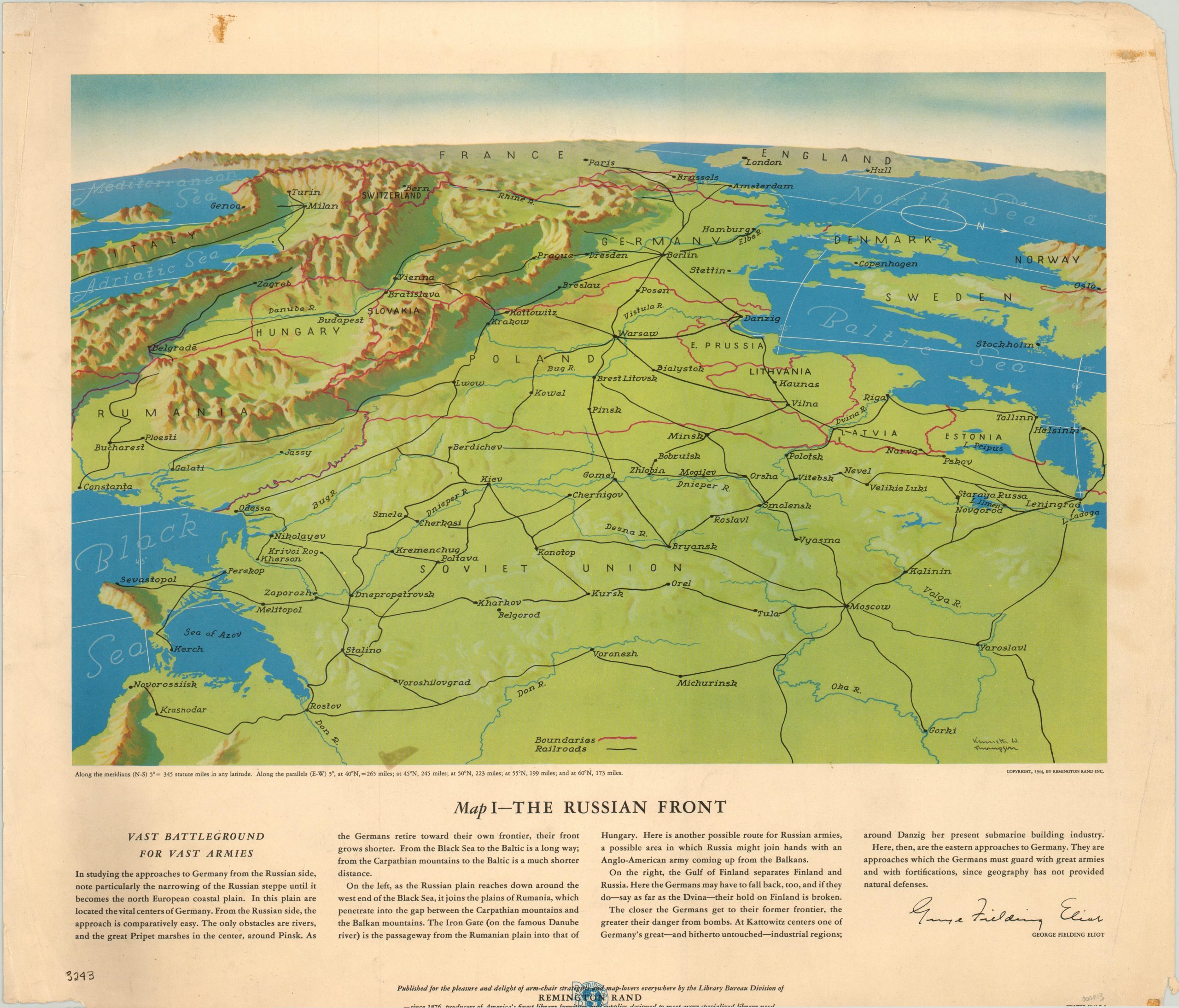
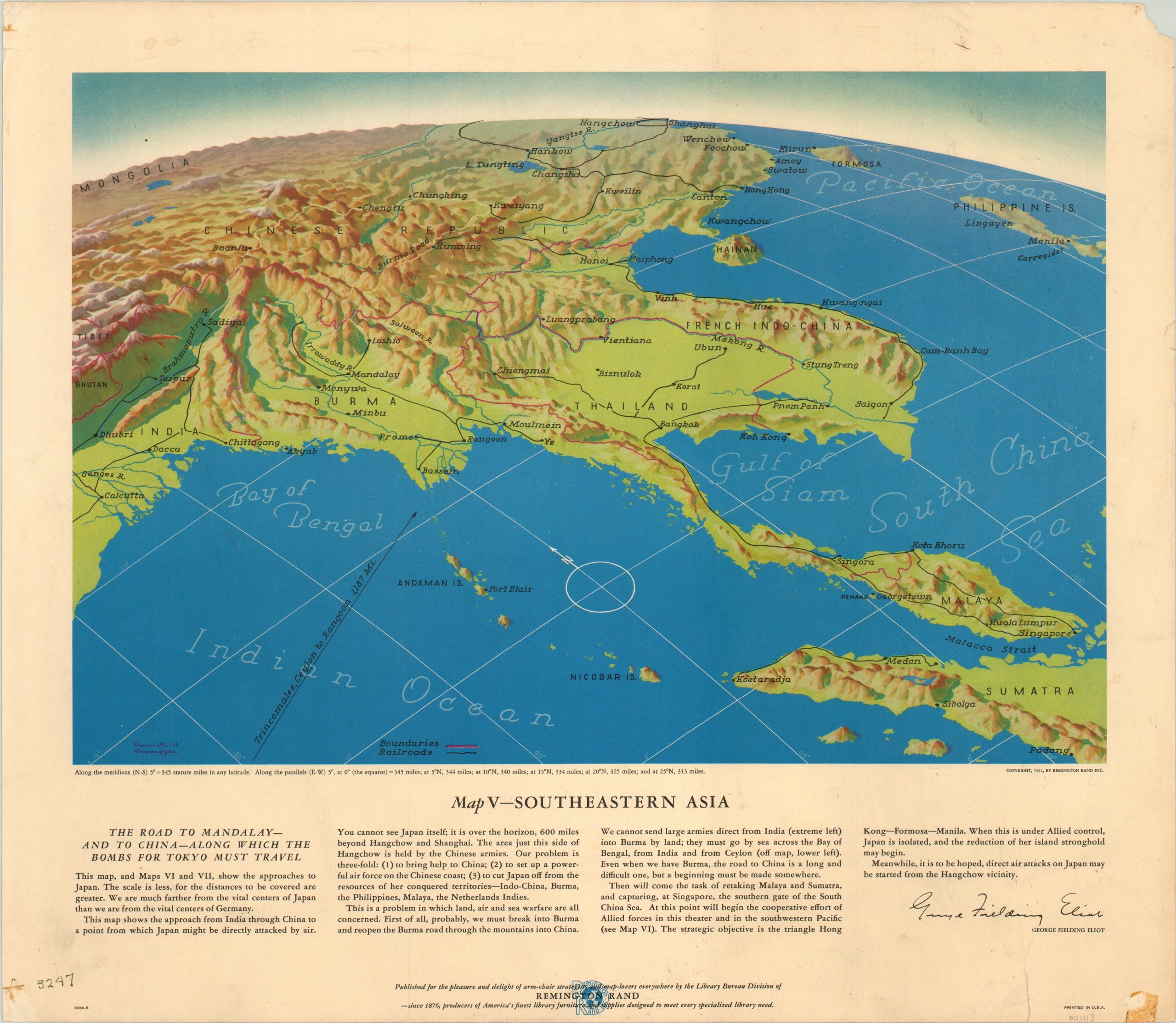
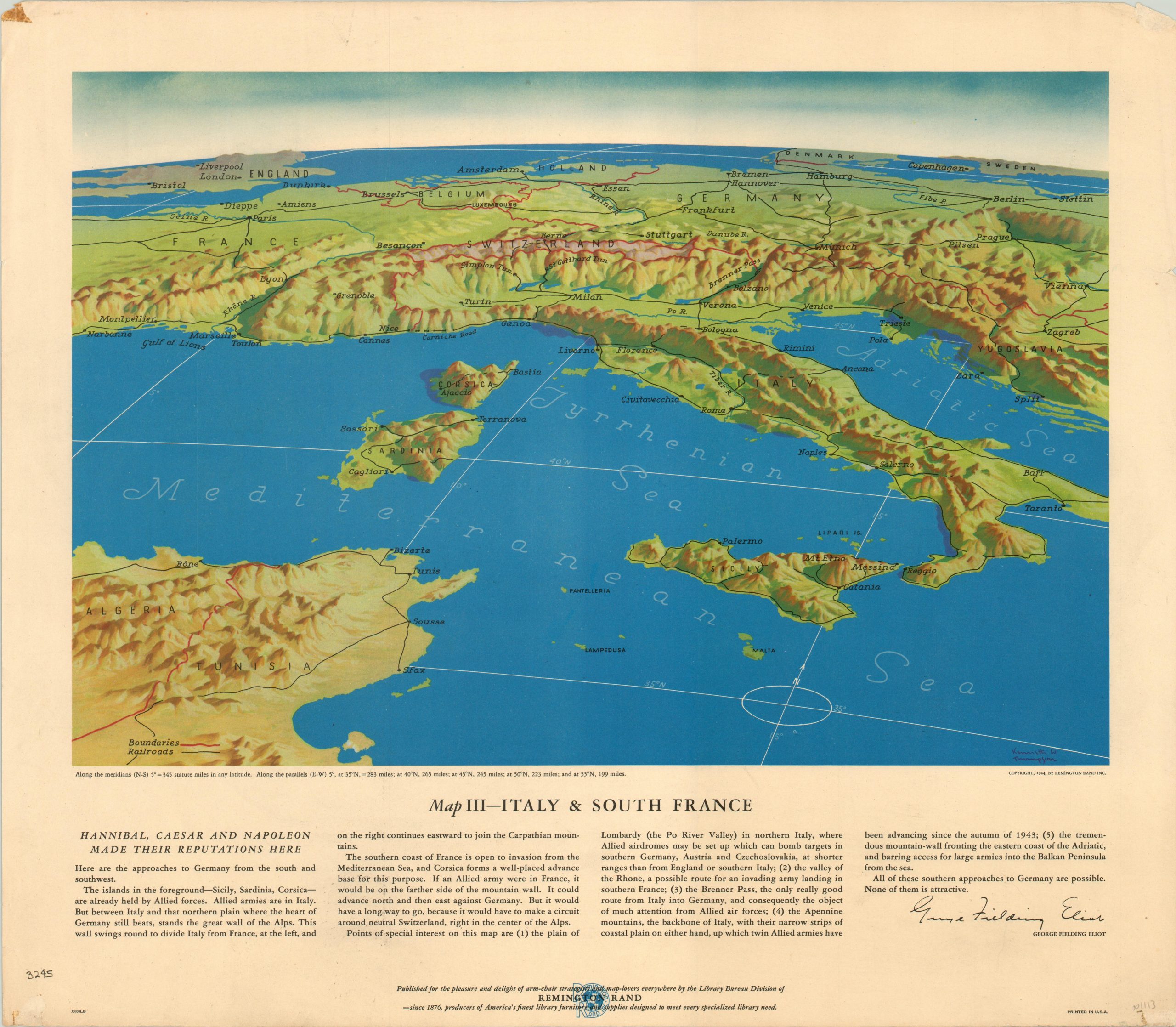
During WWII, Remington Rand was probably best known for the thousands of typewriters it created for stenographers, clerks, and other professionals in the war industry. However, the company’s Library Bureau published this set of seven maps, illustrated by Kenneth Thompson and captioned by George Fielding Eliot (a former Major in the U.S. Army Reserve).
Each sheet shows a different theater of war from an oblique aerial perspective, which was far different from the typical maps seen by the American public. Railroads, rivers and international boundaries are identified, which gives an uncluttered look at the scope and topography of each region. The accompanying text provides geopolitical commentary and a strategic overview courtesy of the experienced military analyst and WWI veteran.
The maps are as follows: Map I – The Russian Front, Map II – The Balkans, Map III – Italy & Southern France, Map IV – The Western Front, Map V – Southeastern Asia, Map VI – The Southwest Pacific, Map VII – The North Pacific.
Map Details
Publication Date: 1944
Author: Kenneth W. Thompson
Sheet Width (in): 21.00
Sheet Height (in): 18.10
Condition: A-
Condition Description: Moderate soiling and wear visible in the margins of most sheets. This includes old tape in the corners, edge wear, a few small tears and extraneous creasing. Map V has a 3" vertical tear from the bottom of the sheet that affects the text, but not the image. Very good condition overall.
$150.00
1 in stock


