[Set of 14 World War II Red Cross Maps]
$2,200.00
Set of 14 maps and guidebooks to various areas supported by the Red Cross.
1 in stock
Description
The American Red Cross involvement in World War II preceded the entrance of the United States into the conflict. When hostilities began in Europe in 1939, the Red Cross became the chief provider of relief supplies for the civilian victims of conflict distributed by the Geneva-based International Red Cross Committee. In February 1941, the Red Cross responded to a request by the U.S. government to begin a Blood Donor Service to produce lifesaving plasma for the armed forces in anticipation of America’s entry into the war. After the attack on Pearl Harbor on December 7, 1941, the Red Cross quickly mobilized a volunteer and staff force to fulfill the mandates of its 1905 congressional charter requiring that the organization “furnish volunteer aid to the sick and wounded of armies in time of war” and to “act in matters of voluntary relief and in accord with the military and naval authorities as a medium of communication between the people of the United States of America and their Army and Navy.”
In addition to providing valuable material, medical support, and sanitary services to the armed forces on the front lines, the Red Cross played a hugely important role in the domestic background of the Allied powers during WWII. Club Service was made available at the request of the U.S. government to able-bodied members of the armed forces serving overseas, while recreational services for the military at home remained, as it had been, limited to hospitals. Overseas the Red Cross staffed and supplied permanent service clubs, travelling clubmobiles, and other recreational facilities that stretched literally around the world. At its peak, the Red Cross operated nearly 2,000 recreational service facilities abroad, staffed by 5,000 Red Cross workers and approximately 140,000, mostly local, volunteers.
As part of their congressional mandate, the ARC issued dozens of maps of cities across the European and Pacific theaters of operation. Apart from being useful guides to local transportation, amenities, and points of interest, the maps also reflect the organizational presence of the Red Cross within each city. Service clubs provided sources of leisure, warm meals, and clean clothes that could help a soldier return to normalcy. These maps were also handy souvenirs for the thousands of volunteers who served at such facilities.
Paris – 1944. Color map that unfolds to 14” x 22.” Moderate wear and discoloration on fold lines. Printed on ration paper. Includes an inset map of the Paris Metro and bird’s eye view of the city center with buildings drawn in profile. ;
Brisbane and Suburbs – late 1942. Color map unfolding to 16.9” x 11.4.” Fold lines as issued, including a few spots of separation that have been repaired and reinforced. Shows a basic transportation map of the city flanked by a street index and locations of interest. The verso provides a small-scale map of Brisbane’s downtown and supplemental information on amenities and currency. Dated based on the location of only one “official” ARC location. The second would open in early 1943.
Map of Berlin – 1946. Color map unfolding to 15.9” x 11.4.” As it’s a postwar map, areas within the city are colored according to Allied occupying force. 48 locations of interest are noted, and the verso shows a transportation map of the city with various special services and Red Cross locations identified. Moderate wear, consistent with age and use.
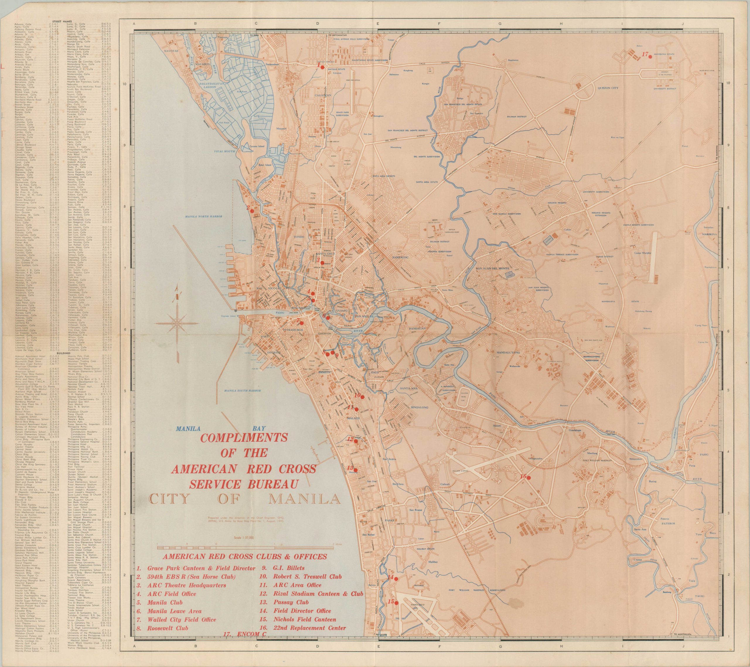
City of Manila – Single sheet unfolding to 22” x 19.8.” 28 ARC locations are overlaid on top of a U.S. Army Corps of Engineering map of the city. Includes index of street names. Manila was the scene of the worst urban fighting in the Pacific Theater, and was key to MacArthur’s promise to return to the Philippines. ;
Firenze (Florence) – Color pamphlet unfolding to 16.5” x 12.2.” Only a handful of ARC locations are overlaid on a pre-war Italian map of the ancient city. It was occupied for nearly a year by the Germans, who declared it an “open city” before retreating in 1944. Many of the medieval bridges spanning the Arno were destroyed in the process.
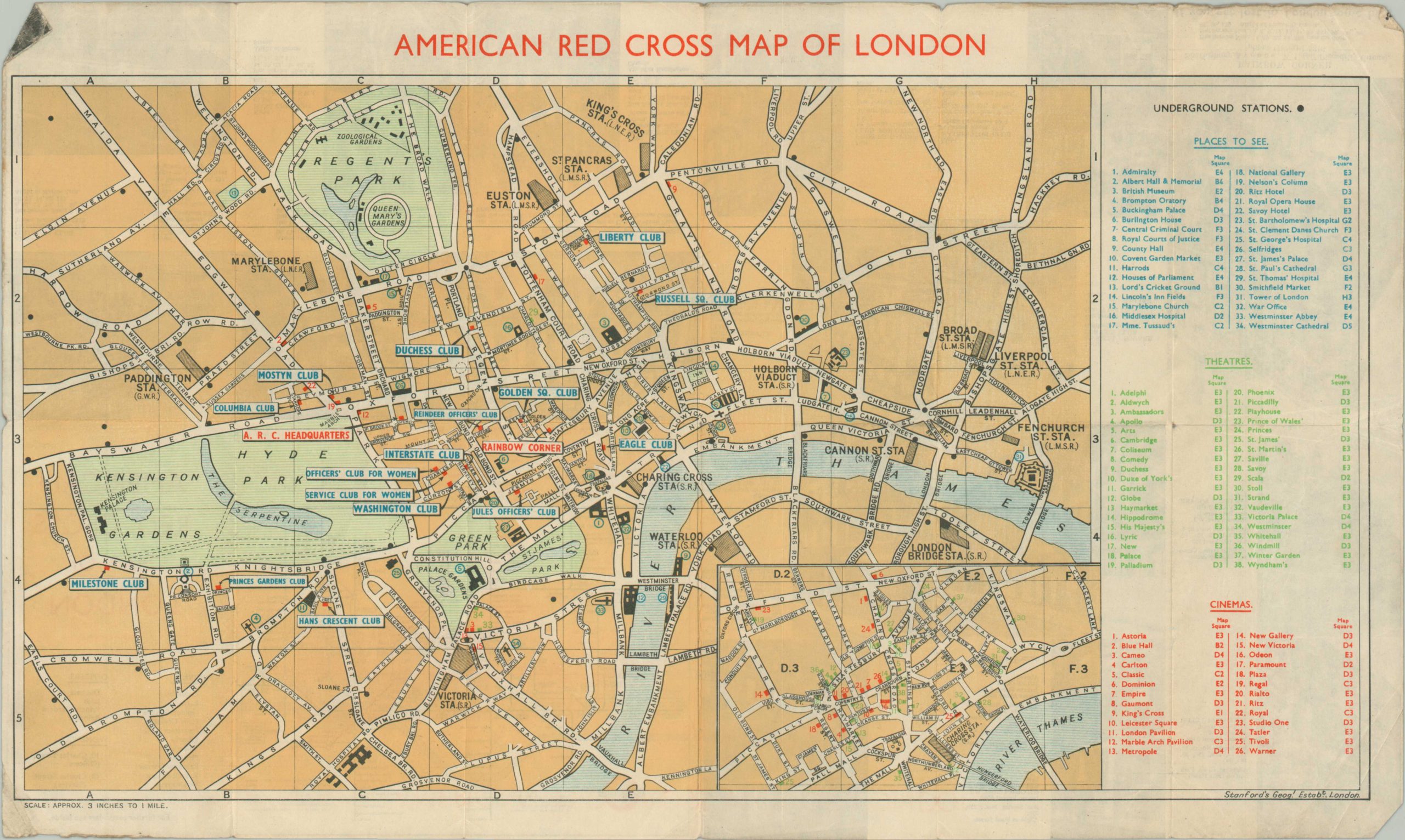
American Red Cross Map of London – 1943. Double-sided color pamphlet unfolding to 18.4” x 11.4.” Places to See, Cinemas and Theaters are noted on the main map, while photographs of various ARC clubs and a small map of the Underground are present on the verso. Moderate wear and discoloration along fold lines.
Map of Sydney and Suburbs – Color brochure that unfolds to 14.7” x 19.8.” The main map shows the greater Sydney area with emphasis on primary routes of transportation. The verso shows a large-scale inset map of Sydney with 41 locations of interest identified, in addition to extensive information on facts and amenities. Heavy separation along fold lines (repaired on verso) and several tears along the outer edges of the sheet; ;
Map of Rome – late 1944/early 1945. 27” x 34.” Scarce, large folding map of Rome created shortly after the 5th Army’s occupation of the city. The underlying map, which shows prominent buildings and attractions in profile, is in Italian; while the red overlaid text is in English. Twenty-nine “Outstanding Points of Interest” are identified. Moderate creasing and separation along originally issued fold lines, with several spots repaired on the verso with archival tape.
Bird’s Eye View of Vienna – 1946. 27” x 19.5” Excellent double-sided map of Vienna published during the Allied occupation of Austria. One side shows a lovely bird’s eye view of the city with prominent buildings illustrated in profile. An inset map shows the divisions of districts within Vienna according to Allied occupational force. The verso features a detailed city plan (in German), with thirty-seven points of interest numbered, described, and illustrated.
Melbourne and Suburbs – c. 1943. 19.25″ x 14.75″ Informative guide to Melbourne and the surrounding area using a base map provided by the Tourist Service of the Victoria Railways. Dozens of places of interest are noted across the image and on the inset map of downtown provided on the verso. Heavy wear and numerous areas of separation along fold lines have been repaired with archival tape.
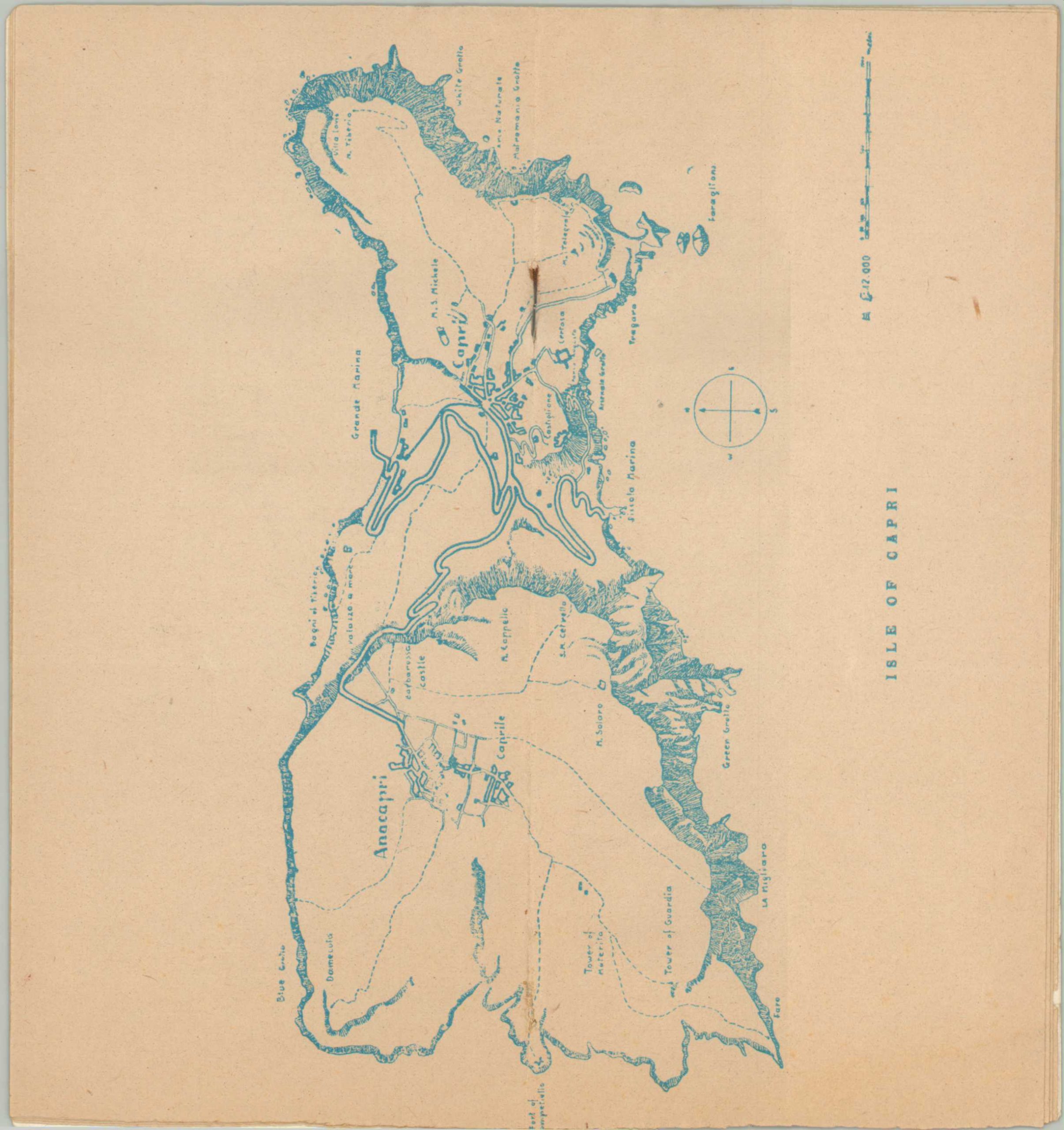
Capri – 1944. 4″ x 9″ pamphlet with 16 pages and stapled binding functions as a handy guide to the small Italian island, which served as a refuge for artists and intellectuals during the war. Includes a centerfold map. Shows some wear, including a bit of rust from the staples.
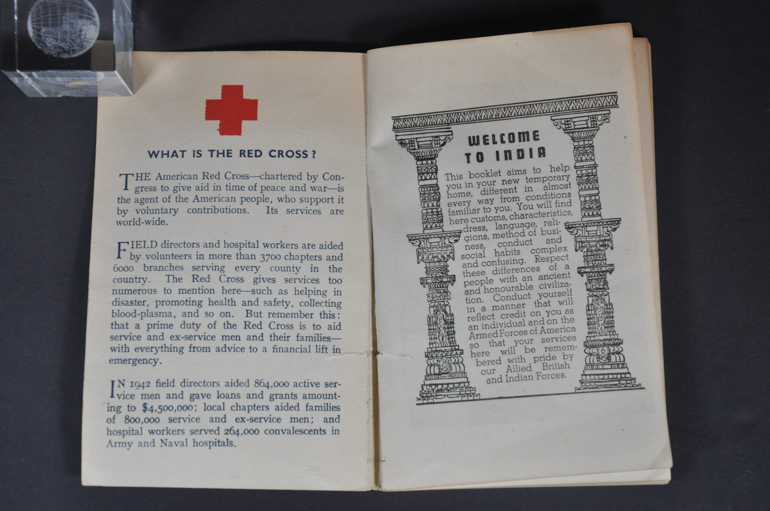
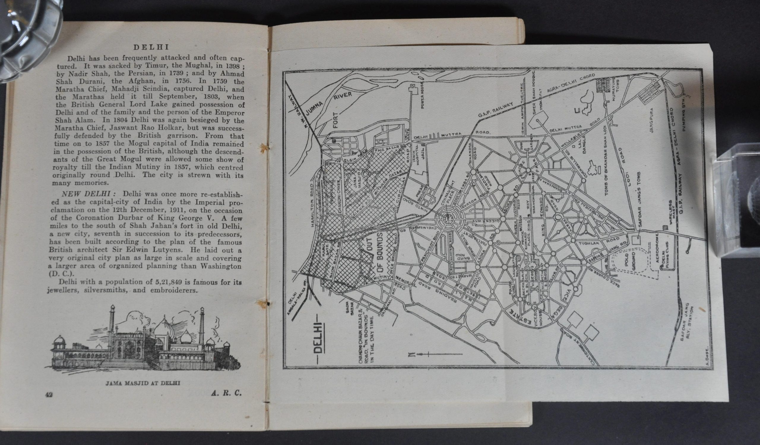
A Guide Book to Calcutta Agra Delhi Karachi and Bombay – 1943. 94 pp. guidebook offering a detailed overview of five major cities in British India. Includes several fold-out maps, summaries of locations of interest, and recommendations to “help you in your new temporary home, different in almost every way from conditions familiar to you.” [Introduction]
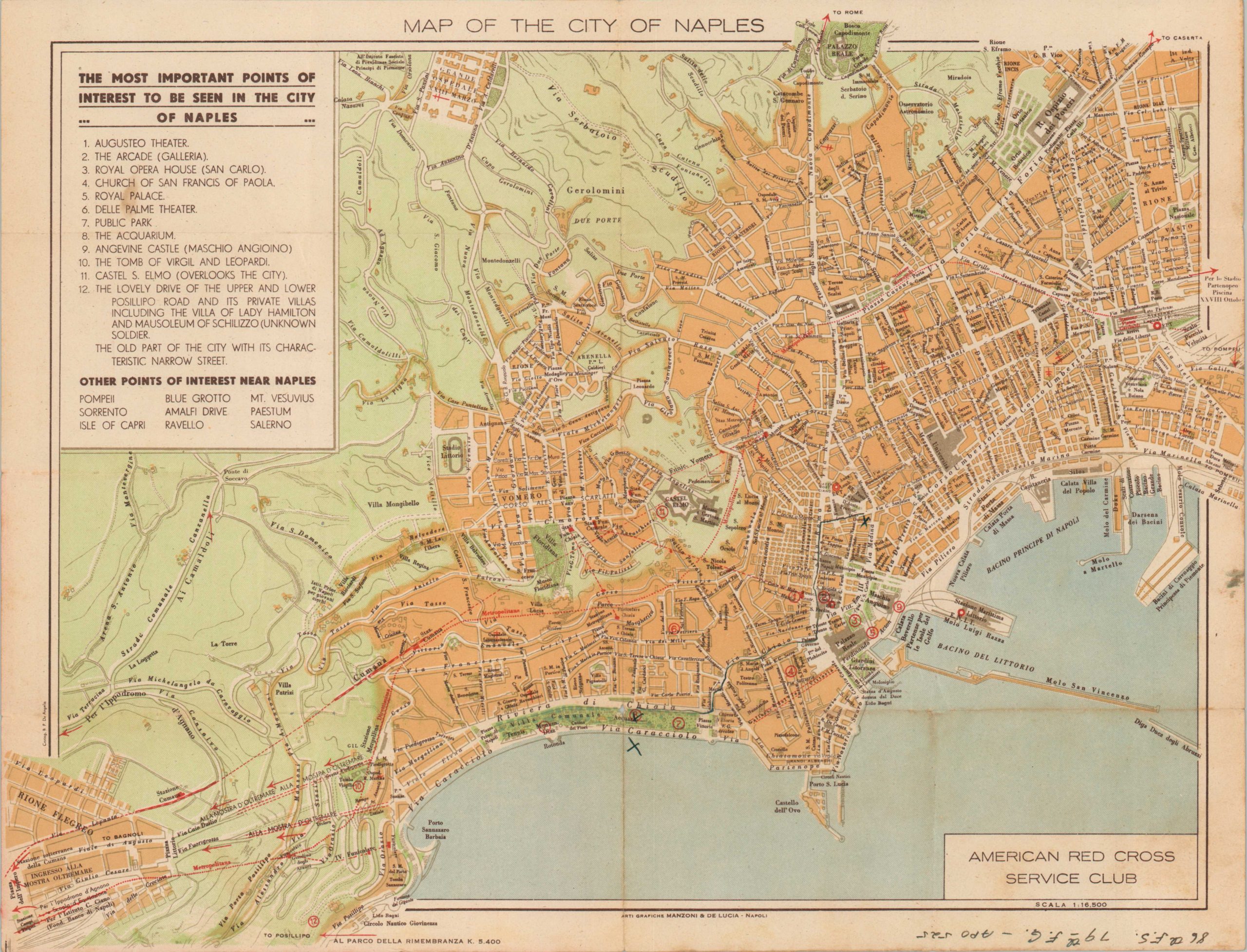
Map of the City of Naples – 1943. 16.75″ x 12.75″ – ‘The Most Important Points of Interest To Be Seen in the City of Naples’ are listed in the upper left. A description of the city and the nearby site of Pompeii are provided on the verso. Issued locally by Manzoni & De Lucia and signed in the lower corner by a member of the 86th Fighter-Squadron, an important component in the capture of Sicily.
Edinburgh, A Pictorial Map of the City – Small map, about 9.5″ x 7.25″, with soiling and tearing along the centerfold, likely disbound from a guidebook. Straightforward street plan identifies various activities and locations of interest, with cartoon vignettes and additional details on the verso. Copywritten C.J. Cousland & Sons Ltd.
Map Details
Publication Date: 1942 - 1945
Author: Red Cross
Sheet Width (in): See Description
Sheet Height (in): See Description
Condition: B+
Condition Description: Collection of 14 different maps published by the Red Cross for use by Allied soldiers during World War II. Each shows varying signs of wear and use - see description for further details.
$2,200.00
1 in stock


