Seeing Colorado Springs
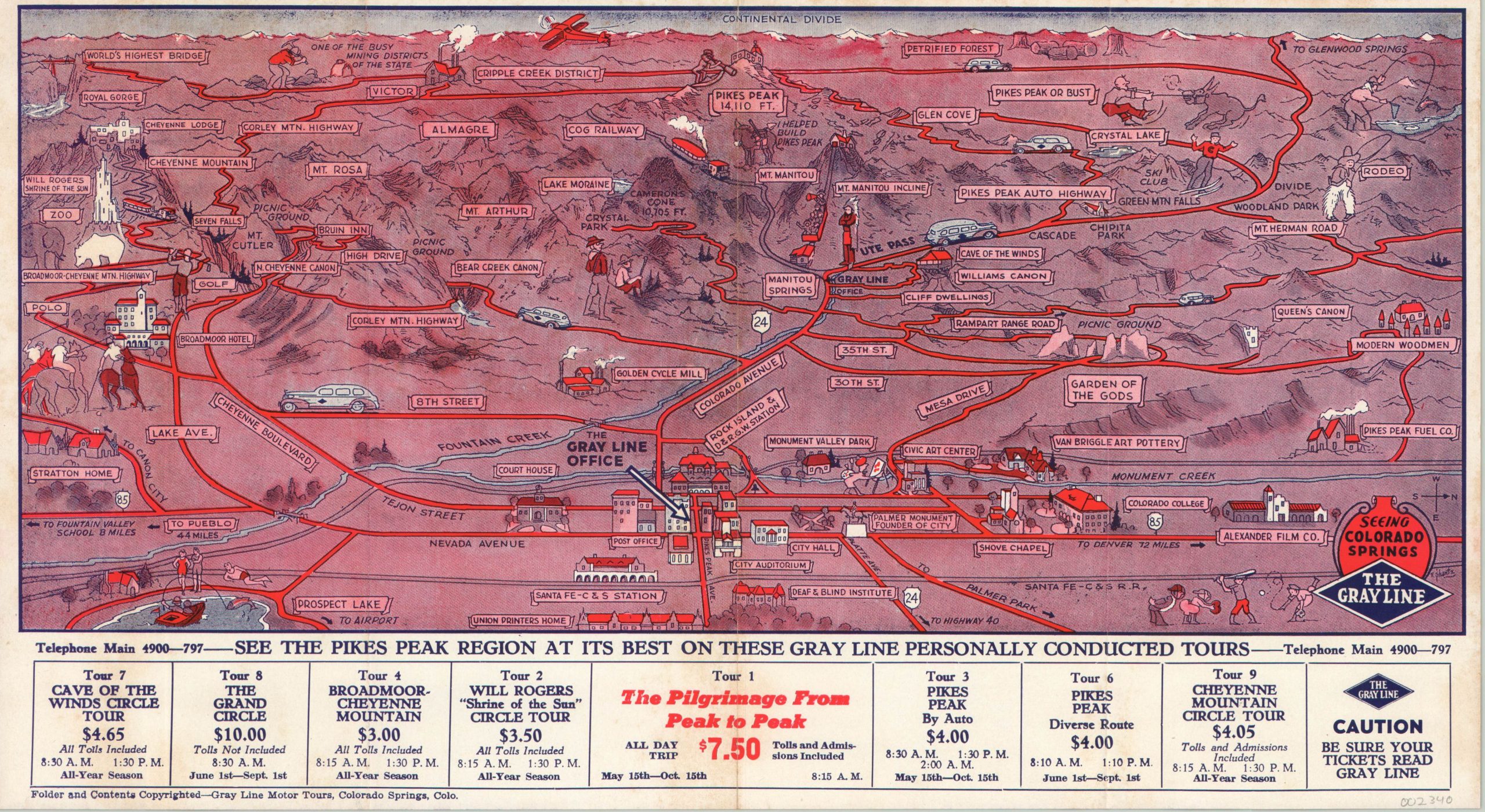
Prewar map and guide to Gray Line tours around Colorado Springs.
Out of stock
Description
This marvelous folding brochure highlights the inclination towards leisure enjoyed by Americans in the years immediately leading up to the Second World War. Bold text and photographs of local landmarks and the luxurious bus fleet advertise the variety of sights available on each of the 8 tours operated by the Gray Line tour company. The highlight of the sheet is a large profile view of Colorado Springs and the area around Pikes Peak in the Rocky Mountains. Tour routes can be seen snaking across the landscape, weaving between place names and vignettes of various points of interest. The panorama was drawn by F. Schantz (signed near the title block), while the sheet was published in Colorado Springs by the Democrat Publishing Company on behalf of The Gray Line. The tour company started operations in Washington, D.C. in 1910 and quickly expanded across the country. It remains in operation today, and Gray Line tours can be enjoyed around the world.
Map Details
Publication Date: 1939
Author: The Gray Line
Sheet Width (in): See Description
Sheet Height (in): See Description
Condition: B+
Condition Description: 8 panel brochure that measures approximately 15.9" x 17.6" when unfolded. The highlight is a 15.9" x 8.9" panorama of the various tours operating in the Pikes Peak region. Moderate wear and light discoloration along fold lines and around the outer edges of the panorama. Heavier discoloration visible down the vertical centerfold.
Out of stock


