See the Wonderful World of Ohio
$75.00
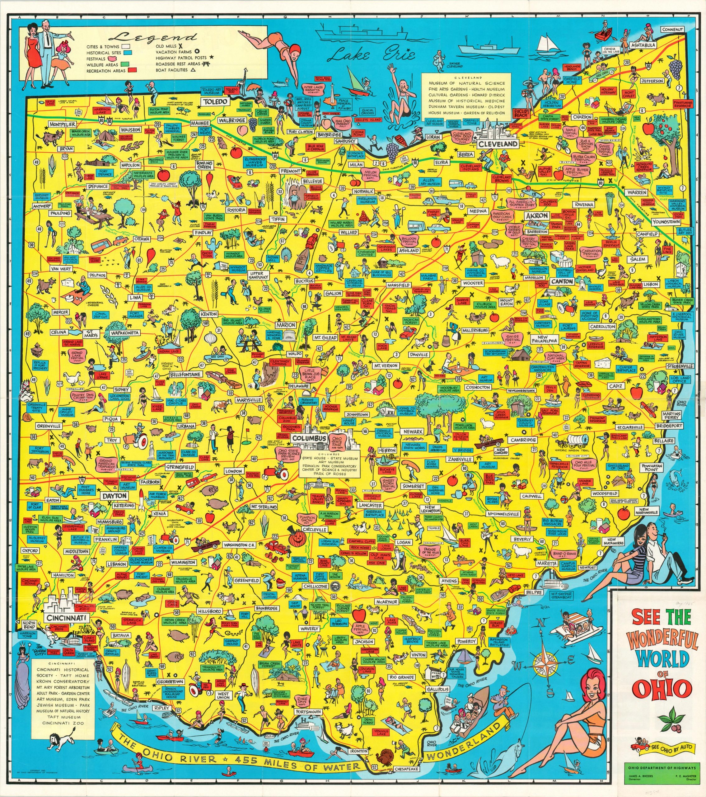
Fun pictorial maps encouraging families to hit the road across Ohio.
1 in stock
Description
Ohio’s road network can be seen reaching to nearly every corner of the state on this action-packed pictorial map, published in 1965 by the Ohio Department of Highways. The various festivals, historic sites, recreational areas, traveler’s amenities, and more are identified across the image according to the legend in the upper left.
Small vignettes highlight local industries, cultural elements, and a myriad of fun activities across Ohio. It’s interesting to note that, apart from two stereotypical Native Americans, there are no people of color depicted within the map. Photographs and a standard road map of the state can be found on the verso.
Map Details
Publication Date: 1965
Author: Ohio Department of Highways
Sheet Width (in): 32.75
Sheet Height (in): 36.50
Condition: B+
Condition Description: Creasing and moderate wear along originally issued fold lines, including spots of separation at fold intersections and along the outer edges. Several areas have been repaired on the verso with archival tape. Good condition overall.
$75.00
1 in stock