See Indiana
$90.00
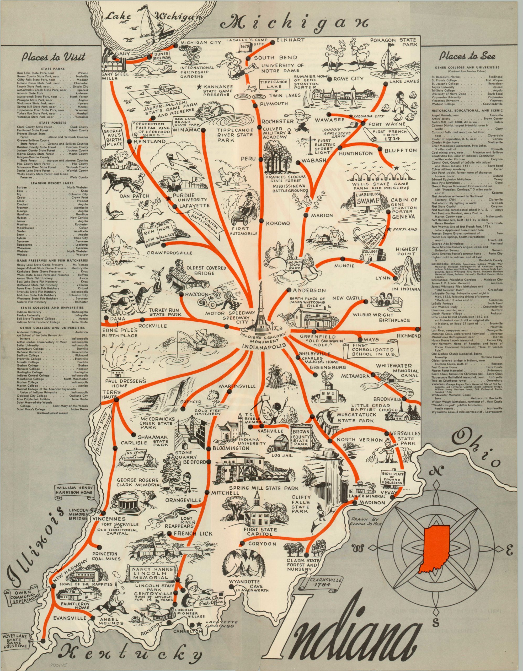
Charming map of the various attractions that can be found throughout the Hoosier State.
Description
This promotional map of Indiana was published as a collaboration between the Departments of Commerce, Conservation and the Indiana Historical Bureau. The result is a well-rounded depiction of the various locations of interest and attractions throughout the state. Attractive illustrations, drawn by the popular artist George Jo Mess, show historical sites such as the First State Capital and New Harmony alongside natural beauty at Clifty Falls and Turkey Run State Parks. Indiana’s industrial capacity is also on display, seen in the steel mills of Gary and stone quarries of Bedford and recreational opportunities can be found at places like the Indianapolis Motor Speedway, French Lick, and the Indiana Dunes (now a National Park).
Interestingly, Indiana is also the state that has been considered the median center of the United States population since 1900. If one were to draw a line north-south or east-west through the calculated location (determined via the census), the population of the country would be divided in half. The median originally was located in Ohio, but has drifted steadily westward ever since. In 2010, the median population center was in Pike County, Indiana.
Map Details
Publication Date: c. 1940
Author: George Jo Mess
Sheet Width (in): 17
Sheet Height (in): 22
Condition: A
Condition Description: The map is in excellent condition, with minor wear along the originally issued fold lines.
$90.00

