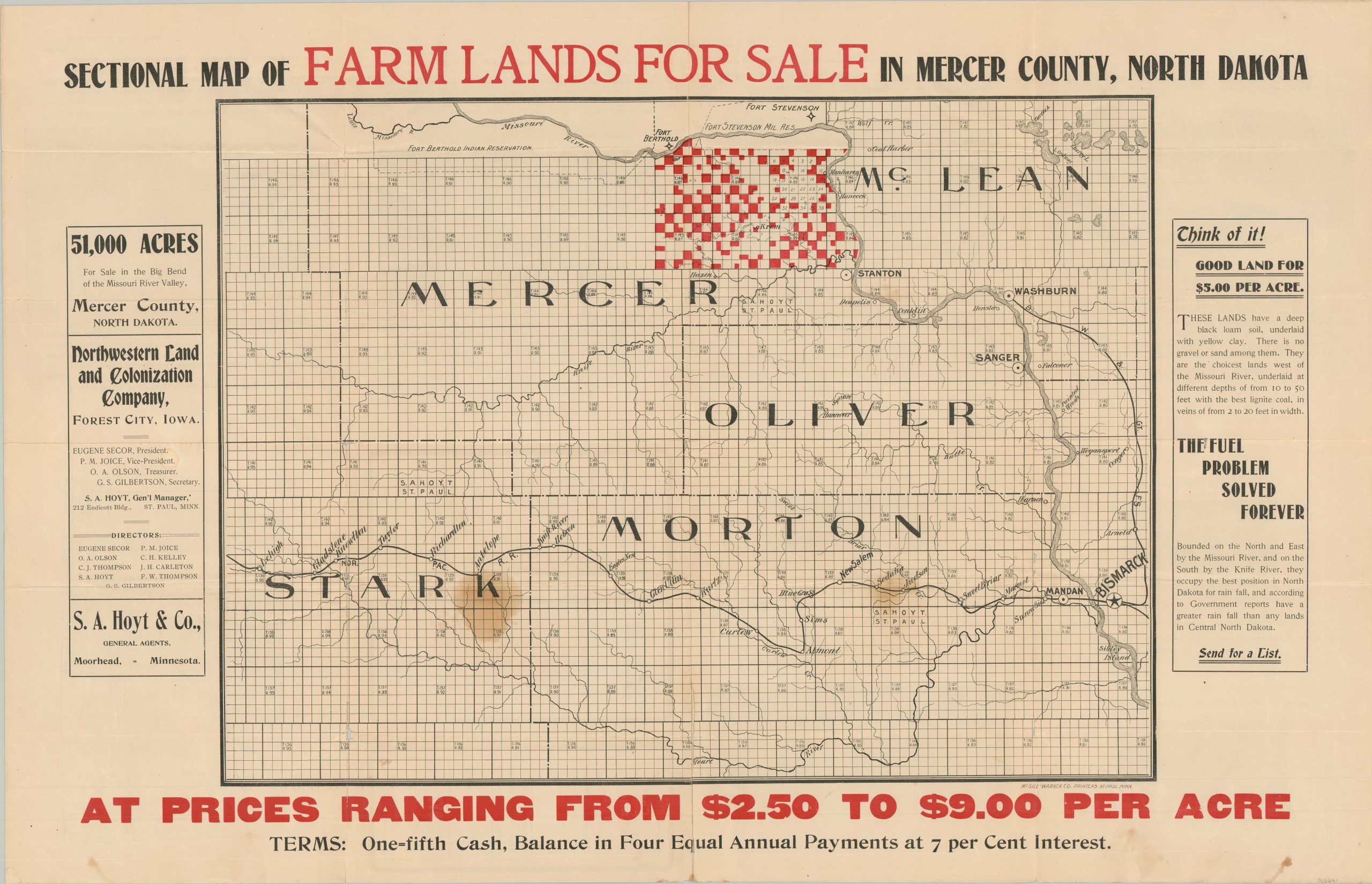
Sectional Map of Farm Lands for Sale in Mercer County, North Dakota
$225.00
Predicting six-fold returns on land in North Dakota.
1 in stock
Description
This promotional real estate map of central North Dakota offers for sale 51,000 acres of the “choicest lands west of the Missouri River.” Bright red squares highlight the available parcels ($5/acre at 7% interest) in Mercer County, where readily available lignite coal deposits promise to solve the fuel problem forever! The nearby Missouri and Knife Rivers offer easy transportation access for agricultural products to the railroad at Washburn.
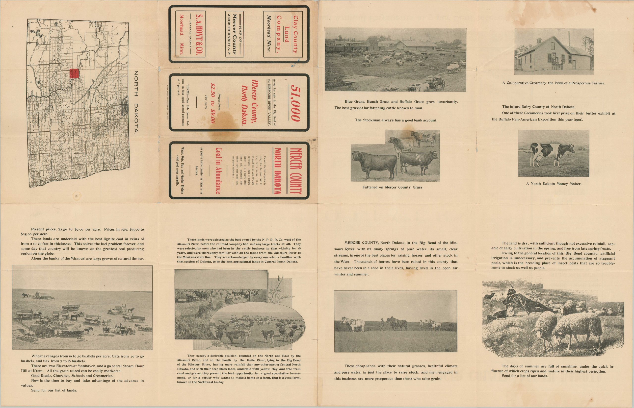
These commodities, primarily cattle, dairy, horses, and wheat, are described with compelling text on the verso and photographs on the verso. It also presents a state map that highlights the tract presented on the recto.
The county borders depicted within help to date the map to between 1896 and 1901. Published in St. Paul by the McGill Warner Company on behalf of S.A. Hoyt & Co., general land agents for at least two companies advertised – The Northwestern Land and Colonization Company and the Clay County Land Company.
Map Details
Publication Date: c. 1898
Author: S.A. Hoyt & Co.
Sheet Width (in): 36
Sheet Height (in): 23
Condition: B
Condition Description: Folding brochure with soft creasing and numerous spots of separation along fold lines. Two large spots in the lower center and scattered soiling visible along the bottom edge of the sheet. About good condition overall.
$225.00
1 in stock


