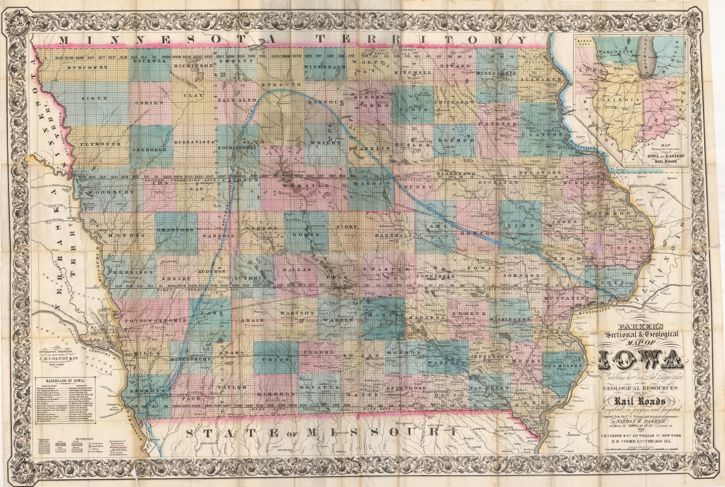
Sectional and Geological Map of Iowa
$425.00
Fine example of the first commercially published geological map of Iowa.
Description
This large map of Iowa was compiled by Nathan Parker in Clinton, Iowa while he was part of the firm Parker, Dole & Co. This firm included land agents and real estate speculators during Iowa’s initial period of settlement in the mid-19th century. Parker, gathering information from public and private sources (the U.S. Geologic Survey wouldn’t be founded until 1879), put together this map to induce settlement (and therefore, profits) to the state. As part of the draw, he elected to include the numerous rail lines already constructed and under construction throughout the state, as well as an inset map that highlights how well-connected Iowa is to its eastern neighbors.
Unlike later geologic maps, the information on this image is of practical use to most potential settlers, and shows areas rich for mining in coal, lead, iron and plaster. Topographical detail, especially marshes, is also especially helpful when determining homestead locations. A fascinating early map of Iowa engraved and printed by the famous firm of J.H. Colton in Chicago.
Map Details
Publication Date: 1856
Author: Nathan H. Parker
Sheet Width (in): 47.50
Sheet Height (in): 33.00
Condition: A-
Condition Description: The map is in spectacular condition, with original hardback covers in great shape and full hand color. Two sheets, joined and printed on a clean sheet with minor seperation along fold lines, common for pocket maps.
$425.00

