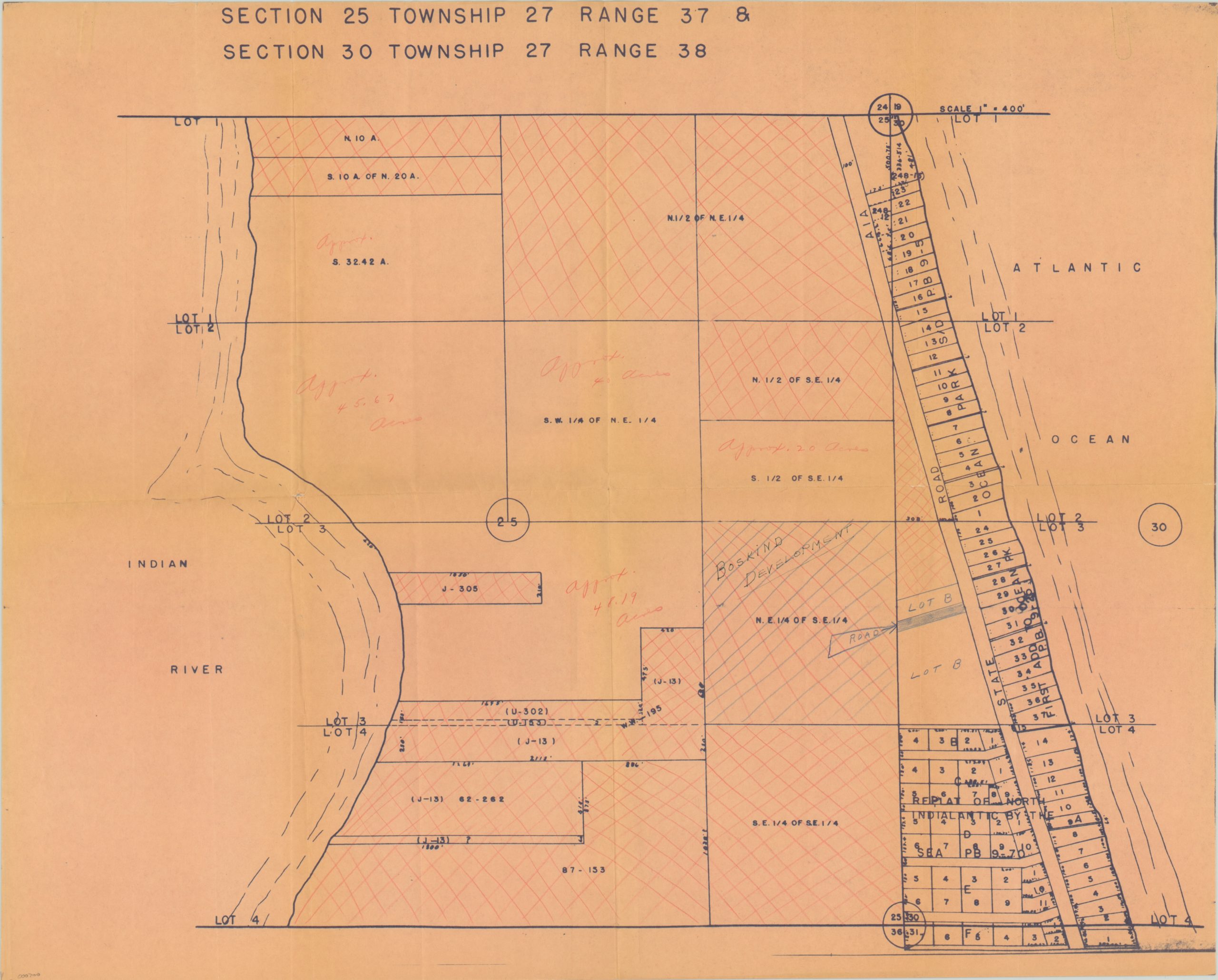
Section 25 Township 27 Range 37 & Section 30 Township 27 Range 38
$75.00
Plat map of new development on a barrier island off Florida’s eastern coast.
Description
The aptly named Indialantic, Florida, lies on a barrier island between the Indian River Lagoon and the Atlantic Ocean. The island was made accessible by road when a wooden bridge was built around 1920 by its first owner, Ernest Kouven-Hoven. It became a popular spot, and new development sprung up quickly along the Atlantic side of the island, as evidenced by this plat map, issued sometime during the 1930’s.
Lots are individually numbered, and their approximate sizes have been penciled in by a previous owner. State Road A1A, a popular route for beachgoers today, can be seen running from north-south along the right side of the map.
Map Details
Publication Date: c. 1930
Author: Unknown
Sheet Width (in): 22.20
Sheet Height (in): 17.90
Condition: B+
Condition Description: Creasing along fold lines and red/blue pencil marks throughout the sheet.
$75.00

