Seattle
$65.00
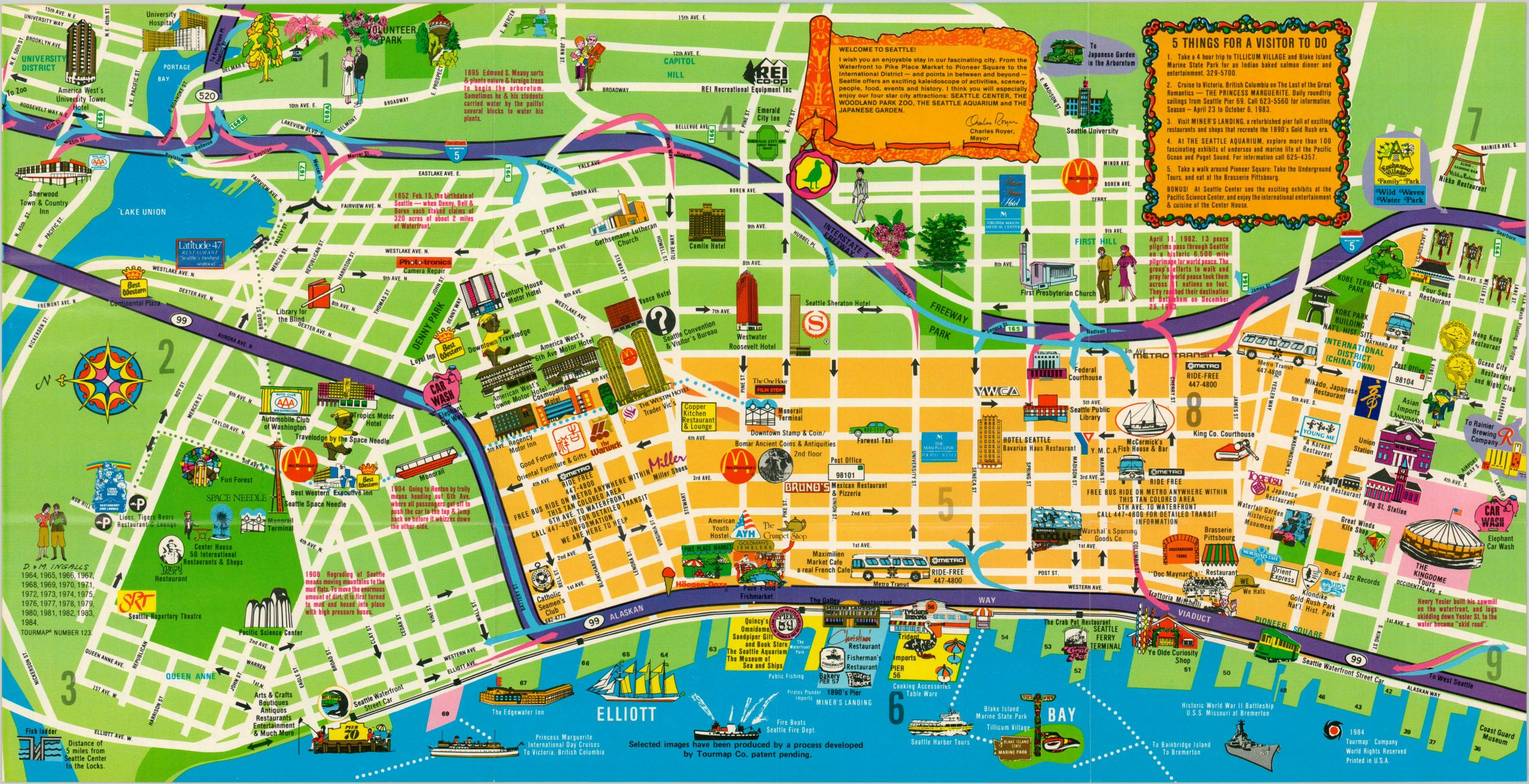
Cheesy 1980’s tourism map of Seattle.
1 in stock
Description
Simplified illustrations highlight tourism hot spots on this 1984 map of Seattle, drawn by D. & M. Ingalls (note the well-dressed pair in the lower left) and published by Tourmap. It is one of at least two promotional street plans published by the company, with another issued in 1975.
The image is oriented with east at the top and emphasizes the Queen Anne Hill and downtown areas. Local attractions vie for attention along with hotels, transportation companies and restaurants. An interesting and somewhat kitschy look at Seattle from the mid-80’s.
Map Details
Publication Date: 1984
Author: D. & M. Ingalls
Sheet Width (in): 22.25
Sheet Height (in): 11.25
Condition: A
Condition Description: Fold lines as issued, otherwise excellent.
$65.00
1 in stock

