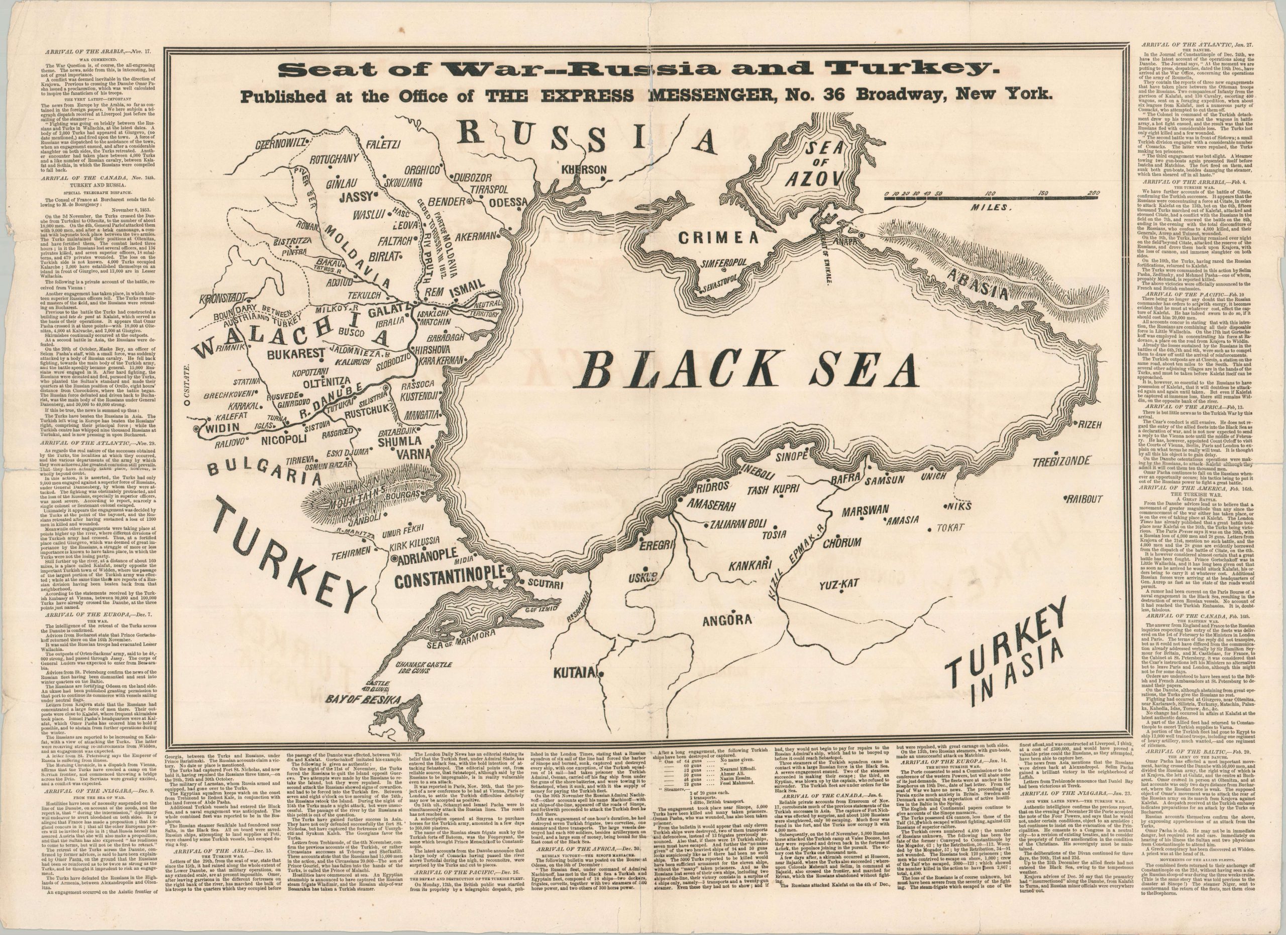
Seat of War — Russia and Turkey
$600.00
Capturing the outbreak of the Crimean War.
1 in stock
Description
Under Tsar Nicholas I, Russia looked to expand its territories in the Balkans at the expense of the Ottoman Empire (whom Nicholas famously described as ‘the Sick Man of Europe’), both as a way to expand national borders and incorporate the Orthodox population as his subjects. The rights of these Christians were the pretext for a war with the Turks, which saw Russian troops march into Moldavia and Wallachia up to the Danube River in late 1853. France and Britain anxiously watched as events unfolded, concerned about the balance of power on the continent and eventual Russian domination of the Eastern Mediterranean.
This scarce broadsheet news-map was issued by The Express Messenger in late February or early March 1854, just weeks before the Western nations issued their respective declarations of war on Russia. A central image shows the area around the Black Sea, with toponyms identifying a variety of important towns and geographic features. Particular emphasis is given to the active theater of fighting along the Danube – names like Alma and Balaklava that would later define the Crimean War are nowhere to be found.
Surrounding the map are dated summaries of dispatches from mail packets, reflecting the real-time stream of information provided to an anxious American public. Various steamships of the Cunard and Collins lines are named along with their dates of arrival. The last entry is from February 20th, with a concluding note about the Allied fleet returning to anchorage at Constantinople on the 22nd after an unsuccessful patrol for Russian ships. There, they met up with the HMS Niger, a vanguard vessel most famous for proving the superiority of screw propeller propulsion in a celebrated 1849 trial against the paddle-wheeled HMS Basilisk.
Map Details
Publication Date: 1854
Author: Express Messenger
Sheet Width (in): 26.00
Sheet Height (in): 19.00
Condition: B
Condition Description: Black and white printed map on a single-sided sheet, heavily worn along old folds. Numerous splits, soft spots, and separations repaired on the verso with archival tape. Minor image loss along a seam in the upper center. About good condition overall.
$600.00
1 in stock