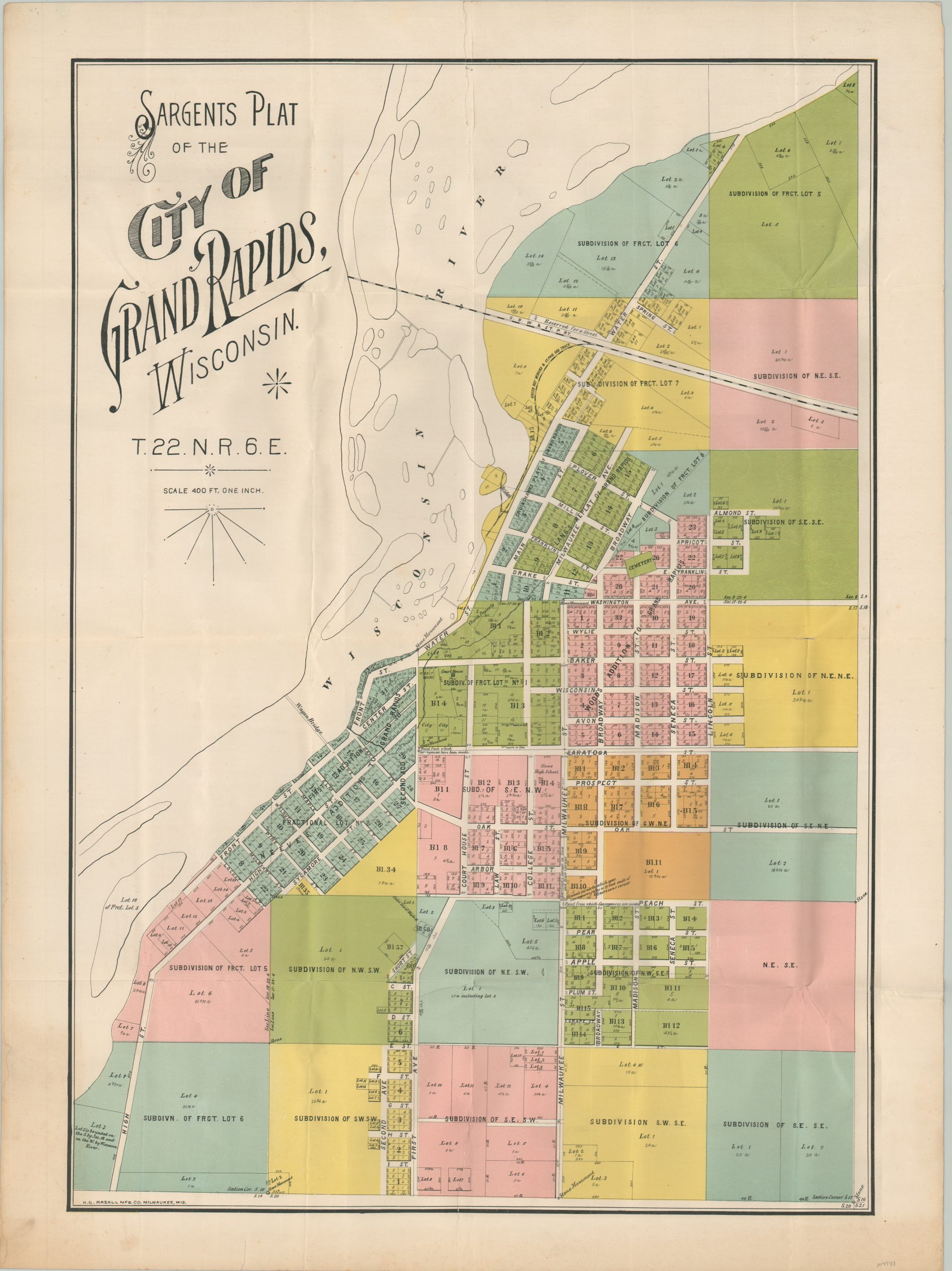
Sargents Plat of the City of Grand Rapids Wisconsin
$400.00
Developing land along the upper Wisconsin River.
1 in stock
Description
This scarce plat map of the city of Grand Rapids, Wisconsin was lithographed in Milwaukee around 1895 by the H.G. Razall Manufacturing Company. Vibrant color highlights the various subdivisions, each of which displays a different degree of further parceling. Lots are numbered, with corresponding measurements or acreages listed. Labels also identify the Courthouse, Howe High School, a cemetery, railroad lines, and the stone monuments used as surveying references.
Grand Rapids was first settled in 1838 by a party of interested individuals looking to leverage the Wisconsin River to power a lumber mill. Logging largely propelled the town’s growth through much of the 19th century, though this development was often hindered by devastating fires. In 1900, Grand Rapids (east bank) consolidated with Centralia on the Wisconsin River’s west bank to form the new incorporated city of Wisconsin Rapids.
The map is rare, and I’ve been unable to find any existing examples in OCLC or other institutional holdings. A handful of oblique references using the document for surveying records or legal proceedings can be found online.
Source: McMillan Library
Map Details
Publication Date: c. 1895
Author: H.G. Razall Manufacturing Co.
Sheet Width (in): 20.5
Sheet Height (in): 27.75
Condition: A-
Condition Description: Creased along old fold lines. Two jagged 5" tears in the upper and lower edges of the sheet that have been repaired with archival tape on the verso. Otherwise in very good condition.
$400.00
1 in stock

