San Francisco and the Bay Area California
$50.00
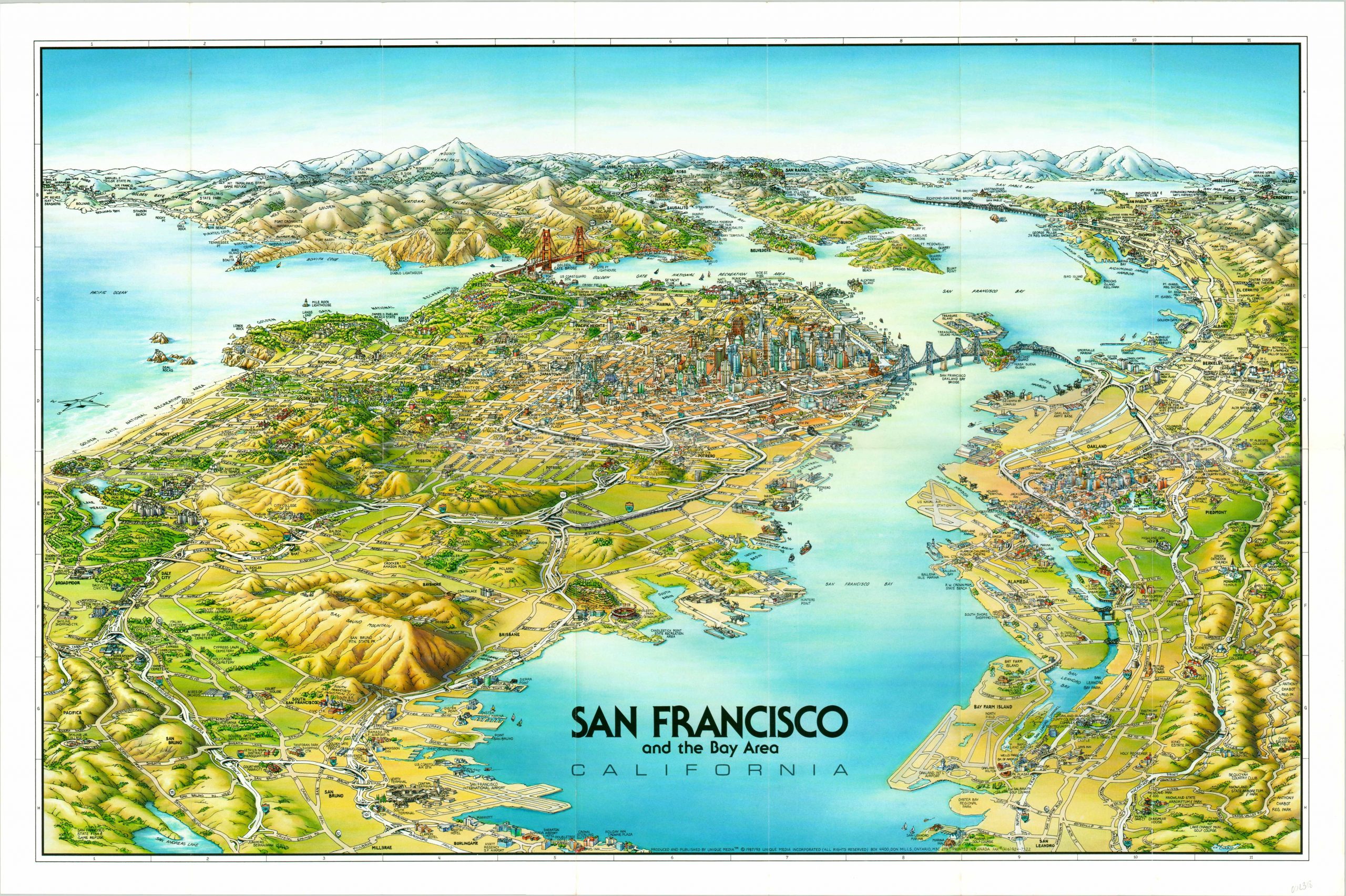
An attractive and finely detailed panorama of the San Francisco Bay, looking north.
1 in stock
Description
This charming illustrated map of the region around San Francisco, California was published by Unique Media in 1993 and covers the Bay Area between the airport in the south and Mount Tamalpais in the north. Finely detailed depictions of major landmarks, locations of interest, and local businesses can be seen interspersed between labeled transportation routes and pictorial geographic features.
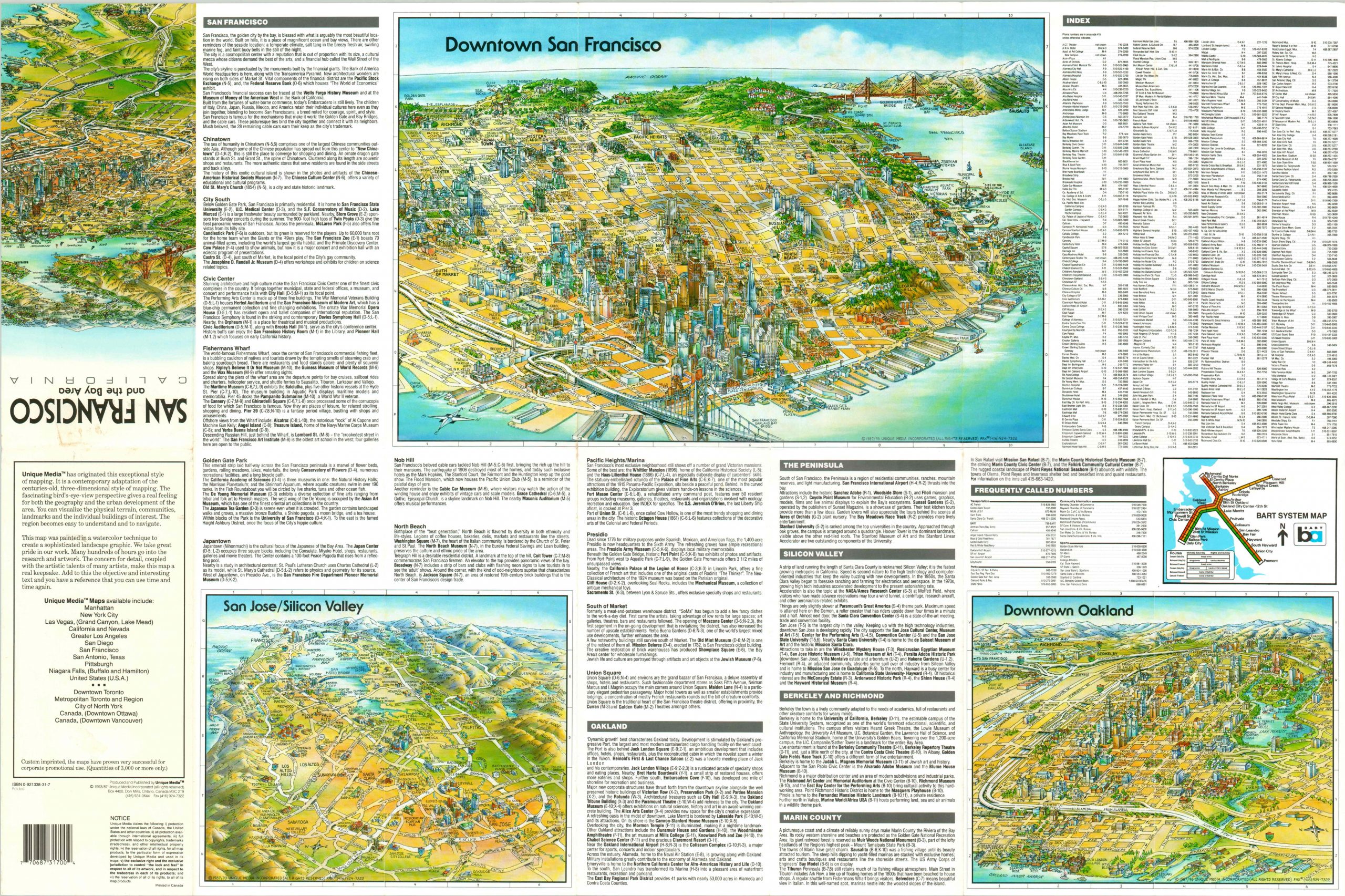
Of particular interest are the highlands of the North Bay, the Golden Gate Bridge, Alcatraz Island, and Candlestick Park. The notorious traffic that plagues the region is completely absent. The verso of the sheet includes inset maps of downtown San Francisco, Oakland, and San Jose; in addition to extensive tourist information.
The distinctive cartoon style is a hallmark of the Ontario, Canada based Unique Media, Inc. Starting in the late 1970’s, the company created a number of maps with a similar aesthetic of locations across the United States and continue to do so today.
Map Details
Publication Date: 1993
Author: Unique Media
Sheet Width (in): 27.00
Sheet Height (in): 17.75
Condition: A
Condition Description: Near fine condition, with light creasing and faint wear along originally issued fold lines.
$50.00
1 in stock