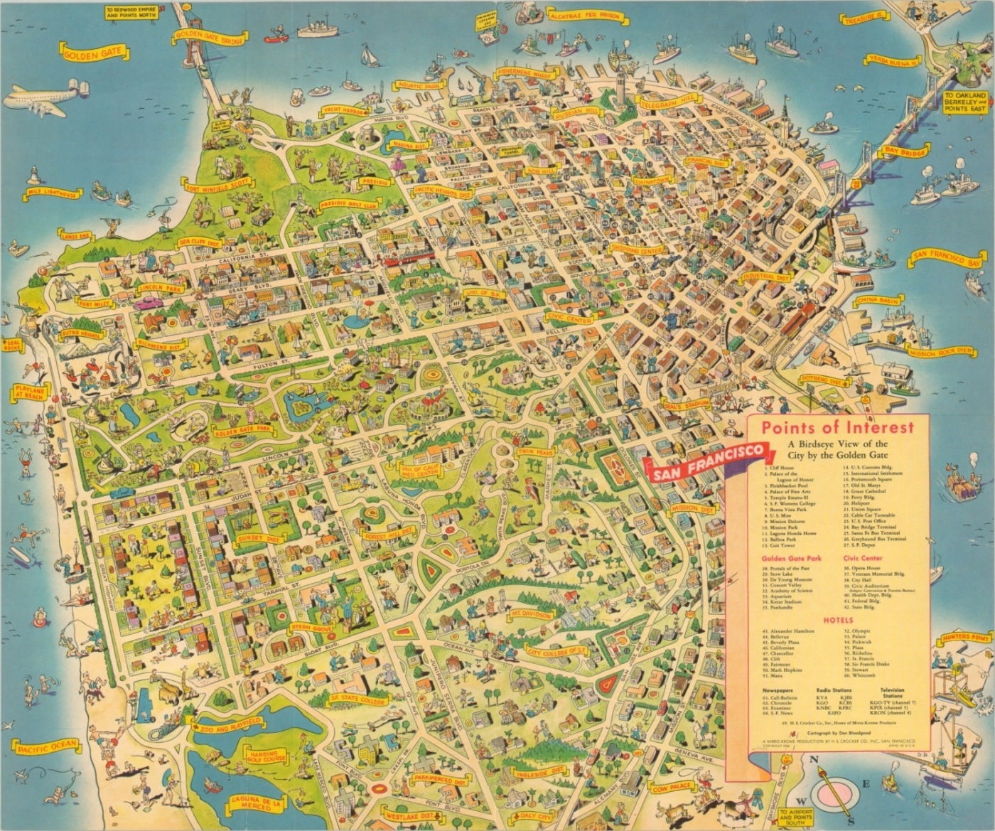
San Francisco A Birdseye View of the City by the Golden Gate
Uncommon pictorial map of San Francisco by the talented Don Bloodgood.
Out of stock
Description
This charming map of San Francisco, California presents an idyllic view of the City by the Golden Gate in an illustrated style typical of the cartographer, Don Bloodgood. In a career spanning over two decades, Bloodgood created numerous maps of popular tourist destinations from across the country. In addition to providing a memorable souvenir for tourists, the maps also provide a snapshot of the cultural composition and self-identity of mid-century America.
This particular example presents a relatively uniform view of the city, though there is a notable discrepancy in density between the waterfront neighborhoods and those further inland. Points of interest, landmarks, and historic districts are individually labeled, and figures engaged in a variety of activities provide an injection of humor and whimsy to the image.
A careful balance of geographic accuracy and artistic license – the hallmark of Bloodgood’s maps. Drawn by Don Bloodgood and published in San Francisco by H.S. Crocker Co., Inc. in 1952.
Map Details
Publication Date: 1952
Author: Don Bloodgood
Sheet Width (in): 21.30
Sheet Height (in): 17.60
Condition: A-
Condition Description: Light creasing in the corners and along originally issued fold lines. One 2" separation, lower left, has been repaired on the verso with archival tape.
Out of stock

