
Sai Gon (Saigon)
$200.00
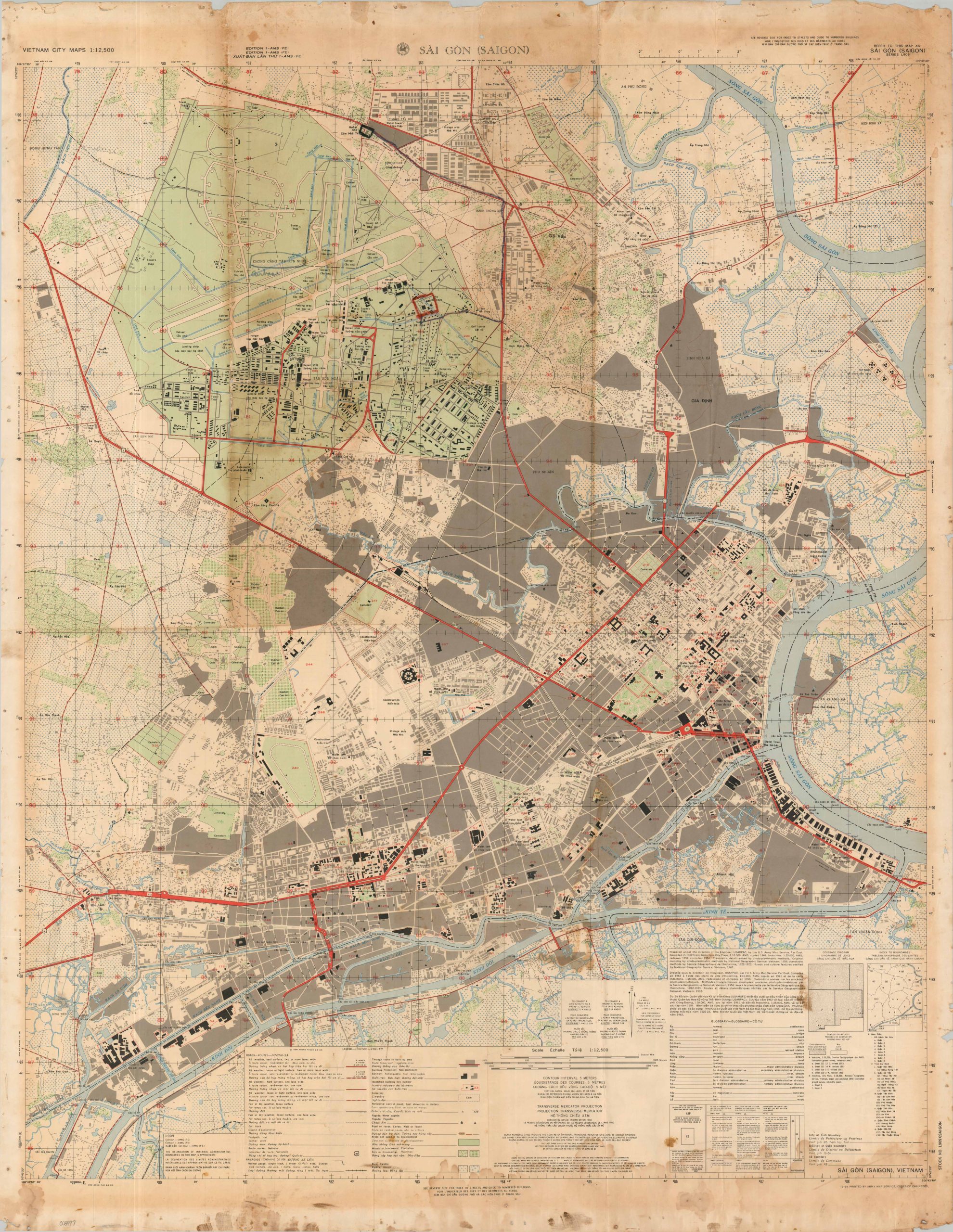
A tactical map of Saigon issued near the end of 1964 by the Army Map Service.
1 in stock
Description
Issued by the Army Map Service in December 1964, this map captures Saigon at one of the most consequential moments in its modern history. Published only months after the Gulf of Tonkin Resolution and mere weeks before the large-scale deployment of American combat troops to Vietnam, it depicts the South Vietnamese capital on the eve of its transformation into the logistical and political center of America’s war in Southeast Asia. Political instability had become the norm as a succession of military juntas vied for control of the South Vietnamese government, while escalating violence would culminate in the bombing of Brinks Hotel on Christmas Eve.
Presented at a scale of 1:12,500, the map offers a remarkably detailed portrait of Saigon at the end of 1964. Densely populated residential districts are shaded in gray, major transportation arteries are highlighted in red, and prominent buildings and landmarks are identified and keyed to an extensive index printed on the verso. Of particular interest is the massive Tan Son Nhut Air Base, shaded in green immediately northwest of the city center and already serving as the principal gateway for American military personnel entering South Vietnam. The legend, glossary, and publication details along the lower margin are provided in French, Vietnamese, and English, reflecting both the city’s colonial legacy and its increasingly international significance.
Map Details
Publication Date: 1964
Author: Army Map Service
Sheet Width (in): 34.75
Sheet Height (in): 44.75
Condition: C
Condition Description: Color printed map on a large, heavily soiled sheet. Dampstaining in the lower right corner, heavy toning along the top half, scattered surface soiling visible in several areas. Various annotations present and numerous marginal tears. Fair condition overall.
$200.00
1 in stock