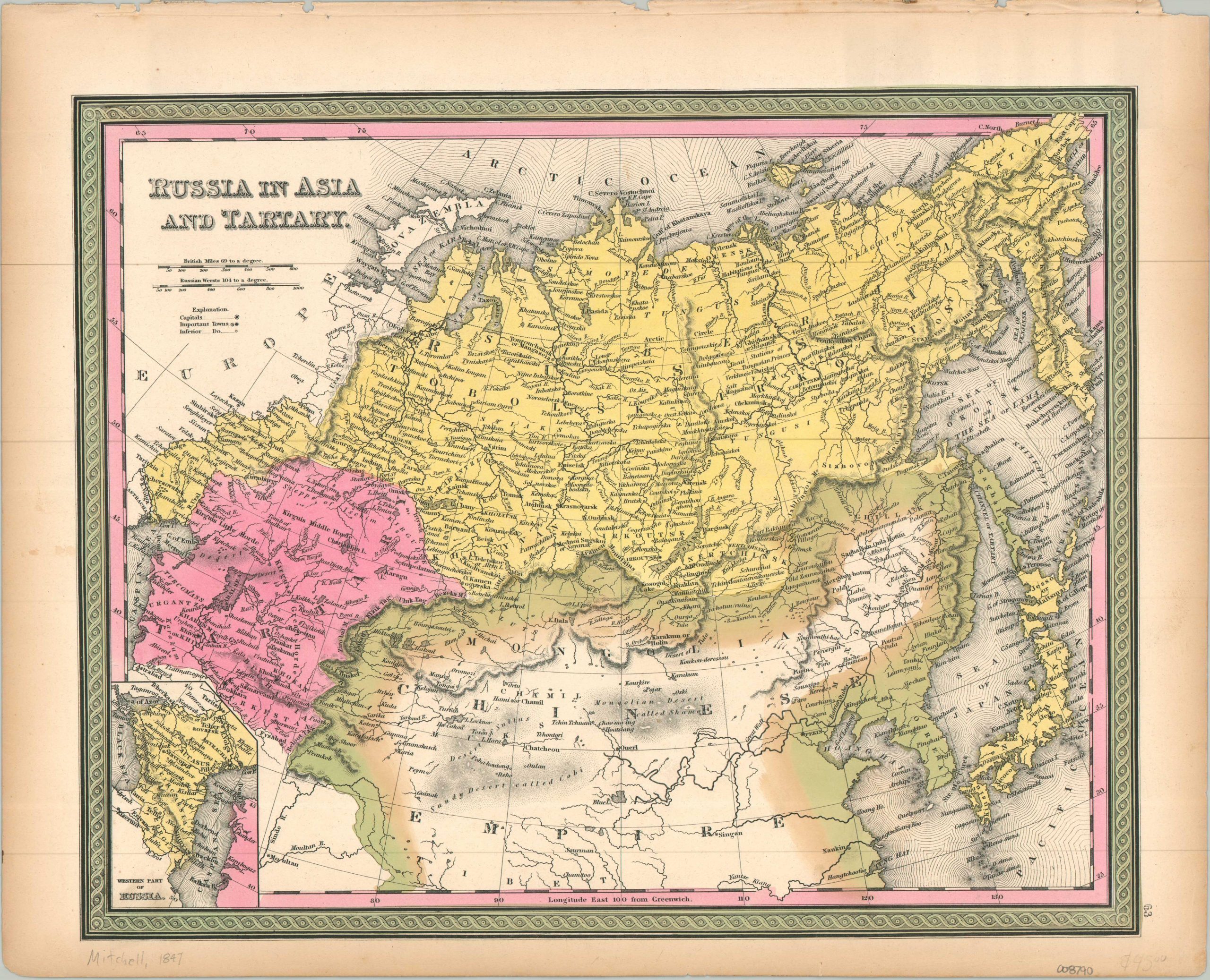
Russia in Asia and Tartary
$65.00
A fascinating mid-19th century map of northern Asia.
1 in stock
Description
This attractive engraved map of northern Asia was published in Philadelphia in 1847 as part of Samuel Augustus Mitchell’s New Universal Atlas. A meticulously detailed image provides an engaging overview of the political and physical landscape. Russian territory, highlighted in yellow, stretches from the Volga River and the shores of the Caspian to the Kamchatka Peninsula in the Pacific. Though the independent rulers of Tartary are credited vast lands, colored in pink, in reality, Russian control extended almost as far south as the Aral Sea. The Chinese Empire is outlined in green and includes the entirety of Sakhalin Island and Outer Mongolia. An inset, lower left, shows the Western Part of Russia between the Black and Caspian Seas, including the Caucasus, Circassia, and Georgia. Particularly interesting features include the ancient Silk Road city of Karakorum, the vast Gobi Desert, an outline of the Great Wall and the Willow Palisade, and the hordes of the Kirguis.
Map Details
Publication Date: 1847
Author: Samuel Augustus Mitchell
Sheet Width (in): 17.10
Sheet Height (in): 13.90
Condition: A-
Condition Description: Faint toning and wear in the margins, including a rough upper edge where previously bound. Very good condition overall. Blank on verso.
$65.00
1 in stock