Route of Colpitt’s Private Car Parties to California and the Pacific Northwest July 5 and August 2, 1930
$125.00
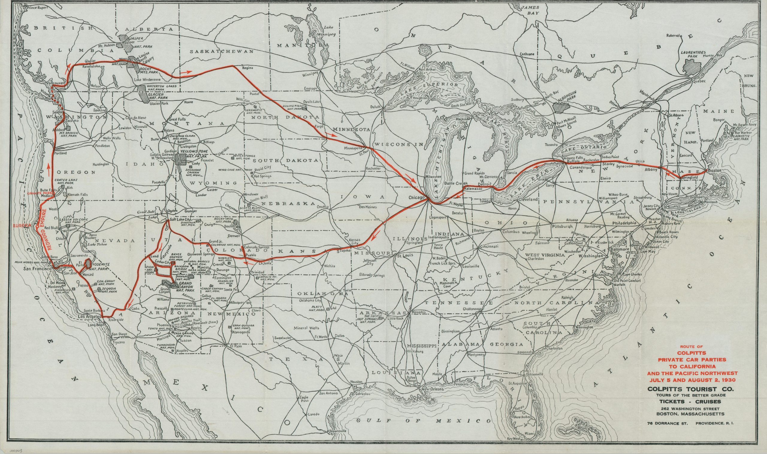
Route map of a Gilded Age-style train tour during the Great Depression.
1 in stock
Description
Promising ‘Tours of the Better Grade’, Boston-based Colpitt’s Tourist Company catered to high-end clientele during the 1920s and 1930s. This ephemeral map of the United States highlights the route of two 1930 railroad tours organized by the firm.
A straight shot from Boston to Chicago along the New York Central is followed by a circular path that explores portions of the Great Plains, Southwest, West Coast, Pacific Northwest, and southern Canada before returning home through the Upper Midwest. Deliberate side-trips include Rocky Mountains National Park (in Canada), Yosemite, Colorado Springs, and the Grand Canyon. Interestingly, it appears as though the map was an ‘in-house’ production; a custom composition, rather than licensing a base map upon which the tour can then be overprinted.
Map Details
Publication Date: 1930
Author: Colpitts Tourist Company
Sheet Width (in): 27.75
Sheet Height (in): 17.00
Condition: A-
Condition Description: Printed on thin paper, creased and lightly worn along old folds. Creased upper right corner and a faintly wrinkled sheet. Very good condition overall.
$125.00
1 in stock