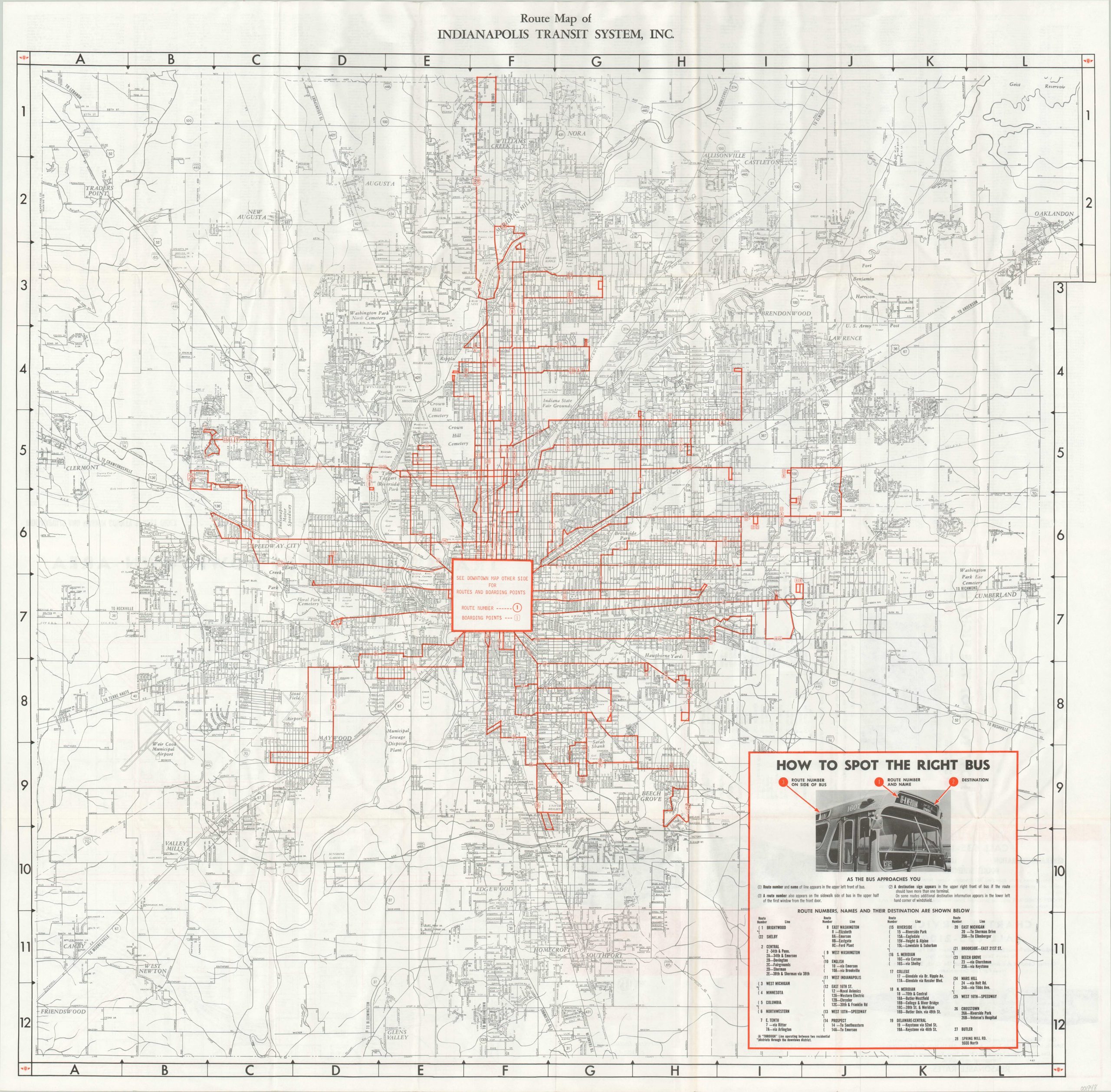
Route Map of Indianapolis Transit System, Inc.
$65.00
Transit map of the greater Indianapolis area.
1 in stock
Description
In 1953, the robust streetcar system that served much of Indianapolis was torn up, to be replaced by motorbuses operating on newly paved roads. This map shows the result around a decade later, with dozens of routes and lines serving various points throughout the city (though service on the west side appears to be stunted). A helpful guide to the rather confusing network is provided in the lower right.
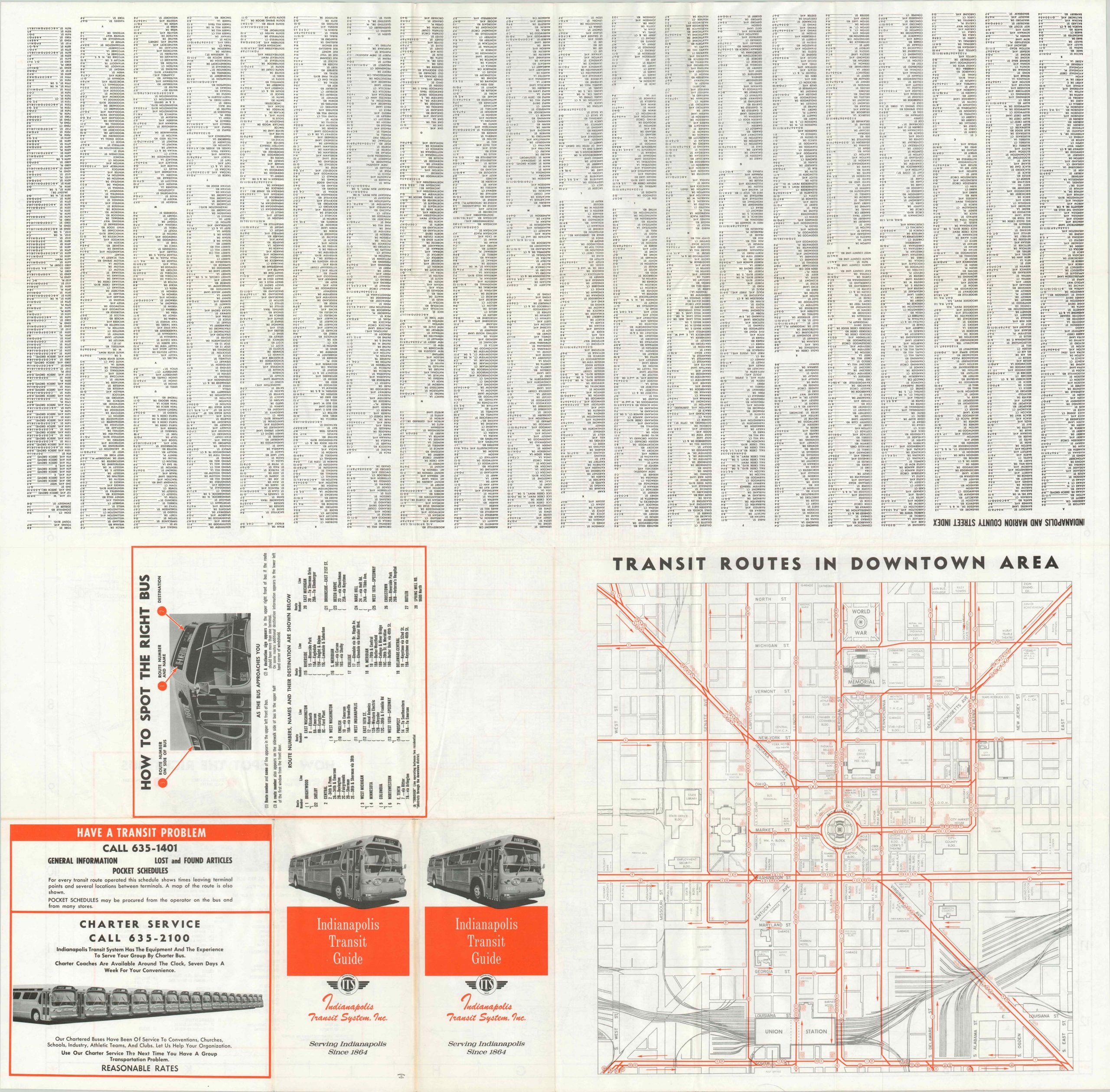
The verso features a large scale inset map of downtown, as well as a comprehensive street index with numbers and letters corresponding to the map’s border. Published by Indianapolis Transit Services, Inc., predecessor to the Indianapolis Public Transportation Corporation (IndyGo).
Map Details
Publication Date: c. 1960
Author: Indianapolis Transit System
Sheet Width (in): 34.5
Sheet Height (in): 34
Condition: A
Condition Description: Creasing along fold lines, but otherwise in like new condition.
$65.00
1 in stock


