Rocky Mountain National Park
$175.00
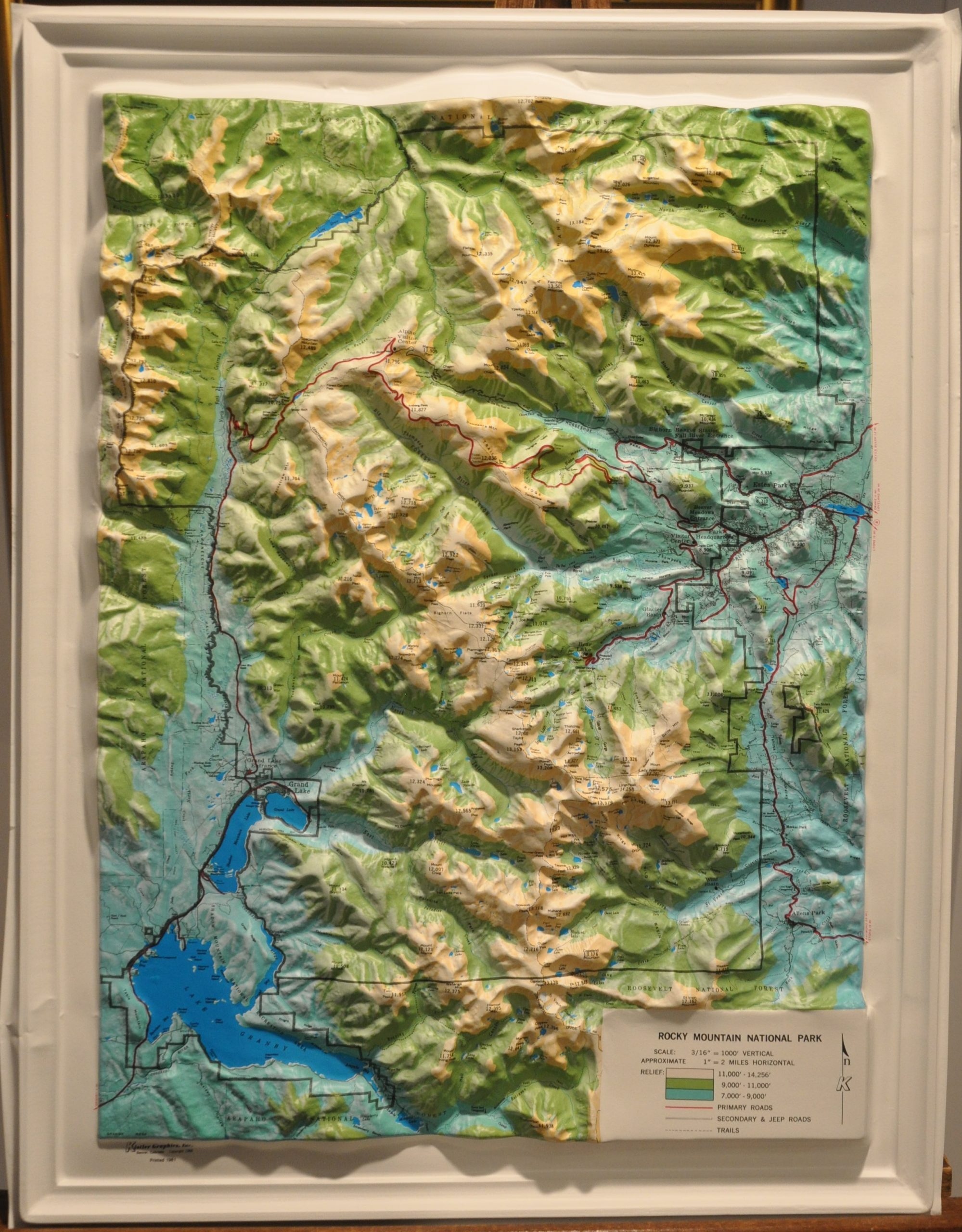
Three dimensional relief map of Rocky Mountain National Park.
1 in stock
Description
This vibrant molded plastic topographic map shows, in detail, the extent of Rocky Mountain National Park in the state of Colorado. The heights of numerous peaks are provided in feet, while varying shades of blue and green provide a visual representation of elevation, as outlined in the accompanying legend in the lower right. Primary roads, secondary & Jeep roads, and hiking trails are also identified in the key.
Within the map’s image are labeled major geographic features and recreational facilities like campgrounds, overlooks, picnic grounds, and more. Produced by Kislter Graphics, Inc. in Denver in 1981.
Map Details
Publication Date: 1981
Author: Kistler Graphics, Inc.
Sheet Width (in): 17.00
Sheet Height (in): 22.00
Condition: A
Condition Description: Molded plastic topographic map in near fine condition. A slight pinch in the outer edge on the lower left side, but otherwise in perfect shape.
$175.00
1 in stock

