
Rocky Mountain National Park
$50.00
What there is to do and see in Rocky Mountain National Park
1 in stock
Description
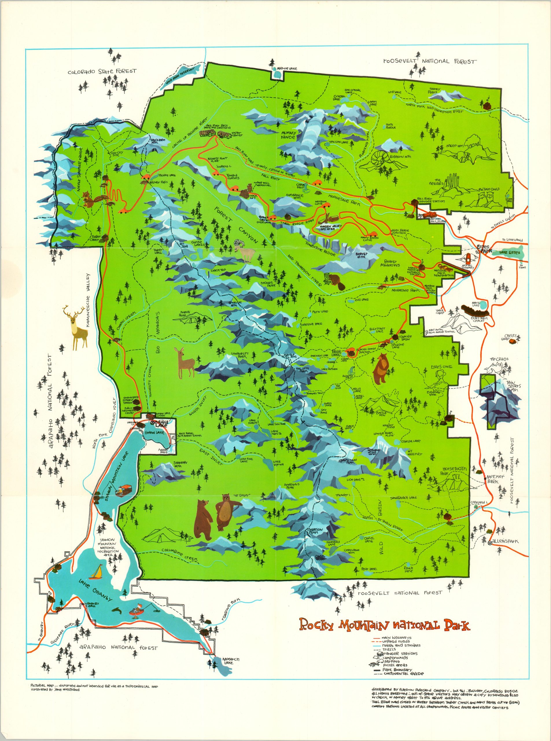
This fun and vibrant map of Rocky Mountain National Park presents a simple but engaging tourist overview of the Colorado destination. Main highways, unpaved roads, and hiking trails are shown throughout, connecting charming little vignettes that reflect local geography and wildlife. Ranger stations, campgrounds, and picnic areas are also pinpointed throughout.
The map was illustrated by Jane Wikstrand. Published and distributed around 1975 by the Flatiron Postcard Company of Boulder, Colorado. A CURTEICHCOLOR ART CREATION, according to the verso, which also features a mileage chart, color photographs, and descriptions of major attractions.
Map Details
Publication Date: c. 1975
Author: Jane Wikstrand
Sheet Width (in): 18.00
Sheet Height (in): 24.00
Condition: A-
Condition Description: Colory printed map on a double-sided sheet of glossy paper. Creased along original folds and lightly worn in the margins. Very good condition overall.
$50.00
1 in stock