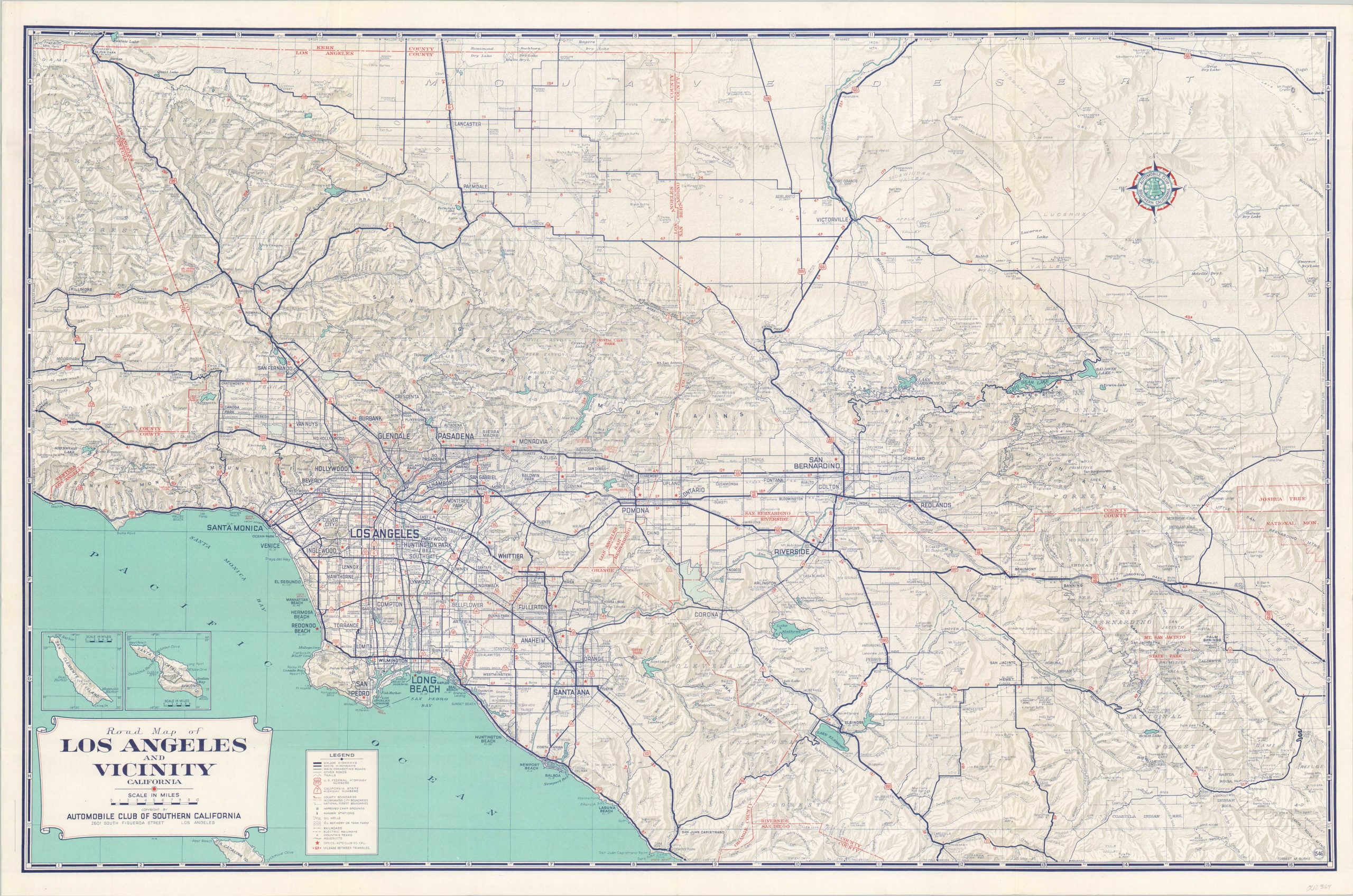
Road Map of Los Angeles and Vicinity
An early look at southern California’s robust (and notorious) freeway system.
Out of stock
Description
This detailed transportation map of the greater Los Angeles area is an excellent reflection on the tremendous shift from rails to roads that took place across the region in the first half of the 20th century. As the automobile became more ubiquitous (and the associated lobbies more influential), highways eventually surpassed inter-urban lines as the favored method of commute and leisure transportation for the average American.
Though this map shows both, the paved roads are clearly emphasized; highlighting their greater coverage and access to local points of interest. Distances between the triangles are noted, while a more comprehensive mileage chart and street index are provided on the verso. AAA offices, oil refineries, ranger stations and camp grounds are also identified according to the accompanying legend in the lower left.
Created by Forrest M. Burke and published in Los Angeles by the Automobile Club of Southern California in 1955.
Map Details
Publication Date: 1955
Author: Forrest Burke
Sheet Width (in): 34.60
Sheet Height (in): 22.75
Condition: A-
Condition Description: Creasing and light wear along originally issued fold lines. Manuscript writing on the front cover that does not affect the image. Very good to near fine overall.
Out of stock