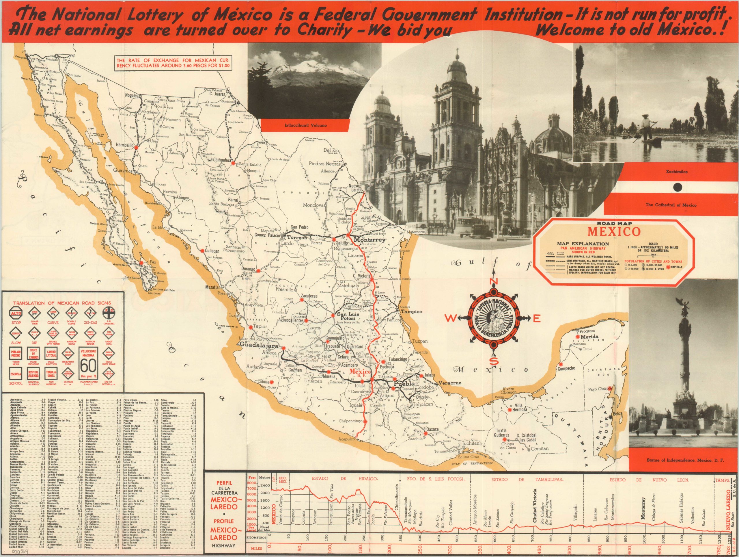
Road Map Mexico
$75.00
Informative road map of Mexico published in the early days of the Pan American Highway.
Description
In the decades leading up to WWII, Mexico experienced numerous uprisings and significant social unrest. In 1934, the former revolutionary Lázaro Cárdenas gained the presidency and attempted to stabilize the economy and regional relations. Although his policies favored charity and social reform, Cardenas did not introduce the policy of the National Lottery as a non-profit. That tradition has much older roots, with the first drawing taking place in New Spain in 1771.
The map, published by the lottery with the aim of drawing new players, shows the various conditions of roads throughout Mexico. The quality ranges from hard surface, all weather roads (including the Pan American Highway) to dirt roads unsuitable for most automobile travel. Helpful information like an index of cities, translation of Mexican road signs, and height profile of the Pan American Highway is also provided. This latter information was very important in early road travel, since significant grades (both up and down) were often the most difficult obstacles for automobile engines and brakes.
On the verso is a list of radio stations, points of interest, and pictorial inset map of Mexico City and its environs.
Map Details
Publication Date: 1937
Author: The National Lottery of Mexico
Sheet Width (in): 23.1
Sheet Height (in): 17.50
Condition: B
Condition Description: Fold lines as issued exhibiting wear and some separation (repaired at verso). Minor image loss at fold intersections, but still very good.
$75.00

