
Road Map Hong Kong and the New Territories
$200.00
Hong Kong before the New Town era.
1 in stock

Description
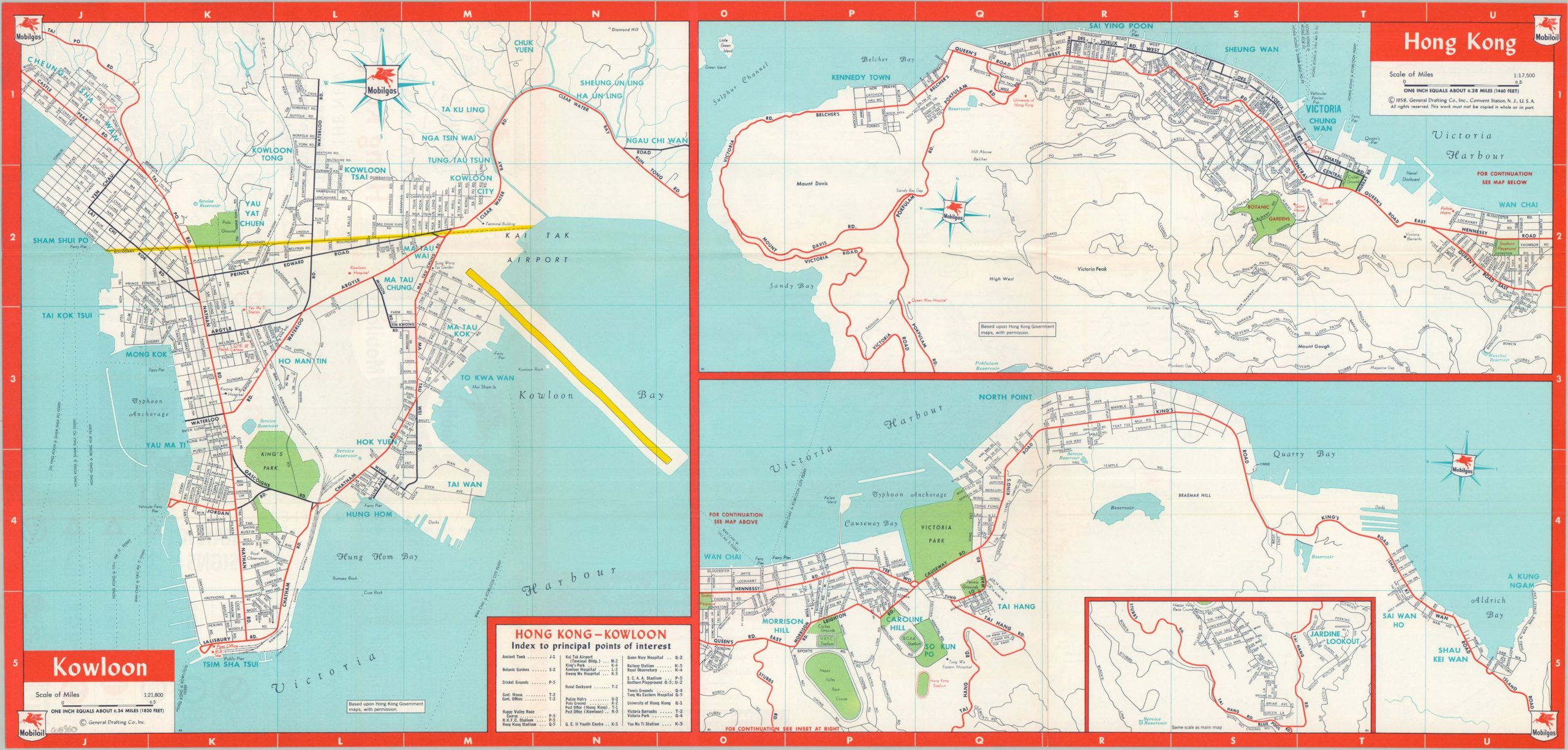
This interesting road map of Hong Kong and its constituent territories presents the colony during the transformative period of the late 1950s. In the years following the Communist victory in mainland China, Hong Kong experienced enormous population growth as waves of refugees arrived seeking safety and opportunity. By the early 1960s, the colony’s population had surpassed 3 million. Wealth disparity was extreme, and transportation and residential infrastructure struggled to keep pace. Large-scale public housing initiatives were beginning to replace the extensive squatter settlements that had spread across hillsides and vacant land.
One side of the sheet presents a composite image of Hong Kong Island (right) and Kowloon (left), with an inset at lower center showing the continuation eastward to Jardine Lookout, then home to some of the city’s most prestigious residences. Primary roads are highlighted in bright red, while parks and recreational areas appear in green. Numerous important structures and attractions are labeled throughout, including the University of Hong Kong, the S.C.A.A. Stadium, Happy Valley Race Course, the Botanic Gardens, and major cricket grounds.
The verso presents a smaller-scale map of Hong Kong Island and the New Territories. Again, the transportation network is emphasized, with “Jeepable Trails” distinguished from All Weather and Limited All Weather Roads. A number of golf courses are identified with small flags, reflecting the recreational amenities associated with Hong Kong’s expatriate and colonial elite. Traffic signs and an index to the various communities of Hong Kong are also provided, along with a prominent disclaimer noting that the map should not be considered an authority on the contested international boundaries.
The map was copyrighted in 1958 by the General Drafting Company of Convent Station, New Jersey. It was published by the Standard-Vacuum Oil Company, one of General Drafting’s major clients, as a promotional piece for Mobilgas products.
Map Details
Publication Date: 1958
Author: General Drafting Company, Inc.
Sheet Width (in): 25.10
Sheet Height (in): 12.00
Condition: A
Condition Description: Double-sided map brochure, creased along original folds and rubber stamped PRODUCTION on the front cover. Near fine condition overall.
$200.00
1 in stock