Road Map Federation of Malaya Singapore
“This map is presented with the compliments of Standard-Vacuum Oil Company and your friendly Mobilgas dealer.”
Out of stock
Description
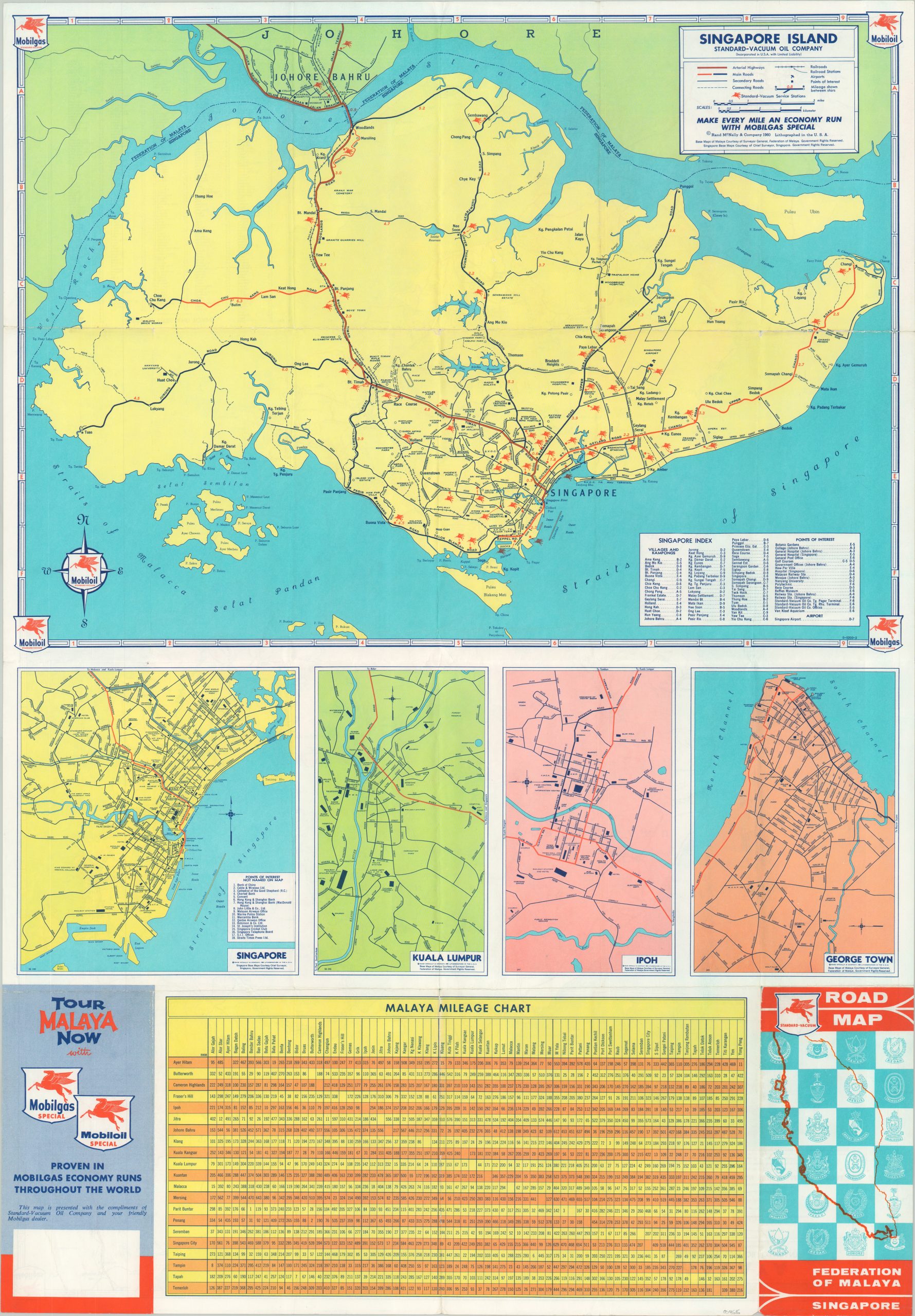
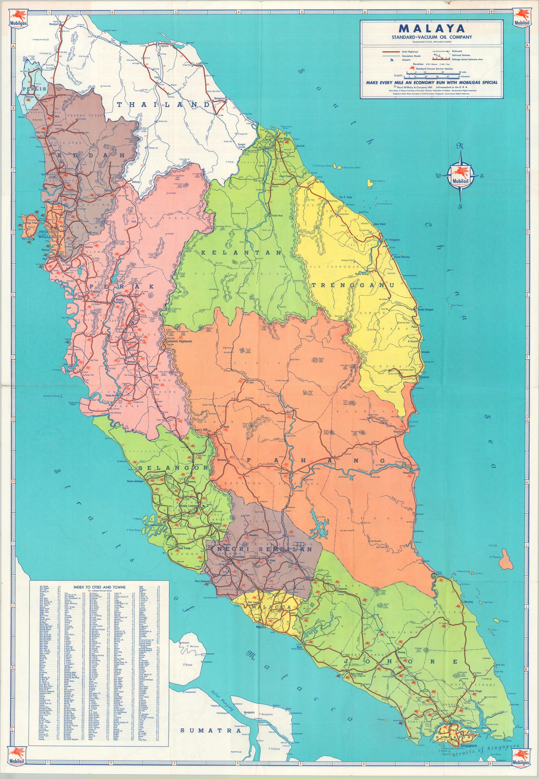
In 1959, the British Crown Colony of Singapore held its first general election, voting in Lee Kuan Yew as the prime minister. He would go on to oversee the island nation’s formal independence from Britain a mere four year laters, which saw a brief union with Malaysia before declaring full sovereignty in 1965. The Federation of Malaya (also a former crown colony) achieved this status in 1957.
This road map covers both nations in the midst of the ongoing political changes. One side shows Singapore Island, noting primary and secondary roads, railroads, points of interest, and Standard Oil service stations. Insets show the cities of Singapore, Kuala Lumpur, Ipoh, and George Town, while a mileage chart provides distances (by road) across many of Malaya’s largest cities. The verso presents a similar image of Malaya, located south of Thailand on tip of the Malay Peninsula.
The map was published in Chicago by Rand McNally in 1960 and distributed by the Standard-Vacuum Oil Company.
Source: History & Timeline of Singapore
Map Details
Publication Date: 1960
Author: Rand McNally
Sheet Width (in): 22.8
Sheet Height (in): 32.8
Condition: A
Condition Description: Light wear along originally issued fold lines and a few small tears along the outer edges of the sheet. Very good to near fine overall.
Out of stock