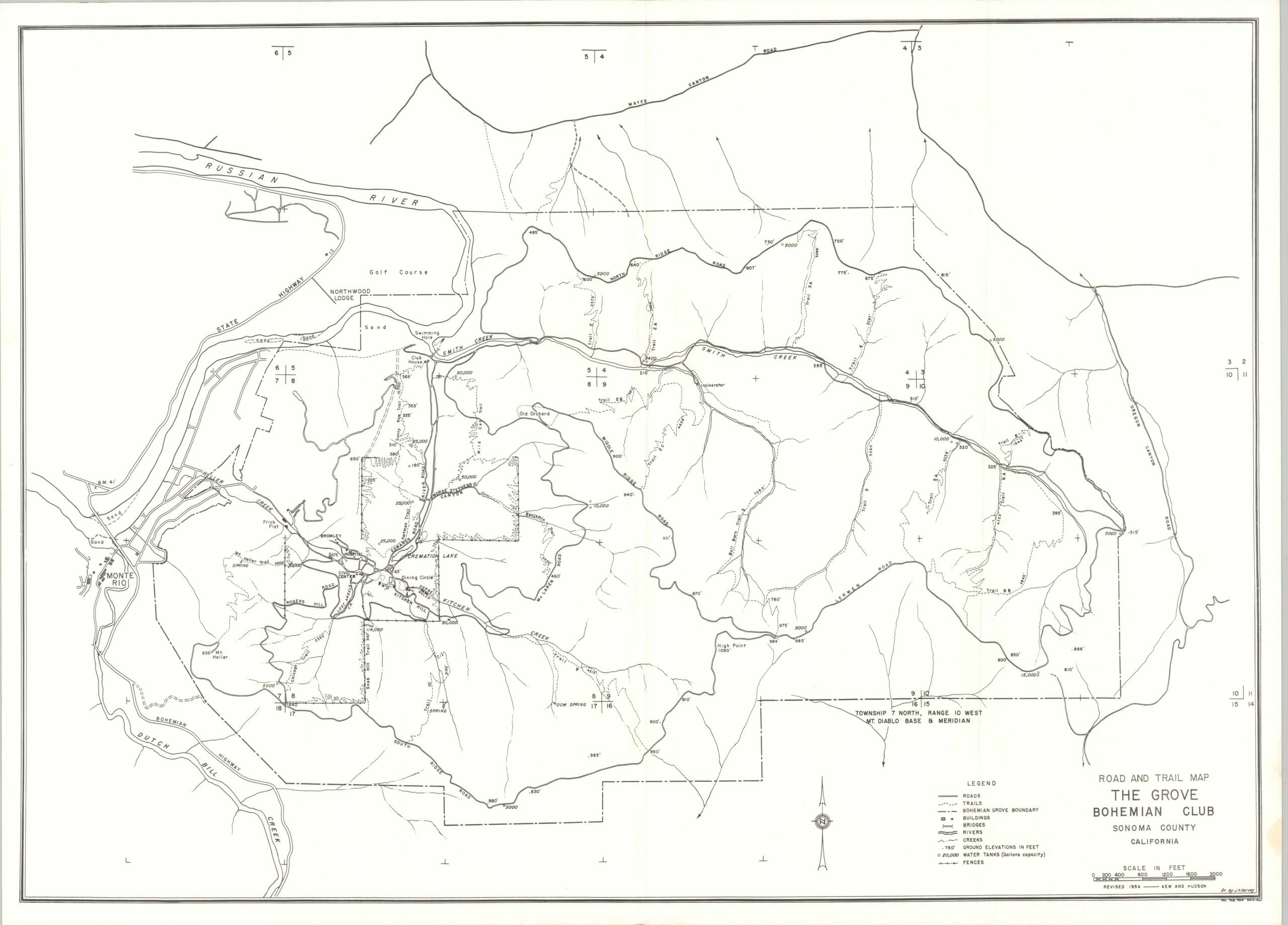
Road and Trail Map The Grove Bohemian Club Sonoma County California
Detailed road map of the exclusive Grove of the Bohemian Club.
Out of stock
Description
This uncommon road map outlines the expansive grounds of The Grove, a property in Monte Rio, California that is owned by the secretive Bohemian Club. The image was originally drawn by J.H. Harvey (signed, lower right) and revised by Kew and Hudson in 1956. Further updates are noted through February 1960, according to an illegible signature in the margin. A legend in the lower right identifies the symbols used to denote different infrastructure elements and geographic features. Further labeled landmarks include the Clubhouse, Hospital, Dining Circle, and Civic Center.
The Bohemian Club is a private, all-male club founded in San Francisco in 1872, originally formed by journalists, artists, and musicians. Over time, its membership expanded to include prominent business leaders, politicians, and influential figures. The club is best known for its annual two-week retreat at the Bohemian Grove, a 2,700-acre redwood forest in northern California, where members participate in theatrical performances, discussions, and social activities. While the retreat is framed as an opportunity for relaxation, sociability, and artistic expression, its exclusivity and the presence of powerful individuals have sparked much speculation and conspiracy theories.
Map Details
Publication Date: 1960
Author: J.H. Harvey
Sheet Width (in): 24.75
Sheet Height (in): 18
Condition: A-
Condition Description: Lightly creased along several vertical folds, where previously rolled. Very good condition overall. Blank on verso.
Out of stock