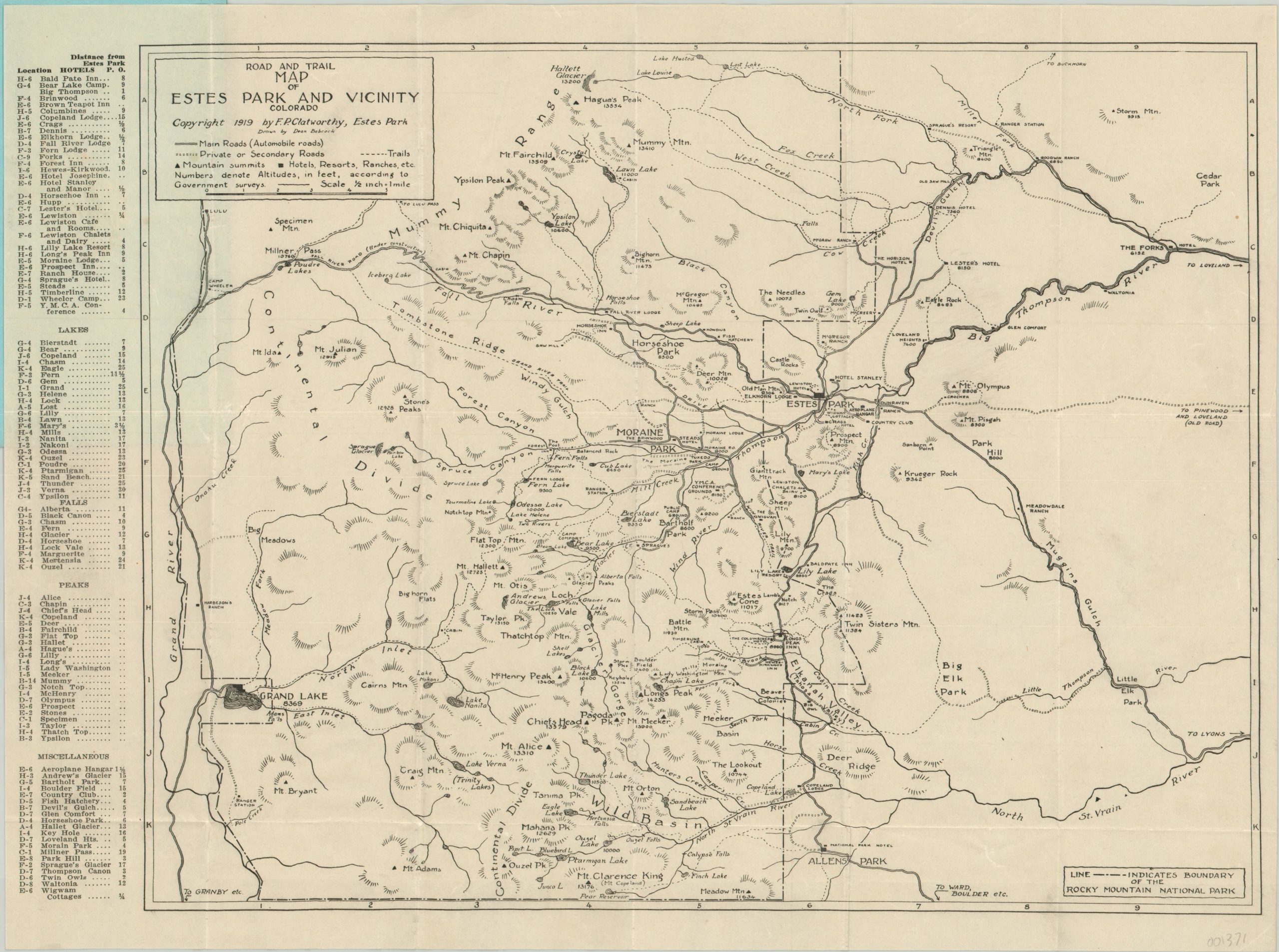
Road and Trail Map of Estes Park and Vicnity
Early road and trail map of Rocky Mountain National Park.
Out of stock
Description
Despite the original arrival of the first white settlers approximately fifty years earlier; the town of Estes Park, Colorado did not officially incorporate until 1917. This organizational step was prompted by the creation of the adjacent Rocky Mountain National Park in 1915 and the associated influx of tourism to the area.
This map was published just a few years after the town’s incorporation, and shows the early road network serving the city and new nearby national park. Primary roads, secondary roads, hiking trails, resorts, ranches and mountain summits are all shown; with the height of the latter indicated in feat next to each peak. The elevation is helpful, as topography is limited to sparse hachure.
An accompanying index along the left side of the sheet corresponds to the grid around the border and identifies the locations of nearly 100 hotels, lakes, peaks, falls, and other points of interest. Drawn by Dean Babcock and published locally in Estes Park by F.P. Clatworthy in 1919.
Map Details
Publication Date: 1919
Author: F.P. Clatworthy
Sheet Width (in): 17.2
Sheet Height (in): 13
Condition: A
Condition Description: Issued folded into 18 panels and affixed to original blue paper covers. Near fine condition, with creasing along fold lines but otherwise free of any defects. The covers are in similarly good condition, with a small spot of soiling along the bottom of the binding edge.
Out of stock


