
Rio City Tourist Guide
$100.00
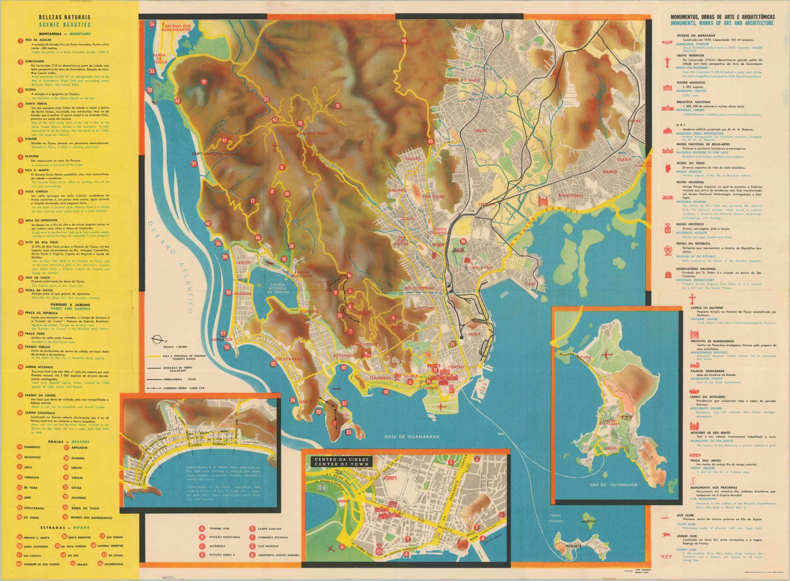
A colorful map of Rio from the early 1960s.
1 in stock
Description
This vibrant tourist map of Rio de Janeiro was compiled around 1961 by Theo Drumond and Rudolf Riehl. It was published locally by Graficos Bloch S.A. and distributed by the Department of Tourism and Competitions of the Government of the State of Guanabara. As described in a translated entry from the National Library of Brazil:
“On one side, it presents grids in blue and white, with black and white photographs, drawings and images that seem to seek to translate the cultural diversity of Rio. The design seems to exude the cultural movements of Tropicália and Bossa Nova, as well as the modernism in vogue in the 1960s. On the back of the folder, there is a general colored map of the city, from the coast of the center and south zone to Recreio dos Bandeirantes and Penha on a scale of 1:50,000. With detailed expansions of Copacabana, the city center, and Ilha do Governador, including Galeão Airport.”
Map Details
Publication Date: c. 1961
Author: Theo Drumond and Rudolf Riehl
Sheet Width (in): 24.25
Sheet Height (in): 18.00
Condition: A-
Condition Description: Double-sided color brochure printed on paper that has lightly toned. Faint wear along the outer edges. Discoloration on the back panel (apparently from old adhesive residue) does not affect the map's image. Very good condition overall.
$100.00
1 in stock