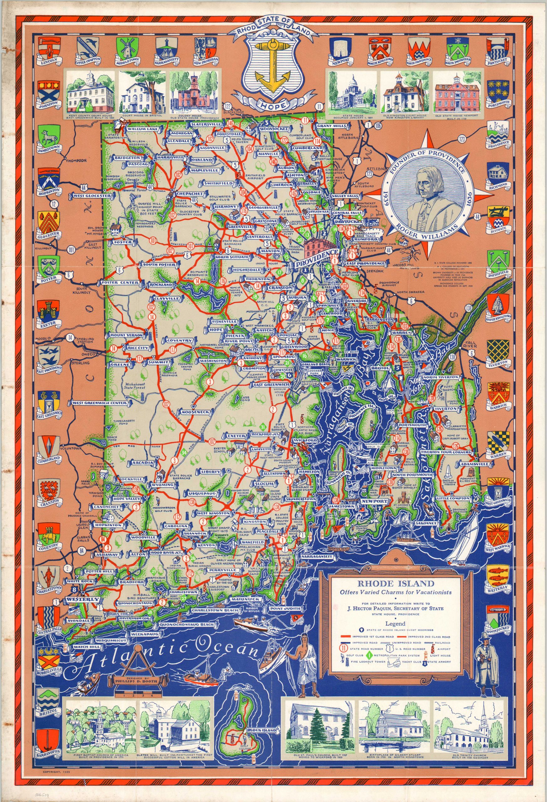
Rhode Island Offers Varied Charms for Vacationists
$110.00
Vacationing in Rhode Island on the eve of World War II.
1 in stock
Description
This gorgeous pictorial map of Rhode Island was designed by Phillips D. Booth and published in 1939 with official support by the Secretary of State. The variety of charms mentioned in the title includes outdoor retreats, historic sites, and sporting opportunities – all accessible via the robust network of statewide highways and paved roads (as well as guest boat moorings, for maritime travelers). Small icons, identified in the legend (lower right), pinpoint the location of airports, lighthouses, golf courses, metropolitan parks, yacht clubs, and fire observation towers.
The vibrant image is flanked by additional captioned illustrations of historic buildings and the coats of arms for Rhode Island’s towns and counties. Photographs and text on the verso encourage the audience to visit The Ocean State and include a map showing the proximity by plane, rail, road, and boat to New York City (then hosting the 1939 World’s Fair).
Map Details
Publication Date: 1939
Author: Phillips D. Booth
Sheet Width (in): 14.6
Sheet Height (in): 21.25
Condition: B+
Condition Description: Double-sided brochure, formerly folded into 12 panels. Moderate discoloration and wear visible in the margins, concentrated primarily on the left side of the sheet. Soft creasing along old folds. Good condition overall, with vibrant original printed color only minimally affected by soiling and staining.
$110.00
1 in stock