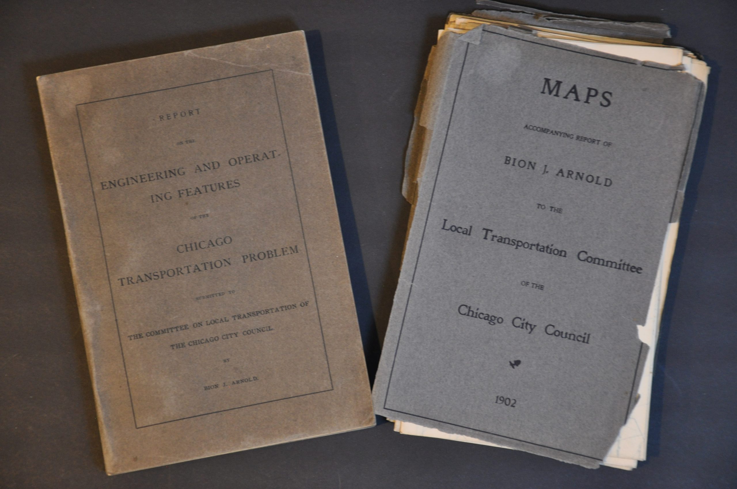
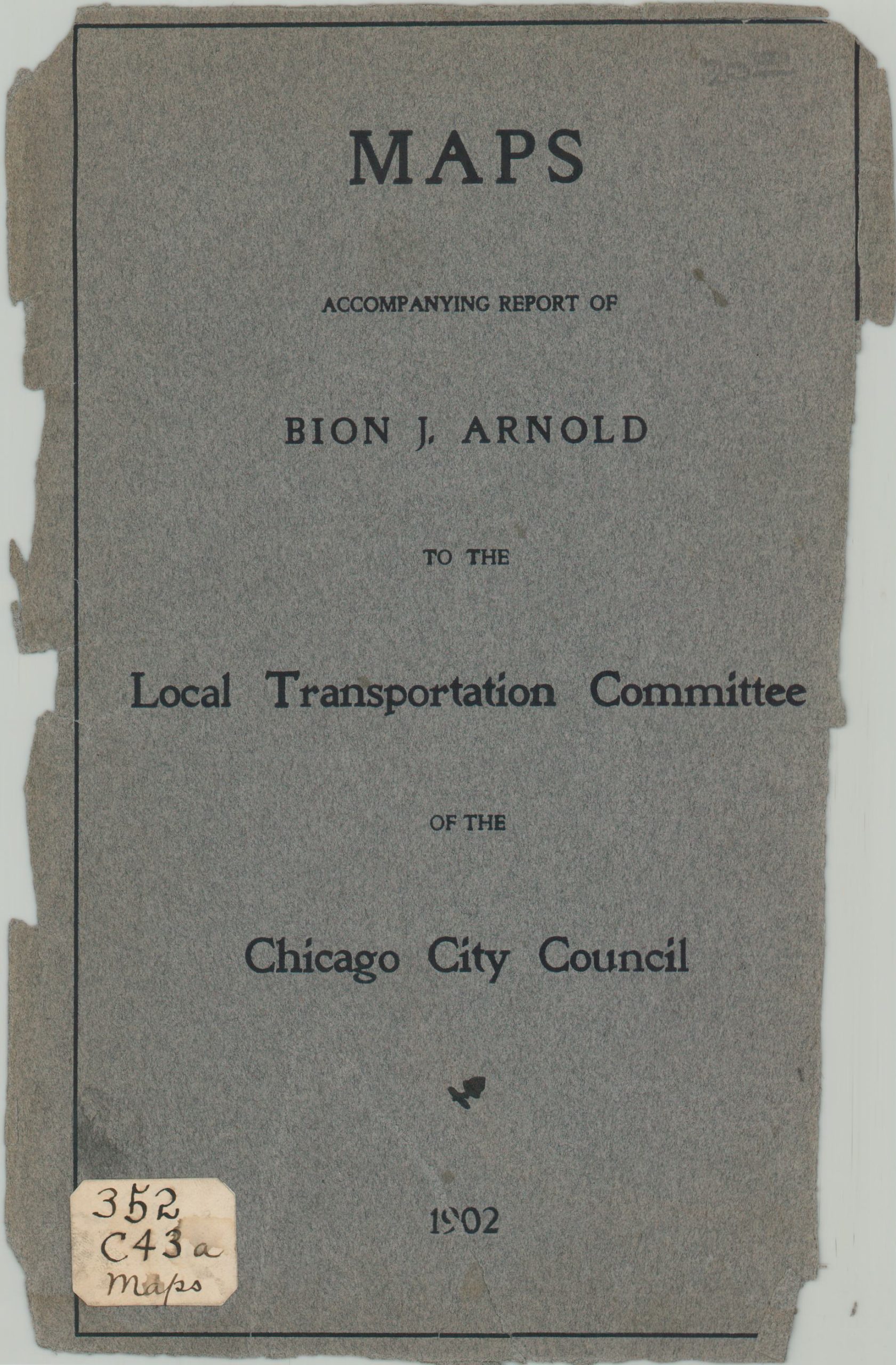
Report on the Engineering and Operating Features of the Chicago Transportation Problem
$950.00
Intensive efforts to update Chicago’s transit system in the early 20th century.
1 in stock


Description
By the late 19th-century, Chicago’s network of transportation systems was a confusing hodgepodge of independently operated elevated lines, horse and electric powered streetcars, horse-drawn busses, and steam railroads. In 1897, Charles Tyson Yerkes opened the Union Loop to connect the 4 elevated lines serving the downtown area, helping to alleviate some of the headaches of navigating the congested region that now shares its name.
However, significant problems remained with the system of independent operators, and the Chicago City Council enlisted the help of talented transportation engineer Bion J. Arnold to propose potential solutions. This is the result of his work, encapsulated in an exhausting 300+ page report and over two dozen fold-out maps, charts, and construction diagrams. Arnold presents a well-researched, persuasive argument for consolidation among companies, the construction of additional subway lines, and other significant improvements. The contents of the report include financial estimates, population/ridership statistics, recommendations for policy and network changes, practical engineering advice on transit construction, and several appendices.
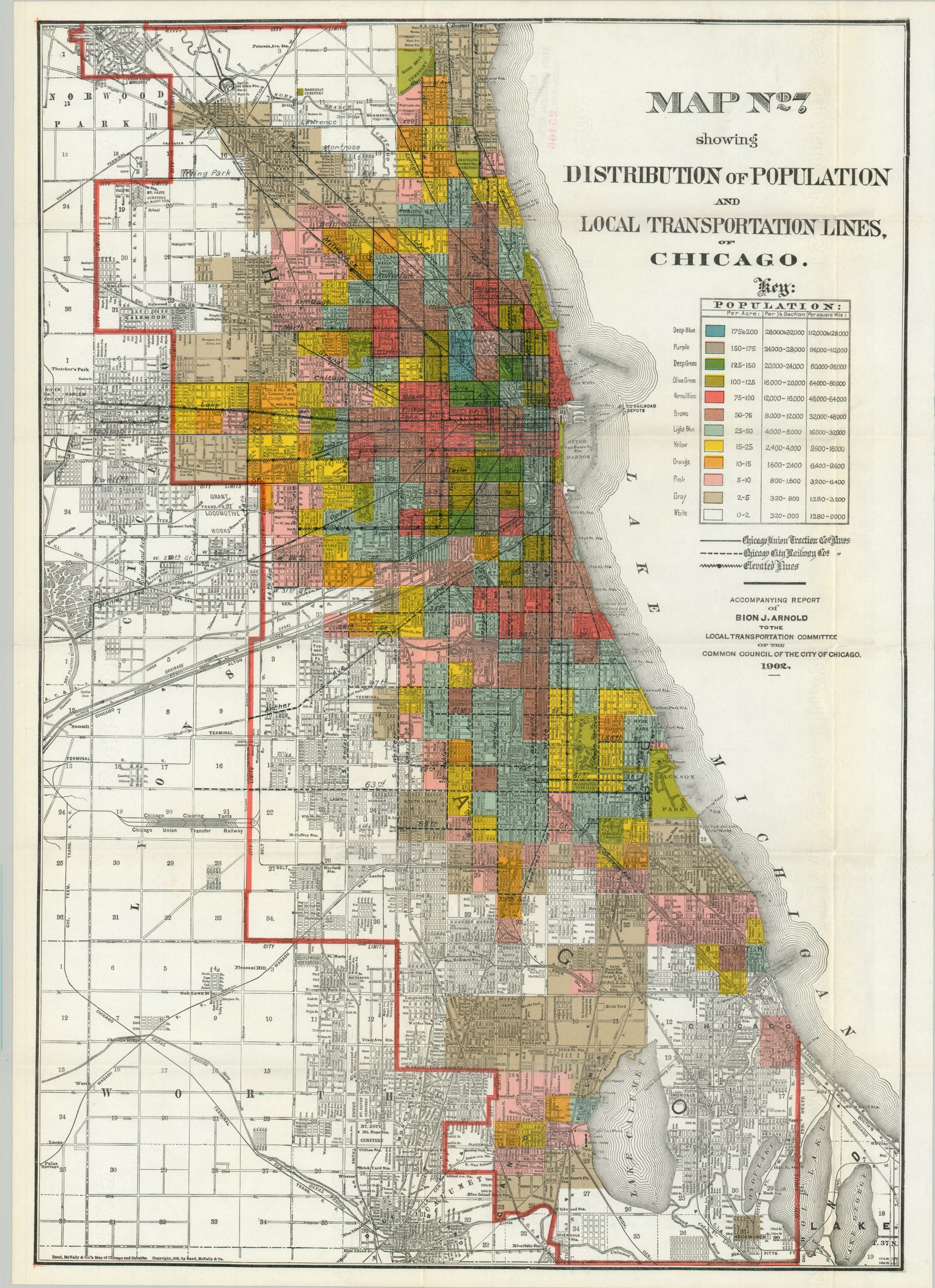
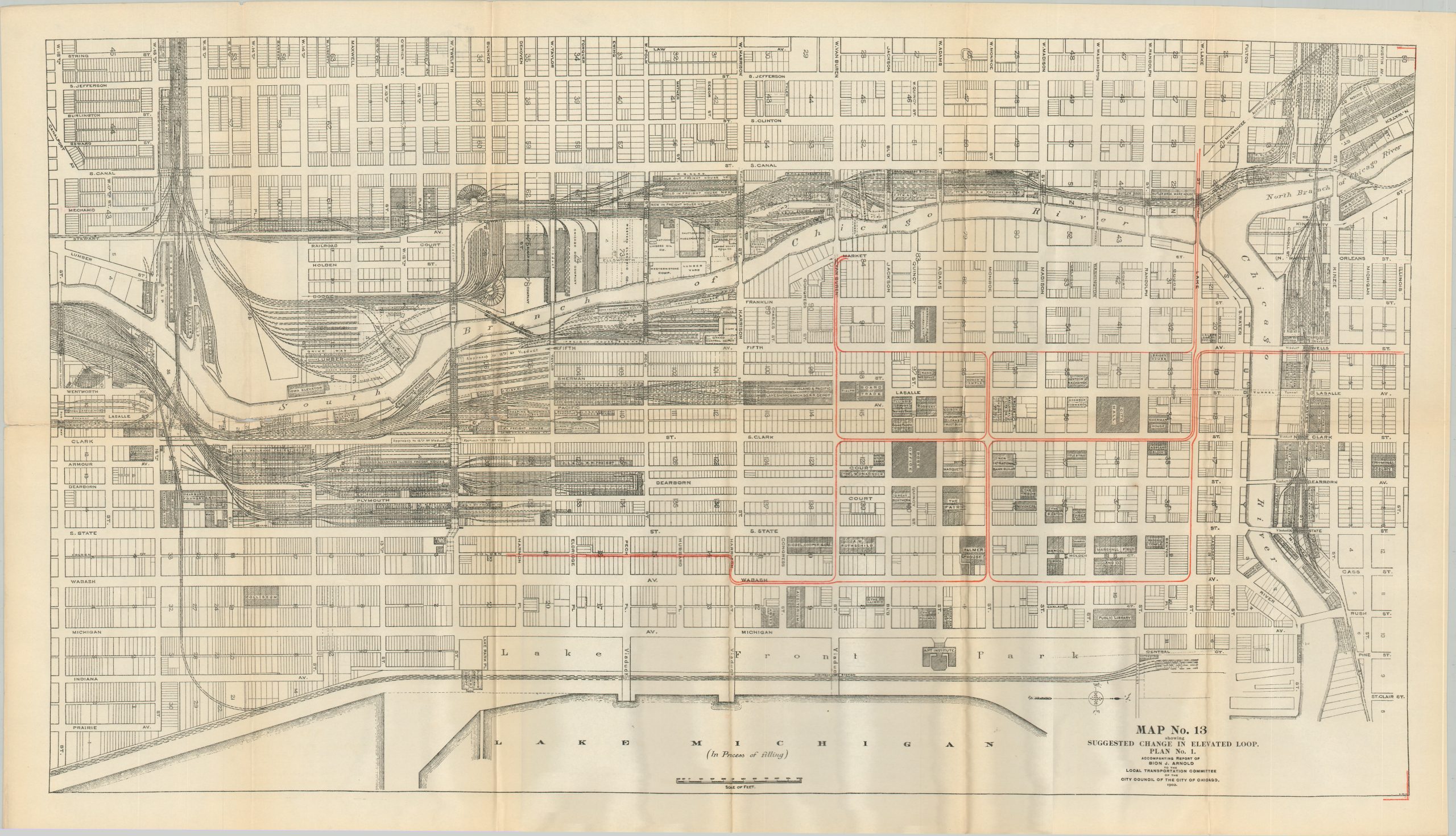
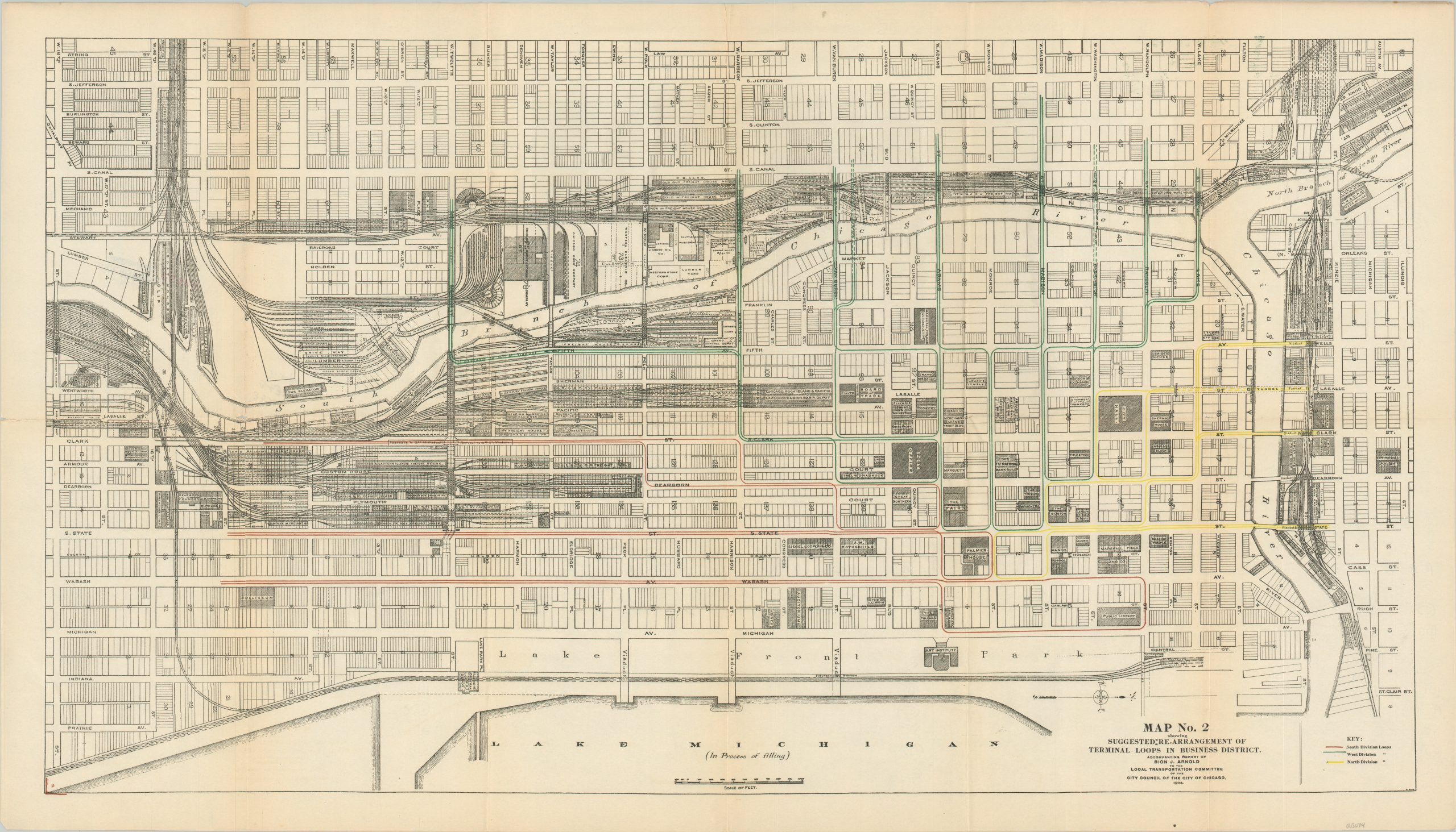
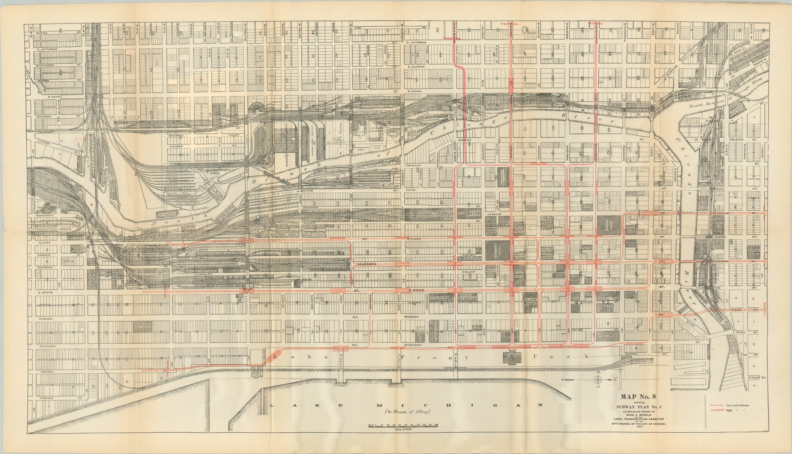
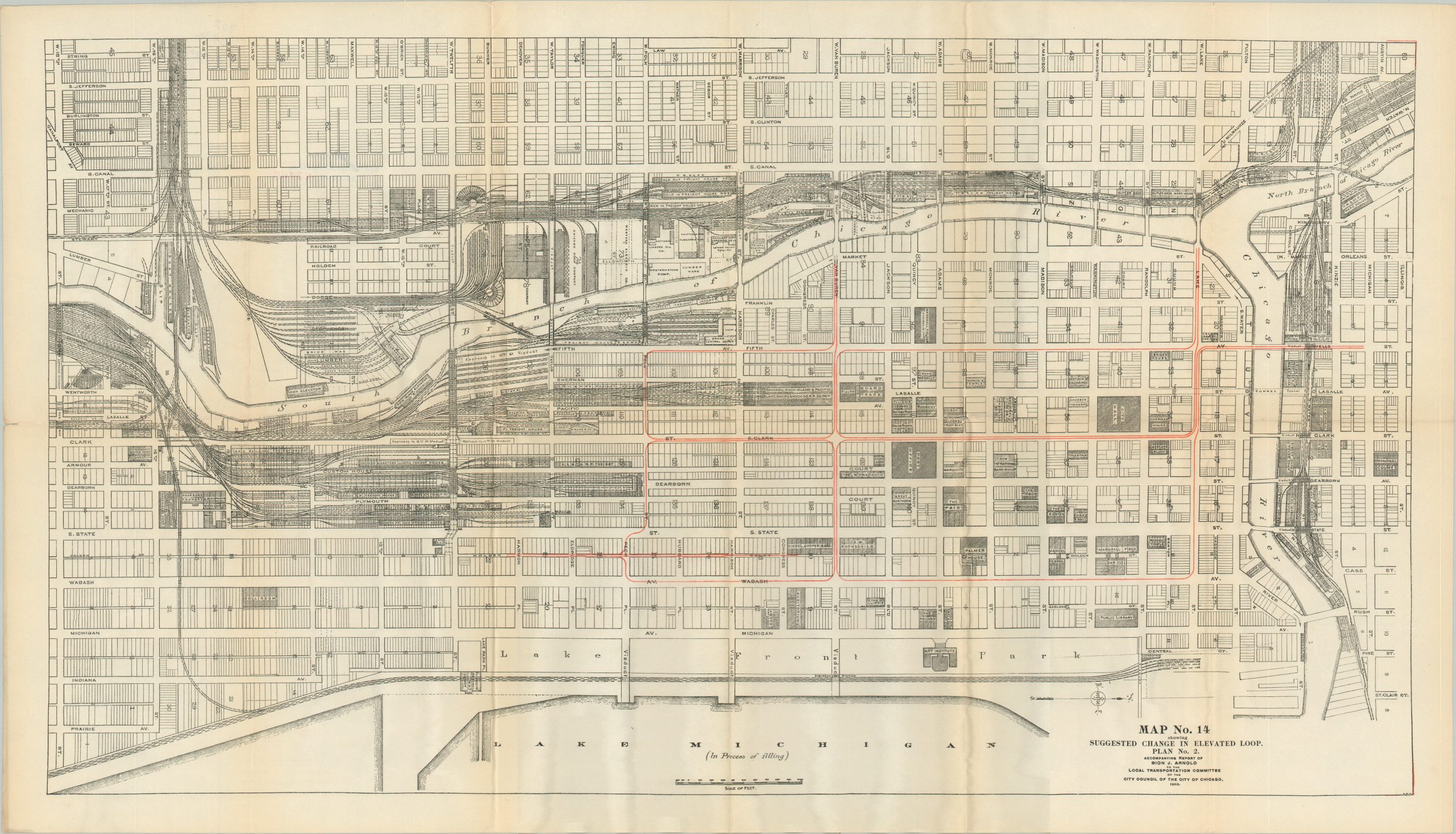
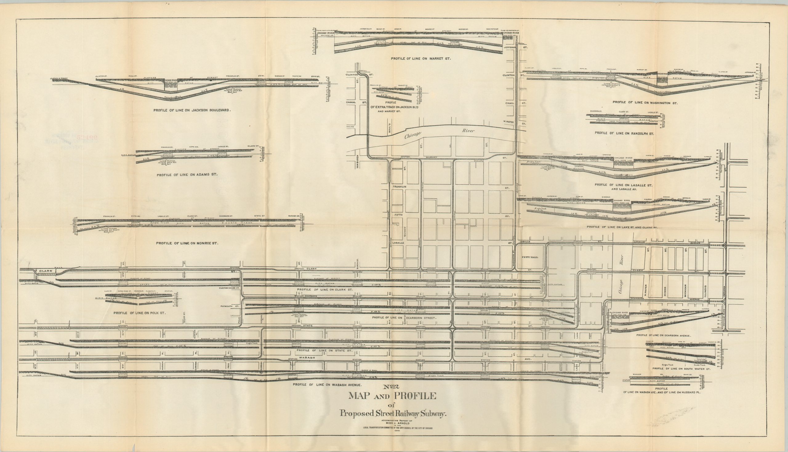
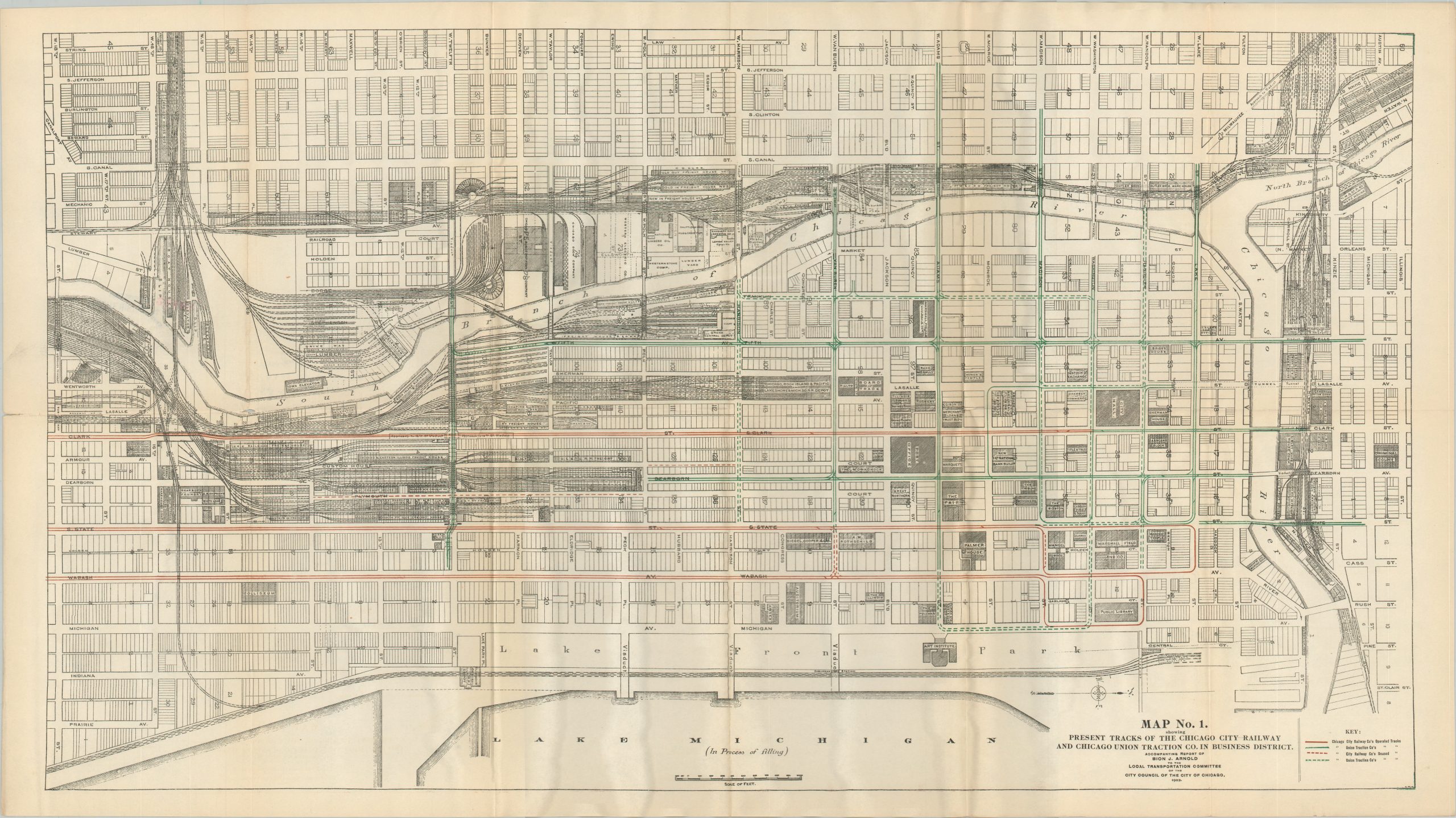
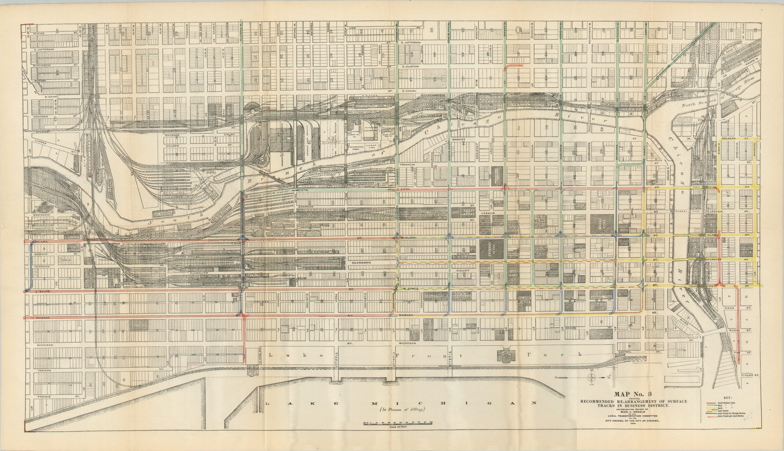
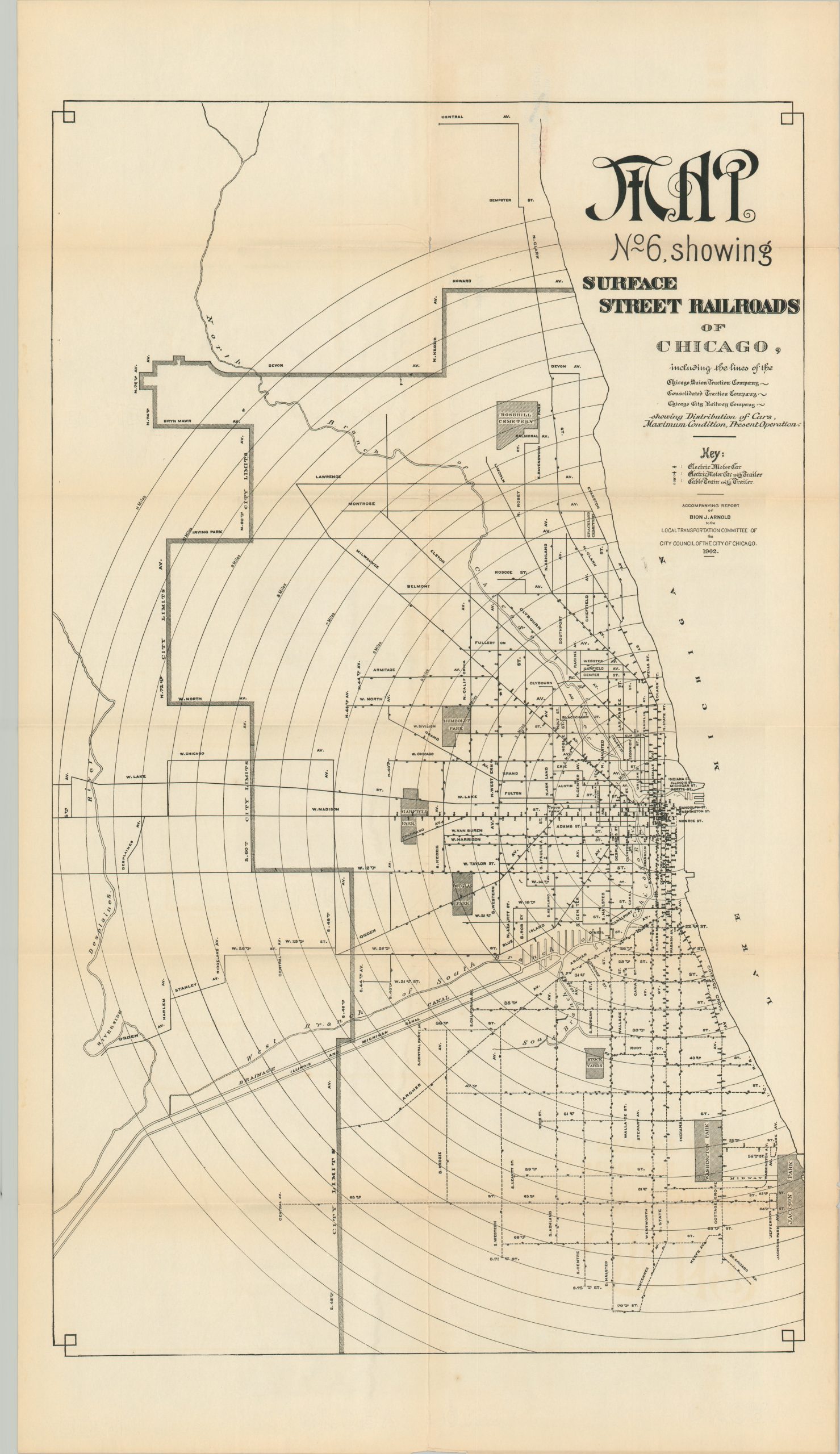
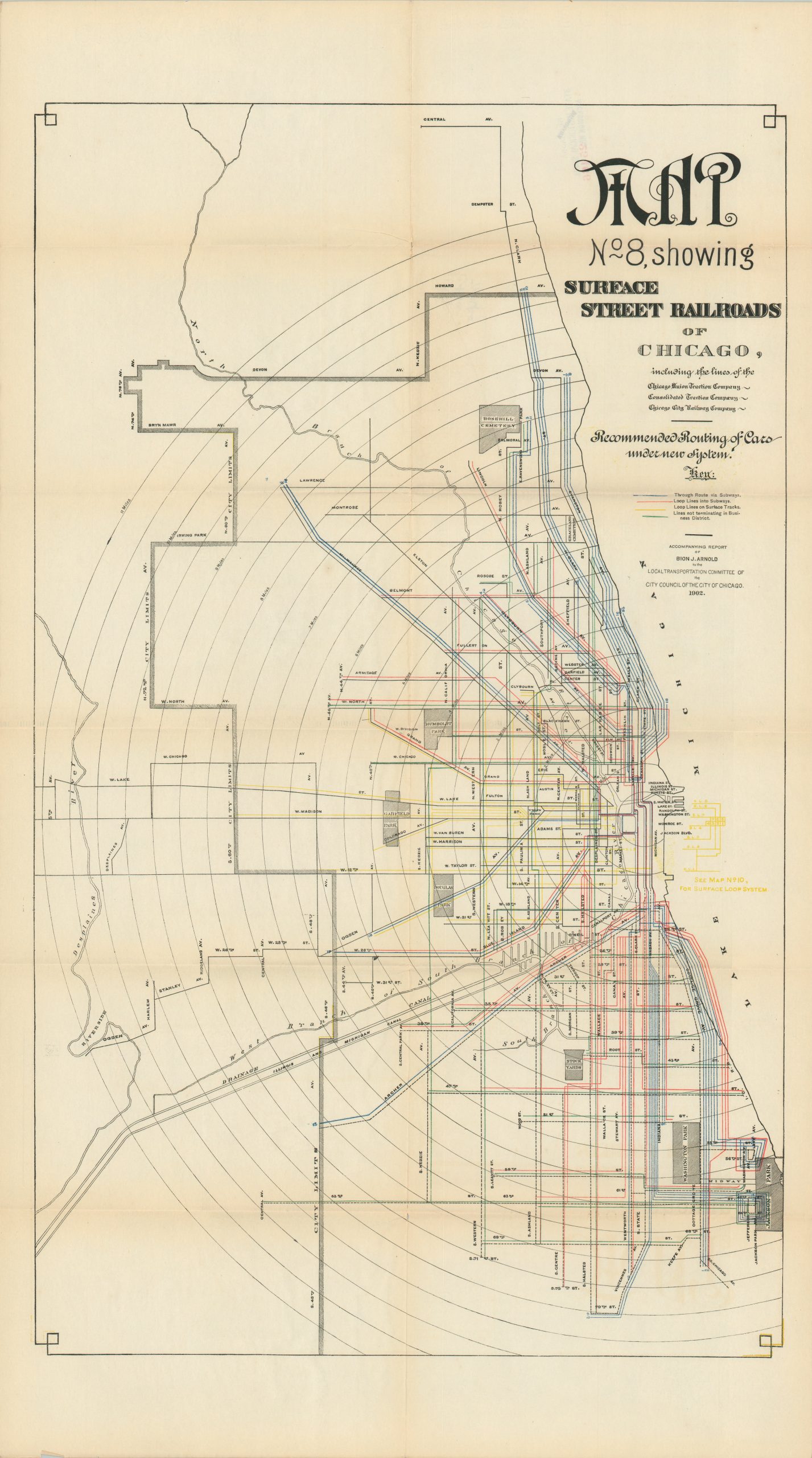
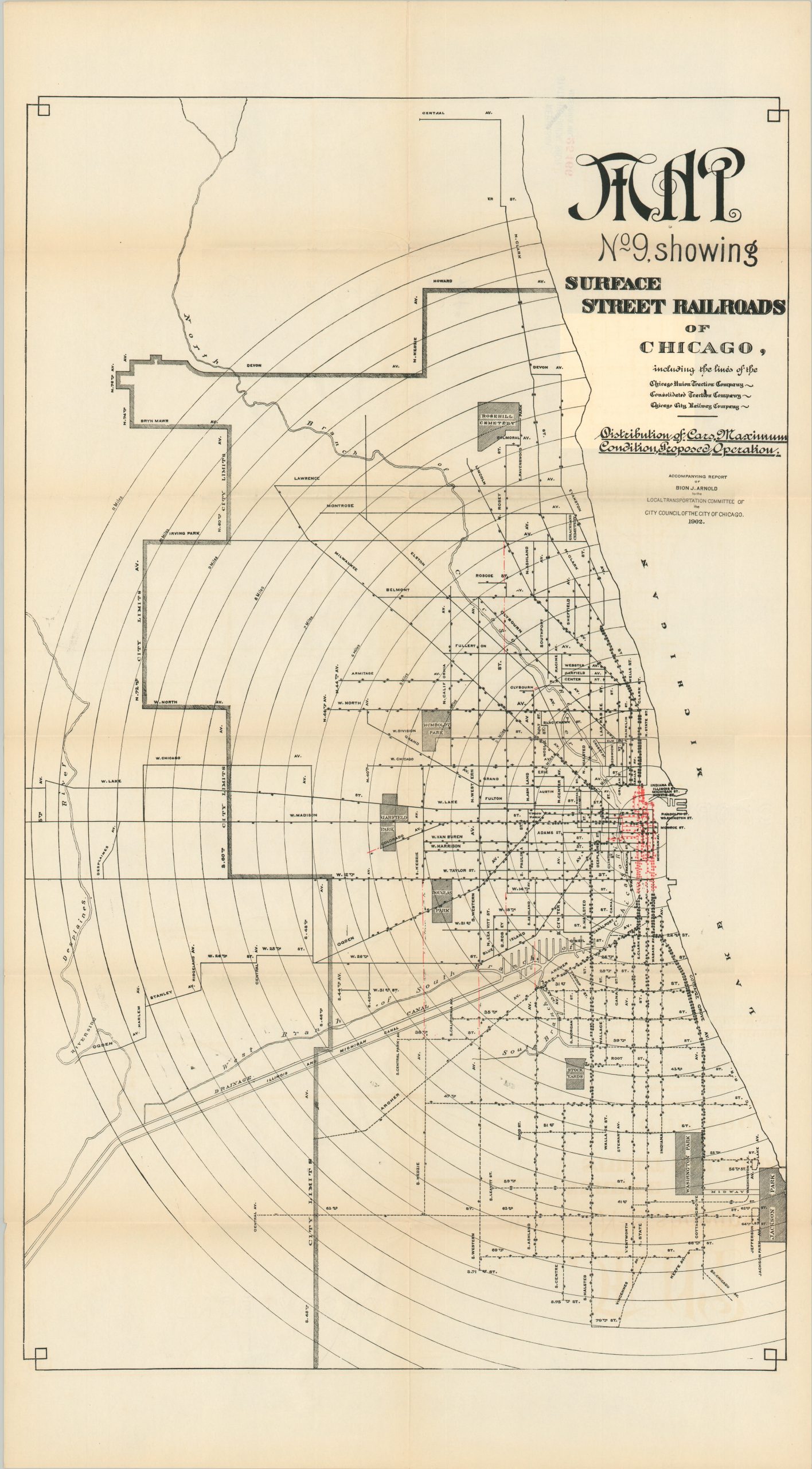
These exhaustive findings are accompanied by a detailed collection of 14 fold-out maps, also designed by Arnold to better illustrate his various proposals. Map Nos. 1, 2, 3, 5, 10, 11, 13, and 14 each show the existing and proposed updates for track arrangement, subway plans, and terminal loops across downtown Chicago and the surrounding area. Dozens of important buildings are shaded and labeled, offering a detailed snapshot of the area’s economic makeup at the beginning of the 20th century. Iconic landmarks like Marshall Field & Company, the Board of Trade, the Coliseum, and the Palmer House Hotel can be seen. New landfill in Lake Michigan is expanding the shoreline beyond the Art Institute, the Chicago River is cluttered with industry and warehouses, and railroads dominate the primary means of transportation. Map Nos. 4, 6, & 8, 9, shows the entire network of surface railroads, highlighting various features like electric conversion. Sheet Number 7 is a vibrant composition highlighting the distribution of population along local transportation lines, while Sheet Number 12 is a profile plan and map of the newly proposed downtown subways.
Collectively, the report and maps present some ideal changes to unify Chicago’s disparate transit systems, and while although most of Arnold’s recommendations were ignored by the City Council, private enterprise was not dissuaded. In 1913, Samuel Insull formed the Chicago Elevated Railways Collateral Trust, a ‘voluntary’ organization of the 4 elevated railway companies that served the Loop. Subsequent mergers and acquisitions would eventually lead to the development of the Chicago Rapid Transit Company and the Chicago Surface Lines – the two primary predecessors to the modern Chicago Transit Authority (CTA).
Sources: JSTOR; Scientific American; Chicago Tribune; Chicago Rail Fan;
Map Details
Publication Date: 1902
Author: Bion J. Arnold
Sheet Width (in): See Description
Sheet Height (in): See Description
Condition: A-
Condition Description: Complete two volume set. 310 pp. printed report with stapled binding and original gray paper wraps. Front covers shows some fading and moderate wear, with the front gutter beginning to split and separate. Scattered foxing along the fore-edge and light marginal toning, consistent with age. Twelve folding plates affixed to the back, each with sharp creasing, light spotting, and toning along folds. Collection of 14 folding maps disbound from original paper wraps. Front cover is chipped and brittle, but present. Creasing, toning, splits, and separations at the fold junction, but overall in good to very good condition.
$950.00
1 in stock