Relief-Panorama of the Rhine
Tourist map of the Rhine River issued shortly after Hitler’s remilitarization of the Rhineland.
Out of stock


Description
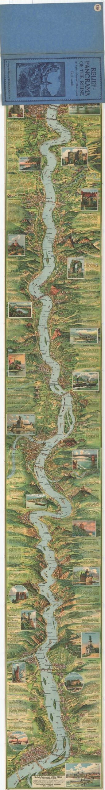
This stunning pictorial map of the Rhine River between Cologne and Mainz was drawn by Emil Winter and published by Hoursch & Bechstedt in November of 1936. Lithography and printing were performed by Adolf Forker in Leipzig.
A dramatically illustrated overview of the river valley is accompanied by attractive scenic landscapes, descriptive text of major landmarks and historic sites, and details on local transportation routes.
The idyllic image cleverly omits any reference to the ongoing tension across the region, as Adolf Hitler ordered German troops into the Rhineland earlier in 1936 in direct contravention to the Treaty of Versailles and a major violation of French strategic security.
Map Details
Publication Date: 1936
Author: Emil Winter
Sheet Width (in): 9
Sheet Height (in): 64.5
Condition: A
Condition Description: Large strip map folded accordion style into its original blue stiff paper wraps. A bit of wear along fold lines and the edges of the sheet, but otherwise in near fine condition.
Out of stock