
Reconnaissance of the Western Coast of the United States from Monterey to the Columbia River
$125.00
Sheet 1 only of the third edition of the U.S. Coast Survey of California.
1 in stock
Description
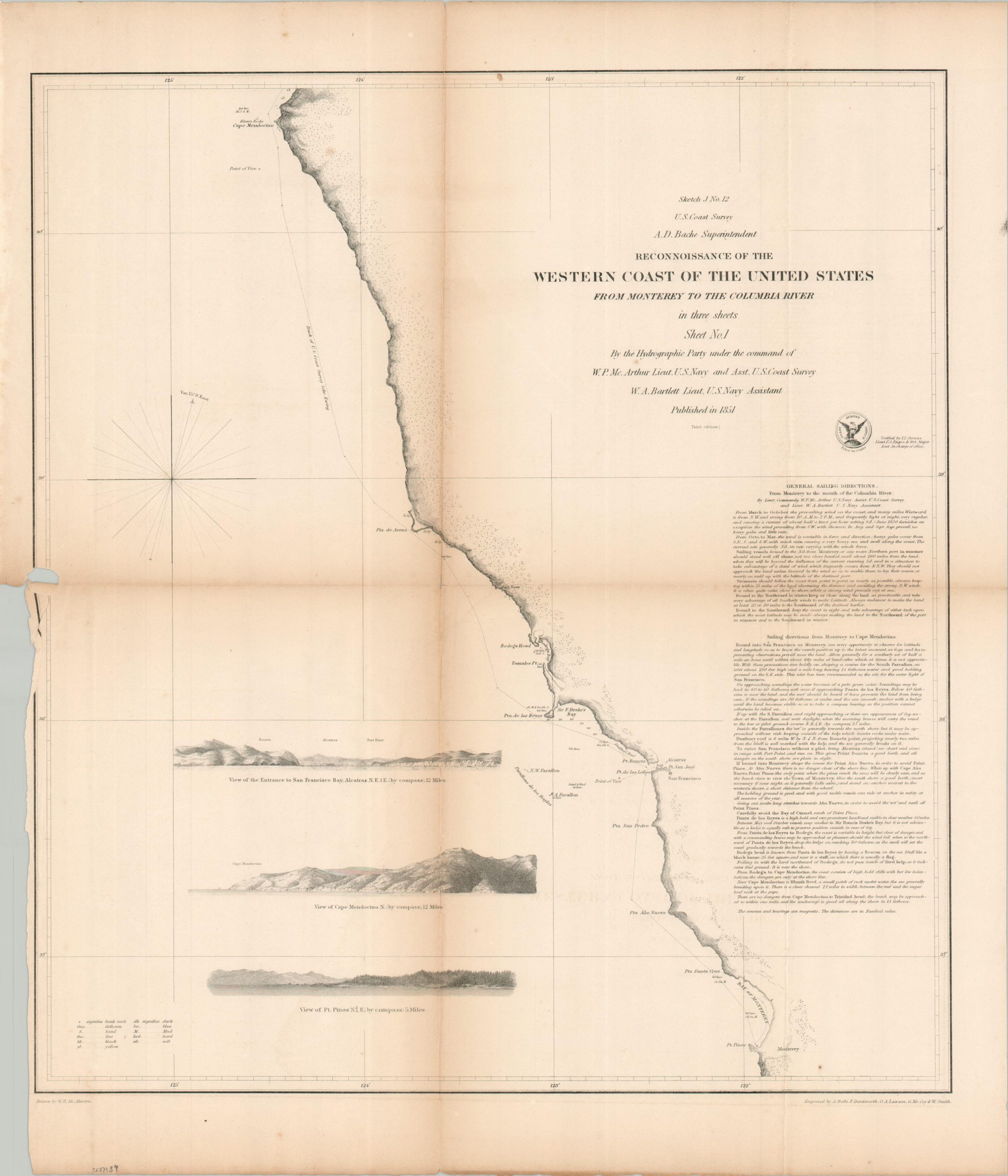
This important antique nautical chart was drawn by W.B. McMurtie and published in 1851 by the U.S. Coast Survey. It is the first of three sheets charting the California and Oregon coastline between Monterey Bay and the Columbia River, with the image cutting off just north of Cape Mendocino.
Three profiles in the lower left show that distinctive feature, plus the entrance to San Francisco Bay and a view of Pt. Pinos. These ‘Points of View’ are among several interesting features labeled on the map, which also includes Alcatraz (a newly established military reservation) and San Francisco, growing rapidly as a result of the California Gold Rush. General sailing directions are provided in the lower right, though they assume the reader is an experienced mariner!
Map Details
Publication Date: 1851
Author: W.B. McMurtie
Sheet Width (in): 18.6
Sheet Height (in): 22.2
Condition: B
Condition Description: Single sheet (1 of 3) sharply creased and toned along originally issued fold lines. Clean splits repaired on verso. Curling and a small chip on the left side of the sheet. Light scattered foxing. About good condition overall.
$125.00
1 in stock