
Rapid Transit Guide New York City
$125.00
Clever promotional work by Rand McNally on the eve of the 1939 New York World’s Fair.
1 in stock

Description
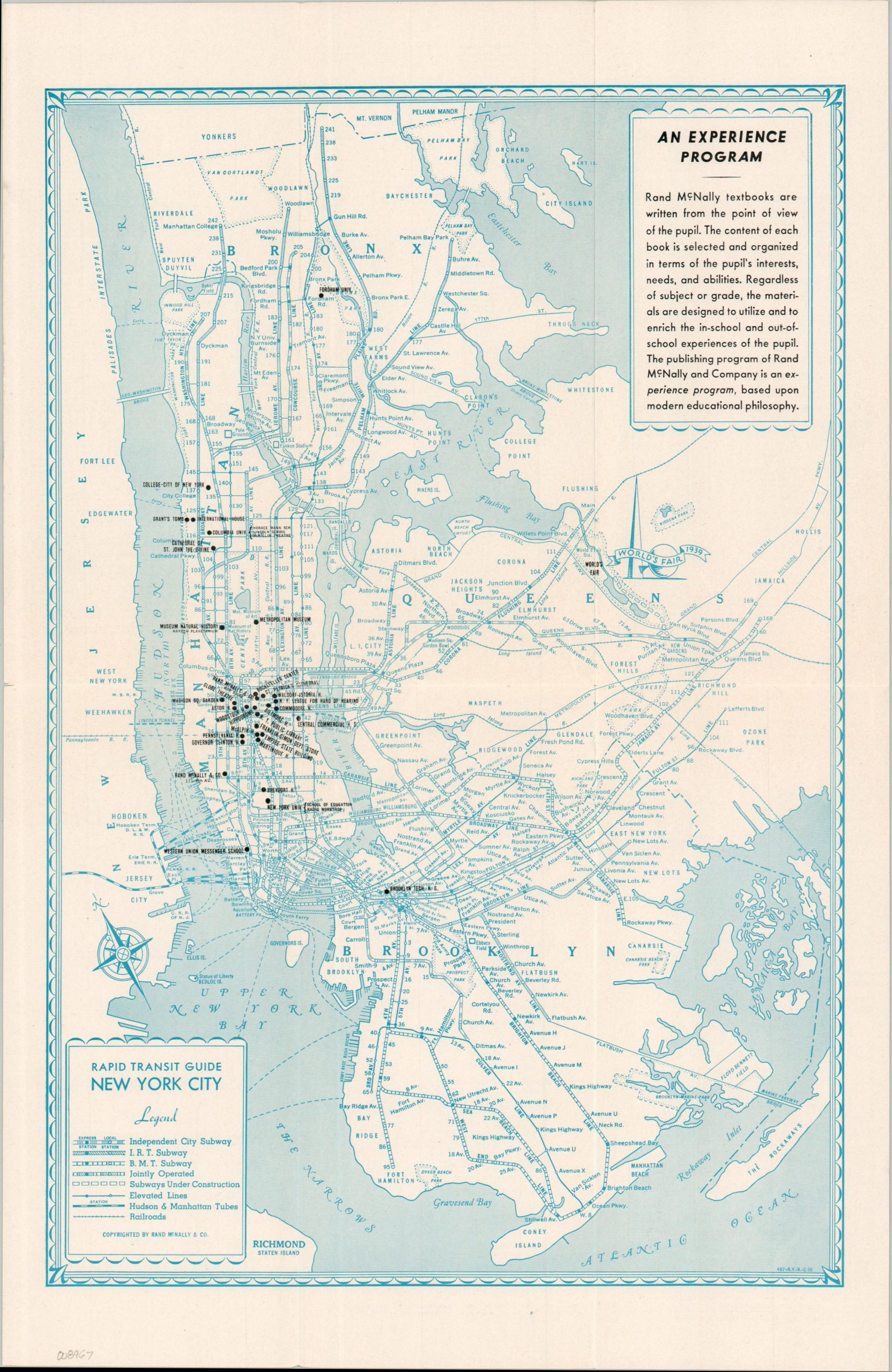
This ephemeral map of New York City highlights the Big Apple’s remarkably complex transit network on the eve of the 1939 World’s Fair. Lines operated independently (or jointly) by the city’s three competing subway systems are shown alongside an extensive web of elevated railways, steam railroads, and numerous ferry routes (the latter omitted from the legend). The map reflects the transportation infrastructure that would carry the millions of visitors expected to attend the fair, whose grounds in Queens are prominently identified.
Stark black overprint highlights numerous locations throughout the city, including a notable concentration of schools, suggesting that educators and students were among the publisher’s intended audience. A promotional panel in the upper right further emphasizes Rand McNally & Company’s long-standing expertise in educational publishing and textbook production.
The verso presents a large-scale plan of New York’s Theater and Shopping District together with an index of hotels, theaters, steamship piers, and other points of interest. Issued just before the municipal unification of New York’s subway systems in 1940, the map captures a pivotal moment in the city’s transportation history, when the IRT, BMT, and IND still operated as distinct networks while preparing to serve the influx of visitors drawn by one of the twentieth century’s most celebrated international expositions.
Map Details
Publication Date: 1938
Author: Rand McNally & Company
Sheet Width (in): 12.75
Sheet Height (in): 19.50
Condition: A-
Condition Description: Double-sided folding brochure printed on glossy paper. Light wear along folds, faint wrinkling, and tiny edge splits. Very good condition overall.
$125.00
1 in stock