Rand McNally World Map for the Air Age
Large wall map of the world designed to educate the public on how geographic realities have changed as a result of the air transportation revolution.
Out of stock


Description
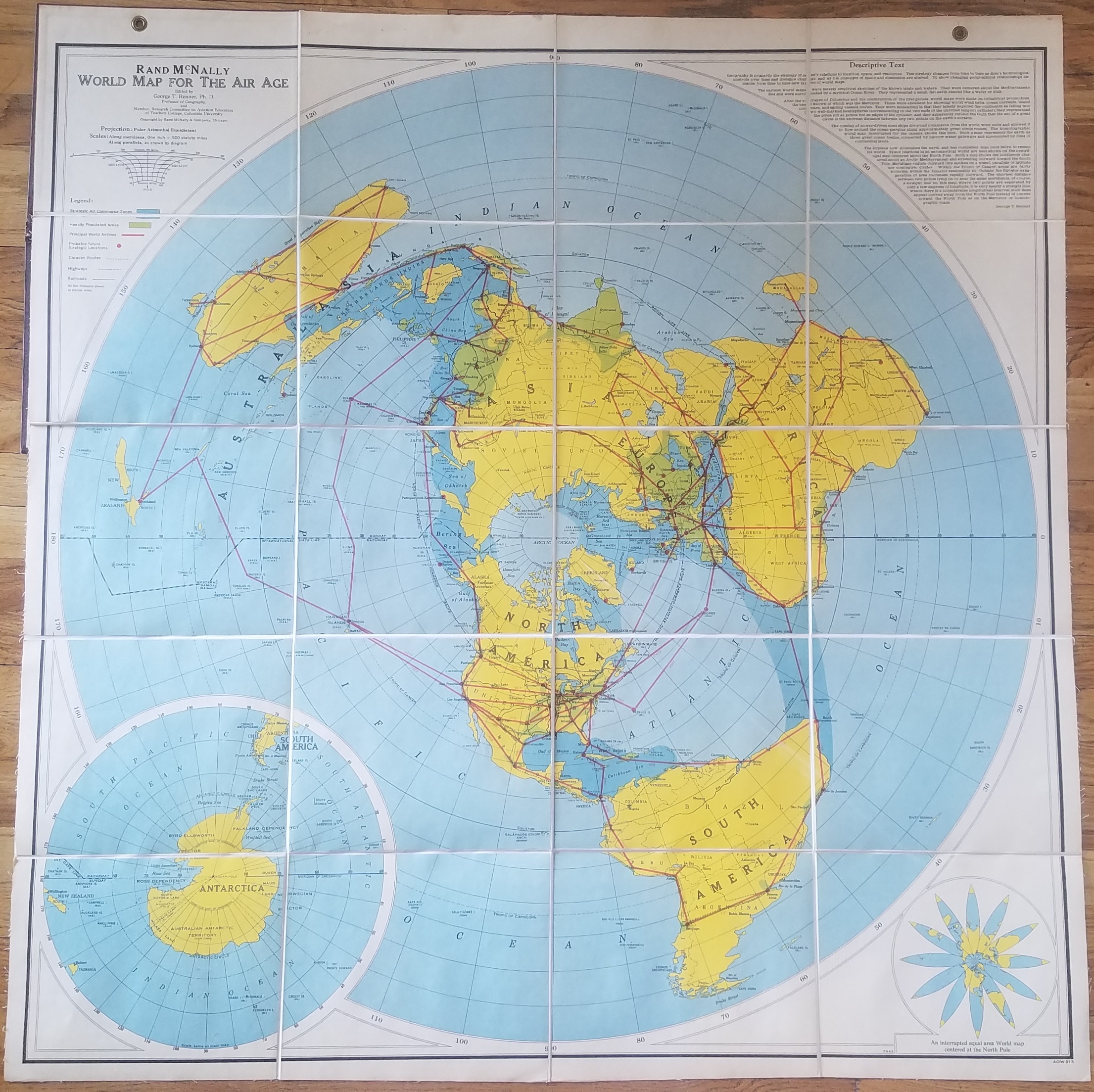
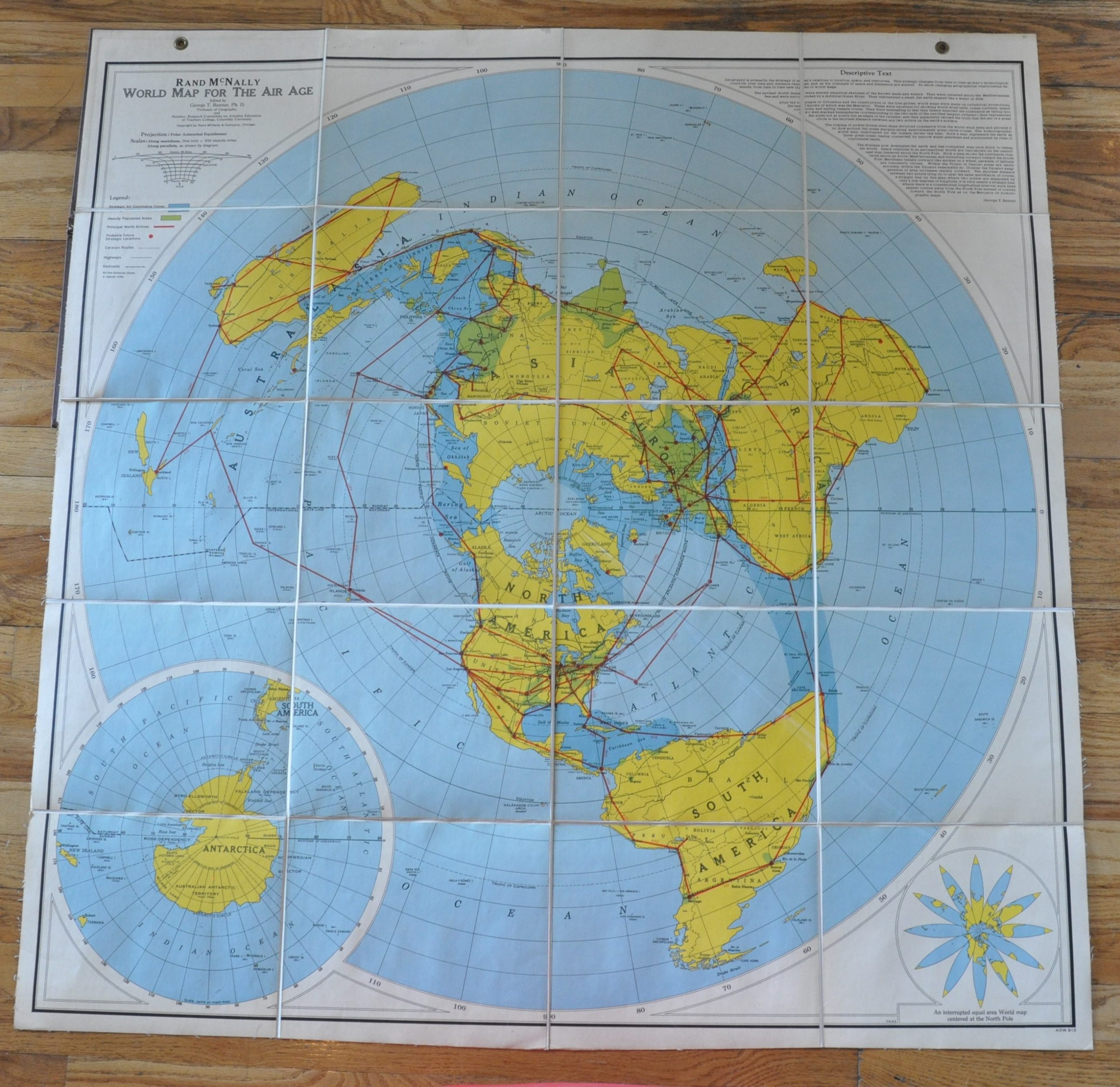
New realities in world geography require new maps, and such was certainly the case with the development of aviation technology in the first half of the 20th century. Generally speaking, global geopolitics and cartography were focused largely on navigable waters for the preceding four centuries. But technology associated with air travel would begin to shift the perspective. According to text adjacent the title, “the airplane now dominates the earth and has compelled man once more to remap his world.”
Mercator’s projection was the first thing to go in the new wave of 20th century aviation mapping. It was replaced with primarily polar projections, like the Polar Azimuthal Equidistant seen on this large wall map, issued c. 1939 by Rand McNally. Viewing the globe from this angle allows a more realistic representation of the straight distance between two points via air (at least within the Equator). The projection is more illustrative than practical – it’s main point is to show relative proximity of areas rather than accurate aeronautical navigation.
Of particular interest to a broad audience at the time of the map’s publication was the nearness of the Eurasia landmass to that of North America. Dark clouds were looming across the Atlantic, and war in Poland may have already erupted by the time this map was distributed. (Note: It’s dated c. 1939 due to the presence of Queen Maud Land in Antarctica (Jan. 1939), the prewar borders in Europe, and the title of Dr. Renner.) The map would have been a useful aid to educate the public about the new geopolitical circumstances, and according to Susan Shulten, the “World Map for the Air Age” sold more copies in its first year of publication than any other map in the company’s history.
Within the image, continental landmass is shown in bright yellow, presumably to allow for easier spatial recognition of the unusual projection. “Strategic Air Commerce Zones” are shaded in dark blue, and largely follow historic routes of trade, with the exception of the Arctic Circle. Routes served by the Principal World Airlines are boldly shown in red. As aviation technology developed in the form of more powerful, efficient engines, planes required less refueling and more remote locations could be accessed. Caravan routes, highways, and railroads are also shown, but in a minimized format due to the small scale possible.
Interestingly, the legend also identifies “Possible future strategic Locations” with large red dots. With hindsight, we can see that the accuracy is hit or miss. Guam, Rabaul and Dutch Harbor would see major action in the Pacific war, and show a level of prescience. However, Kamchatka, Godthaab, and Cairo played less of a role than perhaps was anticipated. The strategic locations listed were likely proposed by the editor of the map and corresponding text, Dr. George T. Renner.
Renner received his Ph.D. from Columbia in 1927 and join the geography staff at the Teachers College there in 1936. He was made a full professor in 1939, and wrote extensively about aviation and global geopolitics during the Second World War. One article, “Maps for a New World”, was published in a 1942 edition of Collier’s and earned Renner scholastic infamy for the rest of his life. In it, Renner is deeply critical of the Versailles Treaty, praises German cartographers, and proposes several new continental maps divided along “cultural lines” to minimize the number of “political units” that breed war. In these maps, major European powers (including Germany) hold huge blocs of territory in Eurasia and Africa, while Japan and the United States effectively “split” the Pacific Ocean. Despite numerous calls for his resignation, Renner continued to teach at Columbia until his death in 1955.
References
De Bres, K. “An Early Frost: Geography in Teachers College, Columbia and Columbia University, 1896-1942.” The Geographical Journal, vol. 155, no. 3, 1989, pp. 392–402. JSTOR, www.jstor.org/stable/635214. Accessed 25 Mar. 2020.
DeVivo, Michael S. Leadership in American academic geography : the twentieth century. Lanham Boulder New York London: Lexington Books, 2015.
Renner, George. “Maps for a New World Charting the future for free men.” Collier’s Weekly, June 6, 1942, pp. 14-16.
Schulten, Susan. The geographical imagination in America, 1880-1950. Chicago: University of Chicago Press, 2001.
Map Details
Publication Date: 1939
Author: George T. Renner
Sheet Width (in): 44.5
Sheet Height (in): 45.5
Condition: A-
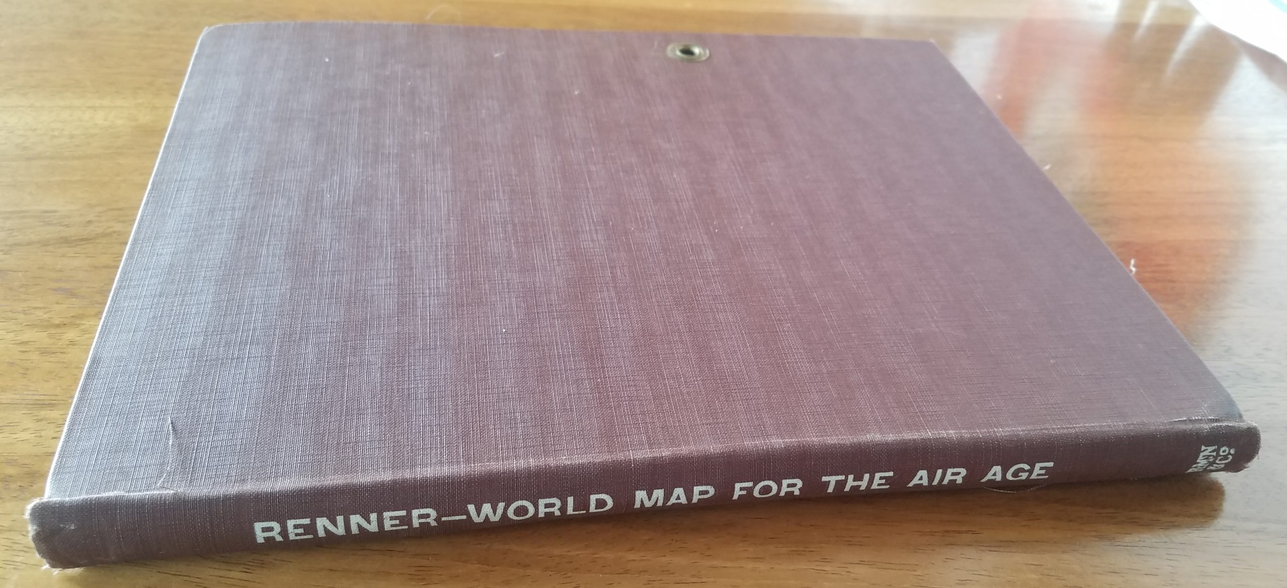
Condition Description: The map is in wonderful condition; mounted on linen, dissected into 20 panels and folded into its original cloth boards. Grommets along the top allow for easy display. The image is bright, with only minor soiling confined largely to the outer margins. There are a few seams where the lithographed color has become somewhat faded, likely from sun exposure. Also, a few small marks in pen are visible in the inset of Antarctica.
Out of stock