Rand McNally World Atlas
An example of patriotic capitalism on the American homefront.
Out of stock


Description
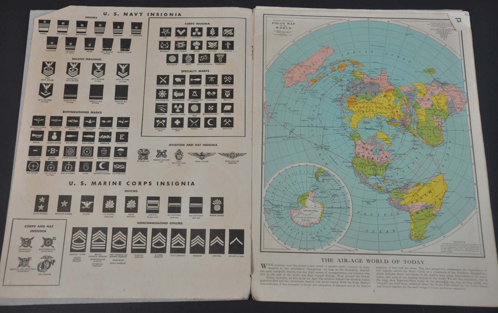
The American desire to consume geographic information was unparalleled during World War II. Fighting in remote places from Attu to Anguar to Algiers led many to look at maps and globes for the first time, wondering where their friends and family members were deployed overseas.
This atlas was published in Chicago by Rand McNally in 1943 and includes ten separate maps, plus charts outlining the insignia of the U.S. Army, Navy & Marine Corps. The polar map has been re-worked into ‘The Air-Age World of Today’, which emphasizes the shortened distances allowed by direct aviation routes. An advertisement for the Hartford Fire Insurance Company can be found on the back cover.
Map Details
Publication Date: 1943
Author: Rand McNally
Sheet Width (in): 10.00
Sheet Height (in): 13.00
Condition: B+
Condition Description: 16 pp. atlas with illustrated stiff paper boards and stapled binding. Covers are slightly worn and completely separated from the contents, which themselves are loose. Front page is slightly toned and there are creased corners and soiling consistent with age, but overall in good condition.
Out of stock