Rand McNally Standard Map of Soviet Union (Russia and Siberia)
$100.00
A detailed look at the Soviet Union – America’s ideological foe in the looming Cold War.
1 in stock
Description
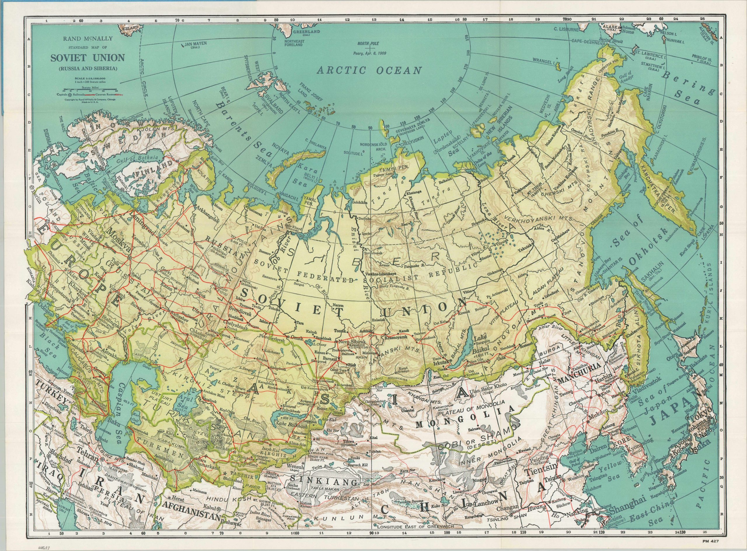
This eye-catching physical map of the U.S.S.R. was published by Rand McNally & Company shortly after the conclusion of World War II. An index on the verso presents an itemized list of geographic features and constituent republics, while the image provides a visualization of the Communist giant. Green coloring, rather than the usual red, highlights the expansive Soviet territory, which extends from recently annexed Carpathian Ruthenia in the west to the entirety of Sakhalin and the Kuril Islands in the east. The railroad network is surprisingly sparse (when compared to the U.S. at the time) and caravan routes are still in use across certain remote regions in the south. Topography is depicted with brown hachures and deserts in black stipples, offering an engaging overview of the diverse landscape spanning the Asian continent.
The underlying geopolitical circumstances of a burgeoning Cold War are also implied, with a little interpretation. The huge landmass is a statement in its own right. The Soviet Union’s extensive coastline, abundant natural resources, and a growing transportation network posed a threat to Western hegemony. Proximity was also key, as Alaska’s St. Lawrence Island and the Chukotsk Peninsula are only about 50 miles apart!
Map Details
Publication Date: c. 1946
Author: Rand McNally & Company
Sheet Width (in): 27.00
Sheet Height (in): 19.75
Condition: A
Condition Description: Color printed map on a single-sided sheet, folded and affixed to original blue paper wraps with red writing on the front cover. Near fine condition overall.
$100.00
1 in stock