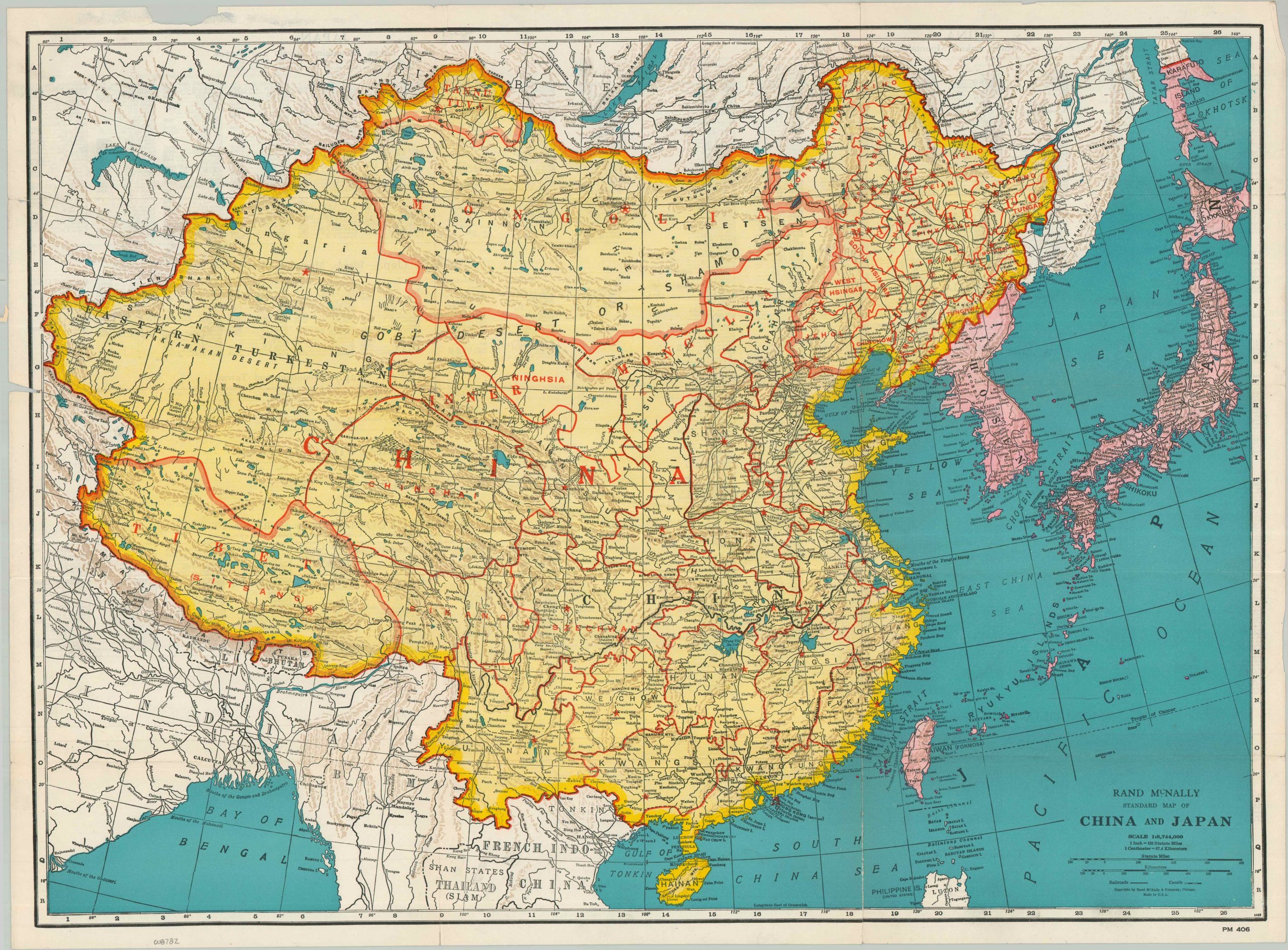
Rand McNally Standard Map of China and Japan
$95.00
Eastern Asia during the mid-1930s.
1 in stock

Description
This detailed pocket map shows the political organization of China and Japan shortly before the outbreak of the Second Sino-Japanese War (1937). Japanese territory, shaded in pink, encompasses the southern part of Karafuto Island, Chosen (Korea), and Formosa (Taiwan), while the puppet state of Manchukuo is shown as nominally independent. Tibet, Mongolia, and Eastern Turkestan are also colored in yellow, alluding to Chinese influence, but in reality all expressed some form of sovereignty. The short-lived Tuvan People’s Republic is labeled as well.
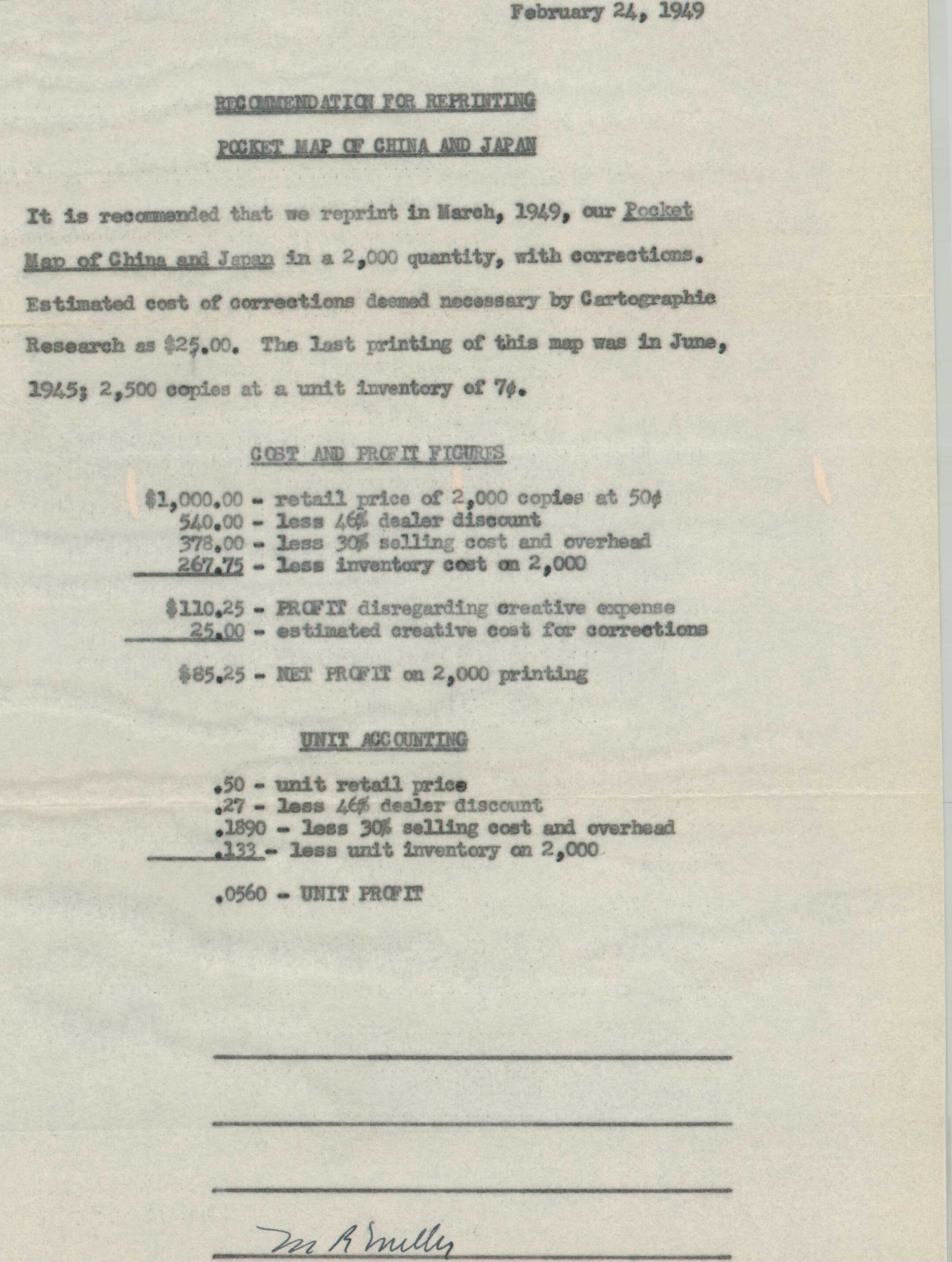
While the content shows the boundaries as of the mid-1930s, this example of the map is accompanied by a mimeographed letter, dated 1949, requesting a reprinting of 2,000 additional, updated copies. It notes the last printing as 1945, at which point the imminent conclusion of World War II would likely mean the pre-war, status quo borders were a useful point of reference. The extensive railroad network also reflects the wartime era.
Map Details
Publication Date: c. 1945
Author: Rand McNally & Company
Sheet Width (in): 27.00
Sheet Height (in): 20.00
Condition: B+
Condition Description: Color printed map separated from original paper wraps (still present) and moderately worn along original folds. Small holes at fold joints and splits along the outer edges, repaired on verso. Good condition overall.
$95.00
1 in stock